Brickyard
Brickyard
A former part of the great West Field of Kingston Manor
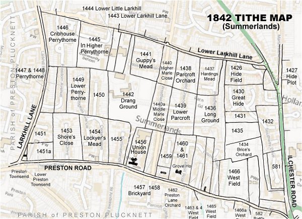
Originally part of the great medieval West Field of Kingston Manor, Brickyard (Parcel 1457) was a long, thin rectangular field running north from Preston Lane (today's Preston Road) and lying alongside the Union Workhouse (Parcel 1456).
The 1846 Tithe Apportionment noted it as 'Brickyard, etc.' with an area of 2a 2r 2p and recorded that the owner was John Moody and the tenant was William Baker. As well as being landlord of a beerhouse and a road contractor, Baker was one of several Yeovil brick makers and was listed as such in Robson's Directory of 1839, Pigot's Directory of 1842 listed him as a 'Brick Maker & Lime Burner' and he was also listed as a brick manufacturer in Hunt's Directory of 1850, Slater's 1852/3 Directory, Harrison, Harrod & Co's 1859 Directory and finally in Kelly's Directory of 1861. From this, Brickyard most likely had a combined lime kiln / brick kiln.
Brickyard was bounded on the south by Preston Road, on the west by the Union Workhouse, to the north by Middle Marle Close (Parcel 1440a) and to the east by Grove Cottage (Parcel 1458) and the un-named plot of ground behind the cottage (Parcel 1459).
In a report of 1859, Hicks & Isaac noted that the brickyard had two kilns.
Today the former Higher Marle Close, Middle Marle Close and the Brickyard (Parcel 1457) are occupied by the houses and gardens of Westfield Road as it joins Stiby Road and Preston Road.
For details on historic land measurement (ie acres, roods and perches) click here.
maps & Aerial Photographs

This map, based on the descriptions in the 1589 Terrier and the 1846 Tithe Map of Yeovil shows the approximate boundaries of the Manors of Kingston and Hendford as well as the manorial three-field system used in Kingston.
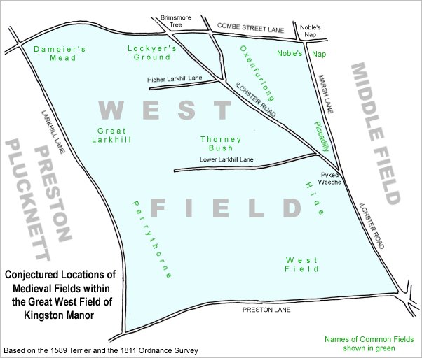
A conjectural map of the great West Field of Kingston Manor showing ancient sub-fields, most likely common fields, within the overall bounds of West Field.
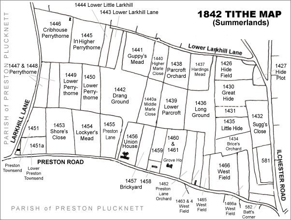
The Larkhill area reproduced from the 1842 Tithe Map. Brickyard is at centre bottom.
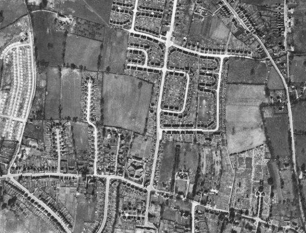
The 1946 aerial photograph - Westfield Road running from its junction with Stiby Road at top centre to join Preston Road at bottom, was built on the former Higher Marle Close, Middle Marle Close and Brickyard.
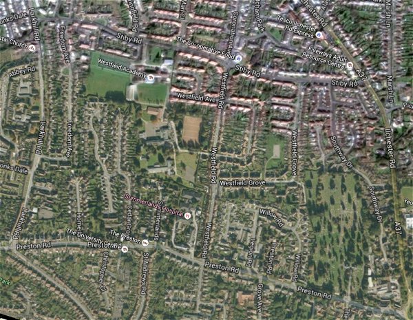
The same area today 'borrowed' from Google maps.
The 1842 Tithe Map superimposed (only very slightly out at the bottom) over a modern map.
gallery
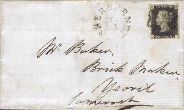
An envelope, posted from Sherborne to Yeovil on 19 May 1841 (using a Penny Black stamp of 1840) addressed simply to Mr Baker, Brick Maker, Yeovil, Somerset. This was William Baker. This envelope was catalogued at £3,500.