Church Acre
Church Acre
A small field later absorbed by its neighbour
Preston Plucknett's Preston Field, or North Field, was originally a large medieval manorial field along the western parish boundary of Preston Plucknett, lying to the south of another medieval field called Field's End. Preston Field was bounded by the parish boundary with Brympton in the west and to the east by the field access track known as Eighteen Acre Lane.
By the time of the 1763 Survey of the Manor of Preston, the large medieval field had been broken up into a number of smaller fields and Church Acre was one of these, located at the centre of the former North Field.
The 1763 Survey recorded that Church Acre's tenant was Henry Gellard and the field measured (in 'old' units) 1 acre, 1 rood, 0 perches and was used as pasture for grazing livestock.
The 1846 Preston Tithe Map shows the field called Church Acre (Parcel 60) bounded on the north by Quarr Close (Parcel 59), to the west by Higher Preston Field (Parcel 58), to the south by Hundred Acre and Ellis's (Parcel 54). To the east it abutted Long Close (Parcel 53).
The Preston Plucknett Tithe Apportionment of 1848 noted that Church Acre was owned by Lady Georgiana Fane of Brympton d'Evercy and the tenant was Thomas Hawkins (who was a tenant of over 200 acres in over 40 parcels in the parish). The field measured (in 'new' units) just 2 roods and 10 perches and was used as arable land for growing crops.
By the time of the 1946 aerial photograph (see below), Church Acre and Hundred Acre & Ellis's had both been included into Quarr Close.
All remnants of the field finally disappeared when the Abbey Manor estate was built in the 1980s and the site of the Church Acre is now occupied by part of the middle section of The Toose with its various projecting culs-de-sac.
For details on historic land measurement (ie acres, roods and perches) click here.
maps & Aerial photograph
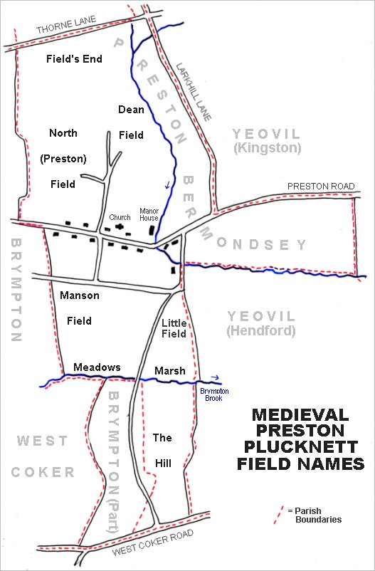
The main post-medieval fields of Preston Plucknett. The original large medieval manorial field called Preston Field, or North Field, lay to the north of Preston Road and west of St James' church.
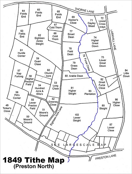
Map based on the 1849 Tithe Map showing Church Acre (Parcel 60) at left centre.
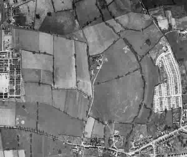
This is a 1946 aerial photograph showing Houndstone army camp (at centre left). At centre is the Preston Plucknett Flax Works and at centre right is the post-war Larkhill Lane pre-fabricated housing estate.. The enlarged Quarr Close is at centre left, one field away from the flax works. At this time it had absorbed Church Acre and Hundred Acre & Ellis's.
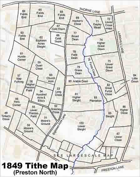
The 1849 Tithe Map superimposed over the modern Ordnance Survey map.