Collins' Ground
Collins' Ground
A field within the great manorial East Field
Collins' Ground (Parcel 936), was originally a field in the great medieval East Field of Kingston Manor.
The 1846 Tithe Apportionment noted that Collins' Ground was in the ownership of Henry Goodford Esq. of Chilton Cantello and occupied by Mrs Phillis Coles, as part of Stone Farm. The Tithe Apportionment shows Collins' Ground was used as pasture for grazing livestock. It measured 3a 2r 20p.
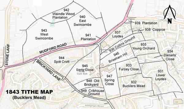
Collins' Ground was bounded on the north by Loydes (Parcel 937) and Coppice (Parcel 938) and on the east by Higher Sleight (Parcel 898), on the west by Long Close (Parcel 945) and on the south by Briseham Hill (Parcel 946) and Young Orchard (Parcel 935).
By the time of the 1946 aerial photograph, seen below, Collins' Ground was still an open field but had been combined with Loydes (Parcel 937). Today, the former Collins' Ground is occupied by Fairmead Special School and houses and gardens of the central section of Fairmead Road.
For details on historic land measurement (ie acres, roods and perches) click here.
maps

This map, based on the descriptions in the 1589 Terrier and the 1846 Tithe Map of Yeovil shows the approximate boundaries of the Manors of Kingston and Hendford as well as the manorial three-field system used in Kingston.

A map of the great medieval East Field of Kingston Manor showing conjectured locations of several fields based on descriptions in the 1589 Terrier.
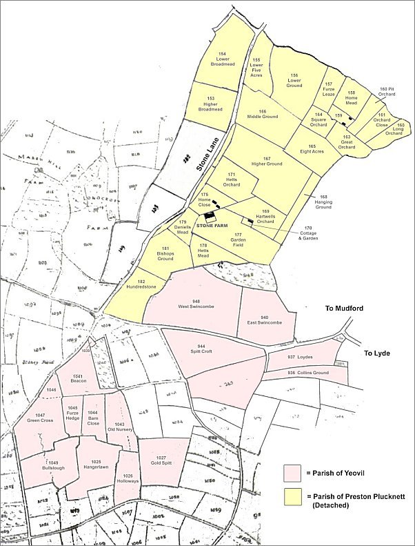
This map, based on the Yeovil Tithe Map of 1842 and the Preston Plucknett Tithe Map of 1849, shows in yellow the parcels of land of Stone Farm that were technically in the Parish of Preston Plucknett and in pink are the parcels that were technically in the Parish of Yeovil.
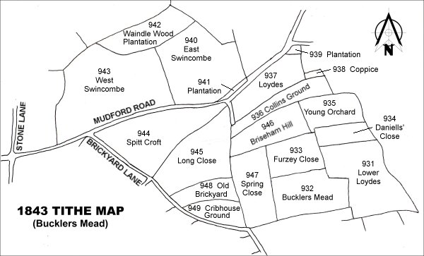
Drawn from the 1846 Tithe Map with field names added from the 1846 Tithe Apportionment, with Collins' Ground (Parcel 936) in the top right quadrant.
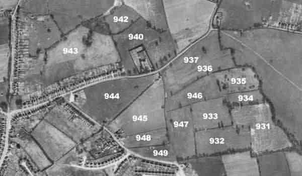
The 1946 aerial survey photograph with parcel numbers of 1846 plotted on.
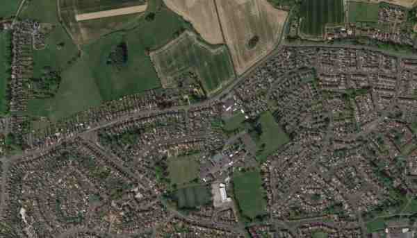
An aerial view (courtesy of Mr Google) of the area today.
The 1843 Tithe Map overlaid onto a modern map of the area.