Cribhouse ground
Cribhouse Ground
A field within the great manorial East Field
Cribhouse Ground (Parcel 949) was originally a roughly-triangular field in the great medieval East Field of Kingston Manor. 'Crib' is used here in the sense of a manger, or rack, for fodder under a shelter - hence 'crib' and 'house'.
The 1846 Tithe Apportionment noted that Cribhouse Ground was in the ownership of Ann Collins and let to James Marten. The Tithe Apportionment shows Cribhouse Ground was used as pasture for grazing livestock. It measured 2a 2r 0p.
Cribhouse Ground (Parcel 949) was bounded on the south and west by Brickyard Lane (today's St Michael's Avenue), on the north by Old Brickyard (Parcel 948) and on the east by Spring Close (Parcel 947).
By the time of the 1946 aerial photograph, seen below, Cribhouse Ground was still an open field. Today, the former Cribhouse Ground is occupied by Givele Close.
For details on historic land measurement (ie acres, roods and perches) click here.
maps

This map, based on the descriptions in the 1589 Terrier and the 1846 Tithe Map of Yeovil shows the approximate boundaries of the Manors of Kingston and Hendford as well as the manorial three-field system used in Kingston.

A map of the great medieval East Field of Kingston Manor showing conjectured locations of several fields based on descriptions in the 1589 Terrier.
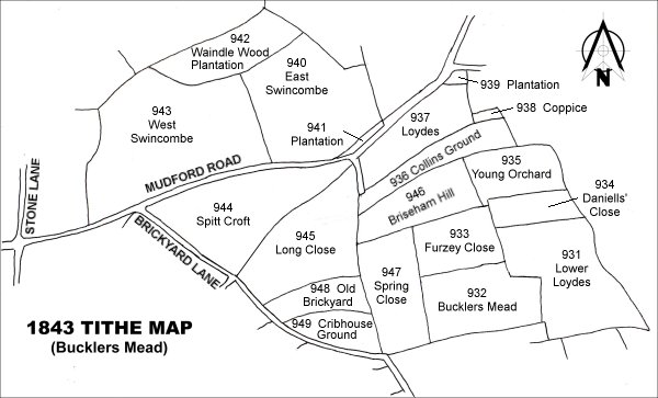
Drawn from the 1846 Tithe Map with field names added from the 1846 Tithe Apportionment, with Cribhouse Ground (Parcel 949) at centre bottom.
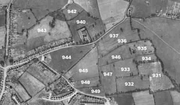
The 1946 aerial survey photograph with parcel numbers of 1846 plotted on. /p>
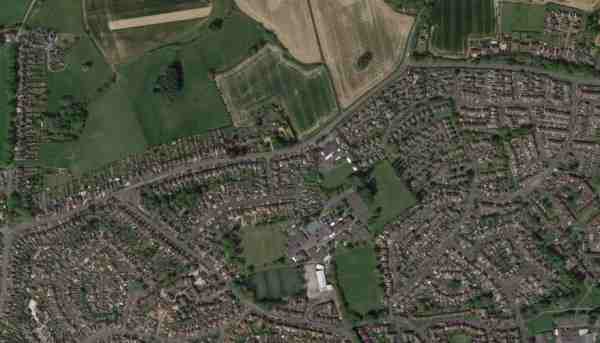
An aerial view (courtesy of Mr Google) of the area today.
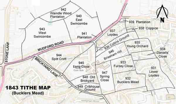
The 1843 Tithe Map overlaid onto a modern map of the area.