Flood Hatch
Flood Hatch
Accommodation land in Yeovil Marsh
Flood Hatch is possibly the field referred to as Floodgates in the 1589 Terrier. It was, however, recorded in the 1743 Terrier as Floodshatch "near the House called Lowhills in Mr Woodrow's Estate". It lay beside the small Yeovil Marsh stream that eventually joins the River Yeo below Pill Bridge, Ilchester.
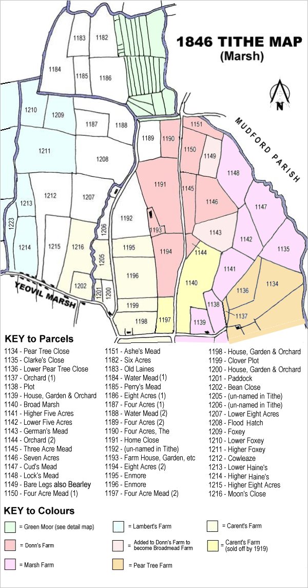
Flood Hatch (Parcel 1208) was accommodation land in Yeovil Marsh. Accommodation land is a term that originated in the early nineteenth-century and was applied to land, often adjoining a town or village, that was let for cultivation or pasture. Accommodation land generally did not form part of a farm.
The 1846 Tithe Apportionment (at least the copy held in the Heritage Centre at Taunton), does not record the details of Flood Hatch. The 1589 Terrier recorded it as arable, for growing crops.
Flood Hatch (Parcel 1208) was bounded on the east by the stream referred to above, to the south by Lower Eight Acres (Parcel 1207), to the west by Higher Foxey (Parcel 1211) and to the north by Four Acres (1) (Parcel 1187) and Water Mead (2) (Parcel 1188).
By the time of the 1919 sale of the six Marsh farms, Flood Hatch had been combined with Lower Eight Acres (Parcel 1207), Four Acres (1) (Parcel 1187) and Water Mead (2) (Parcel 1188) to form one large field of accommodation land.
For details on historic land measurement (ie acres, roods and perches) click here.
MAP