Guppy's Mead
Guppy's Mead
A former part of the great West Field of Kingston Manor
Guppy's Mead (Parcel 1441) was a rectangular field south of the field access track called Lower Larkhill Lane that would become today's Stiby Road.
The 1846 Tithe Apportionment noted Guppy's Mead as 5a 3r 0p and used as meadow. The Apportionment noted that the owner was 'Henry Coward (now John Glyde)' and the tenant was Henry Hurdle.
Guppy's Mead was bounded on the north by the field access track called Lower Larkhill Lane, on the west and south by Drang Ground (Parcel 1442) and on the east by Higher Marle Close (Parcel 1440).
By the 1940s (as seen in the aerial photograph below) the former Guppy's Mead had been built on by Westfield Place and Westfield Avenue.
For details on historic land measurement (ie acres, roods and perches) click here.
maps & Aerial Photographs
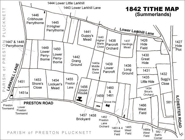
The Larkhill area reproduced from the 1842 Tithe Map. Guppy's Mead is at top centre.
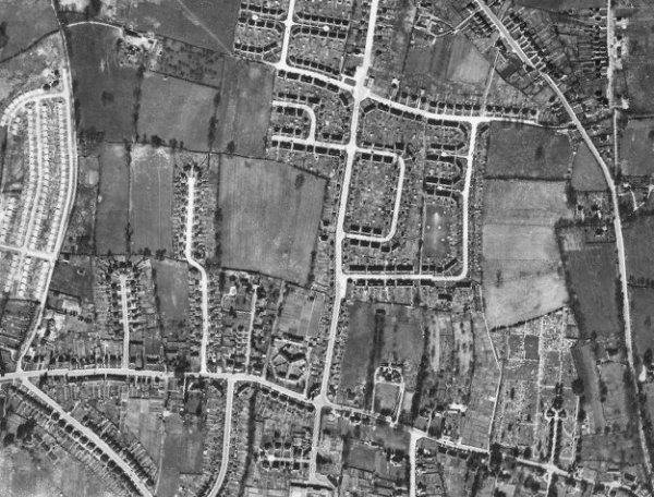
The 1946 aerial photograph - the former Guppy's Mead is at centre with the newly-built Westfield Place and Westfield Avenue and the incomplete Stiby Road to the immediate north.
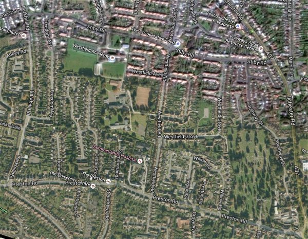
The same area today 'borrowed' from Google maps.
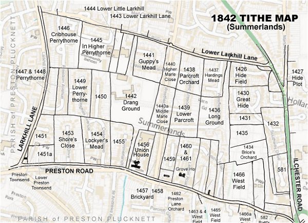
The 1842 Tithe Map superimposed (only very slightly out at the bottom) over a modern map.