the hound stone
the hound stone
18th century boundary marker
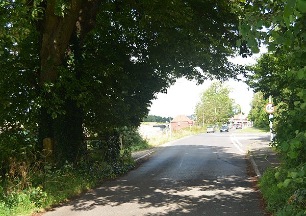
The Hound Stone is located on the northern side of Thorne Lane at Thorne Cross (the staggered crossroads of Western Avenue and the Thorne Coffin road) shown in the first photograph below.
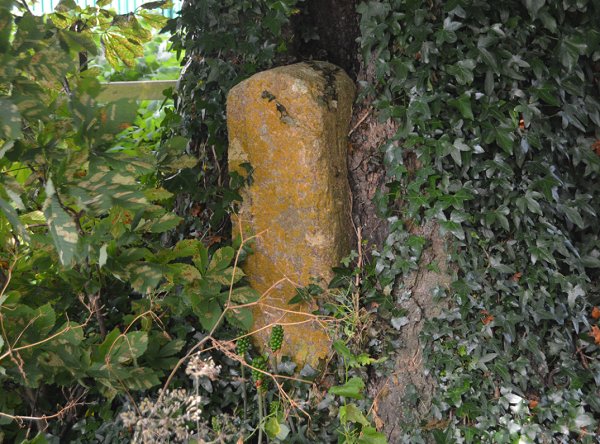
The stone is a boundary marker stone, most likely eighteenth century, taking the form of a Ham stone pillar. It marks the boundary between Yeovil Without Civil Parish and Brympton Civil Parish. Today it is largely enveloped by a large Horse Chestnut tree but the dimensions of the stone are known to be about 14" (350mm) wide at the base, tapering to 10½" (270mm), about 12" (300mm) thick and 4' 1" (1250mm) tall, with a rounded top. An Ordnance Survey bench mark, no longer visible because of the tree, is cut into the base of the stone.
According to local tradition this was the former meeting place of the local hunt, hence the name Hound Stone, which has also now been applied to the district to the south. This, of course, is completely erroneous since 'Hundestone' was actually recorded in the Domesday Book in 1086.
The Hound Stone is Grade II Listed.
gallery
This photograph
features in my
book 'Secret Yeovil'.
Looking east along Thorne Lane, with the junction of Western Avenue at right, this photograph shows the location of the Hound Stone - nestled in the tree at bottom left. Photographed in 2014.
This photograph
features in my
book 'Secret Yeovil'.
A more detailed view of the Hound Stone showing how the tree has grown around the stone. Photographed in 2014.
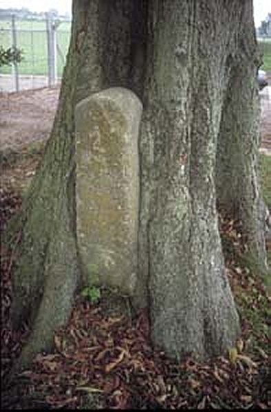
The Hound Stone photographed in 1985.