Hurdle Corner
Hurdle Corner
On the extreme western boundary of Preston Plucknett
Preston Plucknett's Preston Field, North Field, was originally a large medieval field along the western parish boundary of Preston Plucknett, lying to the south of another large medieval field called Field's End. Preston Field was bounded by the parish boundary with Brympton in the west and to the east by the field access track known as Eighteen Acre Lane.
By the time of the 1763 Survey of the Manor of Preston, the large medieval field had been broken up into a number of smaller fields and Hurdle Corner was one of these, located at the northwest corner of the former North Field and abutting Field's End. The 1763 Survey recorded it as Hurle Corner, measuring (in 'old' units) 8 acres, 2 roods, 2 perches. At this time the field was arable and used to grow crops. The name possibly derived from the corner of the field originally being fenced in with hurdles.
The 1846 Preston Tithe Map shows the field called Hurdle Corner (Parcel 61). It was bounded on the north by Field's End (Parcel 63), to the west by the parish boundary with Brympton, to the south by Nap Furlong (Parcel 57) and to the east it was bounded by Eighteen Acres Sleight (Parcel 62) and Quarr Close (Parcel 59).
The Preston Plucknett Tithe Apportionment of 1848 noted that Quarr Close was owned by Lady Georgiana Fane of Brympton d'Evercy and the tenant was Thomas Hawkins (who was a tenant of over 200 acres in over 40 parcels in the parish). The field measured (in 'new' units) 10 acres, 2 roods and 33 perches and was now used as arable land for growing crops.
The 1946 aerial photograph (see below) shows the field as undeveloped. It disappeared when the Abbey Manor estate was built in the 1980s and the site is now occupied by Western Avenue, Malmesbury Way and Flax Way.
For details on historic land measurement (ie acres, roods and perches) click here.
maps & Aerial photograph
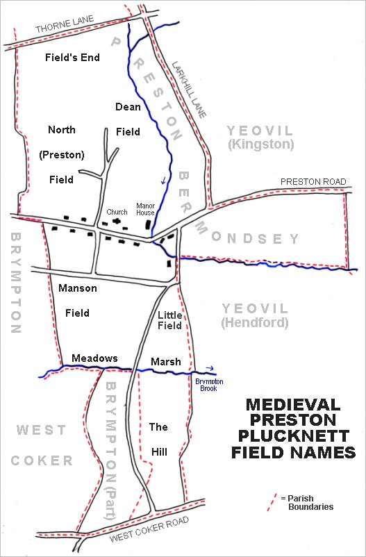
The main post-medieval fields of Preston Plucknett. The original large medieval field called Field's End is at top left, with North Field to its south.
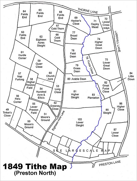
Map based on the 1849 Tithe Map showing Hurdle Corner (Parcel 61) at centre left.
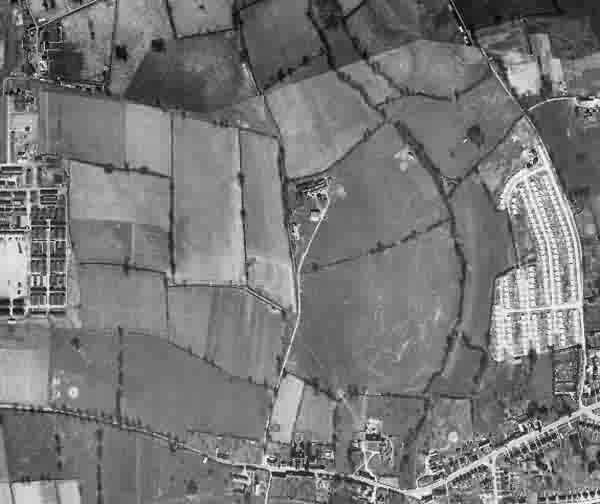
This is a 1946 aerial photograph showing Hurdle Corner towards top left as a trapezoidal field to the immediate east of Houndstone army camp (at centre left). It appears that a portion of Quarr Close (Parcel 59) had been added to Hurdle Corner - showing as a lighter colour, in order to make both Hurdle Corner and Quarr Close into rectangular fields.
At centre right is the post-war Larkhill Lane pre-fabricated housing estate. At centre is the Preston Plucknett Flax Works.
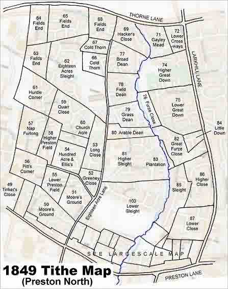
The 1849 Tithe Map superimposed over the modern Ordnance Survey map.