Little Hide
Little Hide
A former part of the great West Field of Kingston Manor
The Terrier of 1589, referring to the great West Field recorded "In Elizabeth Diers close next the way 5yds upon the Hide" - 'next the way' meaning alongside Ilchester Road. Originally a hide had been an area of land, albeit a variable unit but usually taken to mean about 120 acres. Originally the hide represented the amount of land which could be ploughed in a day by one plough team of eight oxen. A hide was considered adequate for the support of one free family and the term had originally meant a household. Apparently Hide Farm existed until 1950 but I have been able to find little trace of it in the records.
Little Hide (Parcel 1435) was a rectangular field just west of Ilchester Road and lying halfway between Lower Larkhill Lane (today's Stiby Road) to the north and Preston Lane (today's Preston Road) to the south.
Strangely (albeit not uniquely), although shown numbered on the 1842 Tithe Map, the 1846 Tithe Apportionment does not mention Little Hyde at all and it may be that it was included within Great Hide (Parcel 1430) for the purposes of the Apportionment.
Little Hide was bounded on the north by Great Hide, on the west by Long Ground (Parcel 1436), to the south by Brice's Orchard (Parcel 1434) and to the east by Sugg's Close (Parcel 1432).
During 1939 negotiations took place to acquire another field to extend Yeovil Cemetery northwards - this was Little Hide. The owner of the field, Mr F Brown, was demanding the sum of £300 even though the then-current value was £50 - as a result the negotiations floundered somewhat. The field was eventually acquired however.
Today the former Little Hide forms the northernmost part of Yeovil Cemetery.
For details on historic land measurement (ie acres, roods and perches) click here.
maps & Aerial Photographs
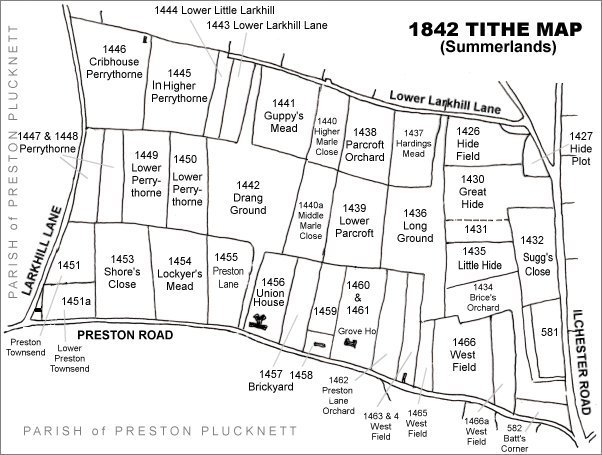
The Larkhill area reproduced from the 1842 Tithe Map. Little Hide is centre right.
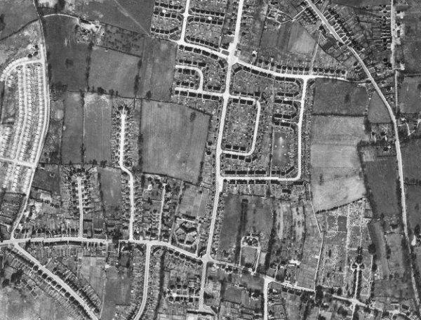
The 1946 aerial photograph - at this time, although part of Yeovil Cemetery, Little Hide had yet to be used for interments..
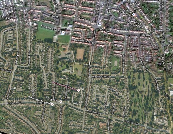
The same area today 'borrowed' from Google maps.
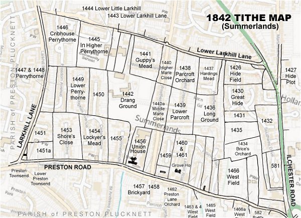
The 1842 Tithe Map superimposed (only very slightly out at the bottom) over a modern map.