yeovil people
Thomas moore
Solicitor
Thomas Moore was born in West Coker around 1791, the third son of John Moore and Elizabeth née Chaffey, the daughter of Joseph Chaffey of Martock. He married around 1828 or 1830 and his wife Elizabeth bore him several children including Elizabeth (b 1831), Thomas Jnr (b1832), Joseph Chaffey (b 1833) and Sarah (b 1837). Both his sons would become Solicitors like their father and Joseph would also become Mayor of Yeovil.
Thomas Moore began as a solicitor in West Coker but before 1839 had moved to Yeovil. He had his legal practice, and the family lived, at Far End House, Higher Kingston (shown below). They were listed there in the 1841 census. As well as 45-year-old Thomas and 35-year-old Elizabeth were their children Elizabeth aged eleven (who would later marry solicitor Henry Shorland Watts), Thomas aged nine, Joseph aged eight and Sarah aged three as well as an articled clerk, James Benson, and two female servants.
In 1840 the Somerset Gazette Directory listed Thomas twice; once as an Attorney of Back Kingston (today's Higher Kingston) and again as the Agent for the Atlas Fire & Life Insurance Company. Both listings were repeated in Hunt & Co's Directory of 1850 and Slater's Directory of 1852.
Elizabeth died in the winter of 1850 and in the 1851 census Thomas was listed as a 60-year old widower living with his daughter Elizabeth, son Thomas Jnr and two servants in Higher Kingston. Thomas gave his occupation as Attorney at Law while Thomas Jnr gave his as Articled Clerk.
In late November 1854, during the Crimean War, the Yeovil Local Patriotic Fund was created as part of the national scheme to support widows and orphans of servicemen killed in action. Support in Yeovil was instantaneous. A list of subscribers was published in the Western Flying Post's edition of 12 December 1854. On first glance it may seem that people were being less than generous until it is realised the £5 in 1854 would be worth around £600 at today's value. The total amount listed was some £427 - in excess of £50,000 at today's value - and all raised in the first week of the appeal. Thomas subscribed £5 to the fund (around £600 at today's value).
Thomas Moore died in the winter of 1859, aged 68. The listing of 'Thomas Moore, Solicitor of Higher Kingston' in the Post Office Directory of 1866 referred to his son, Thomas Jnr, who continued his father's law firm, and was later to be joined by his brother Joseph to form the firm of T&JC Moore, Solicitors of Higher Kingston.
See Jekyll - Newman - Paynter - Moore Family Relationships Tree
Land Holdings
The Yeovil Tithe Apportionment of 1846 shows that Thomas Moore owned four houses.
| Owner | Occupier | No | Name |
| Moore, Thomas | Eyles, John | 282 | Houses & Gardens |
| Moore, Thomas | Moore, Thomas | 280 | House & Garden (Far End House) |
| Moore, Thomas | Moore, Thomas | 281 | House, Garden & Orchard |
| Moore, Thomas | Toop, John | 278 | Houses & Gardens |
Map
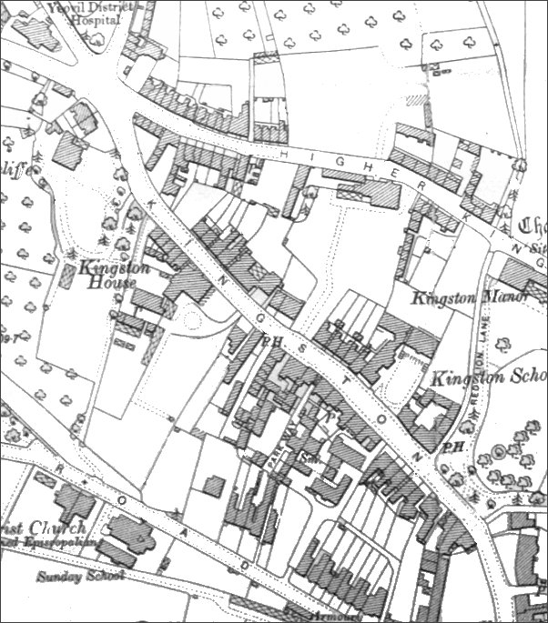
This map, based on the 1901 Ordnance Survey, shows the entire original length of Kingston from the Fiveways Crossroads at top left to Mansion House and North Lane at bottom right at which point Kingston becomes Princes Street. Thomas Moore's home, Far End House', is the large house with extensive gardens reaching to Kingston. The house itself appears just below the letters 'GHE' of 'Higher' at top, right of centre.
gallery
The original photograph
features in my
book 'Yeovil
From Old
Photographs'.
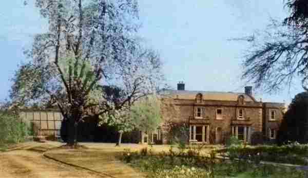
A colourised photograph of Thomas Moore's home, 'Far End House', Higher Kingston, seen from Kingston. In order to create a grand first impression of the house its driveway and extensive gardens were reached from Kingston (immediately above the 'S' in 'Kingston' on the map). The less-impressive rear elevation of the house, as seen in the next photograph, backed immediately onto Higher Kingston.
In 1961 Far End House was owned by the Ministry of Health and let out to Owen Edgar Stephens as tenant - from an agreement held in the Heritage Centre, Taunton.
Courtesy of South Somerset Heritage Collection
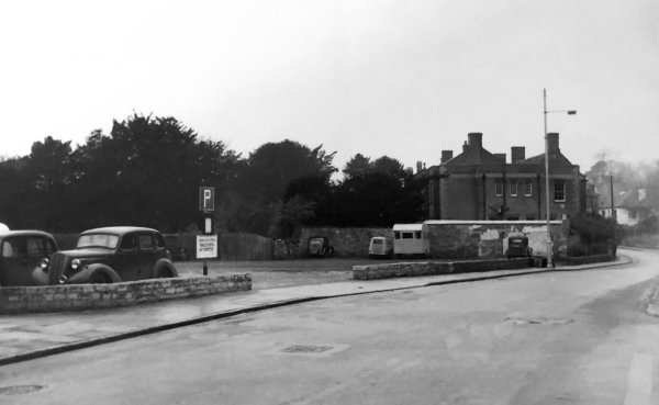
A photograph of the early 1950s showing a car park in Higher Kingston. At the extreme left, the footpath curves around to meet the northern end of Red Lion Lane, while at the right is the south-eastern flank wall of Thomas Moore's Far End House.
Courtesy of South Somerset Heritage Collection
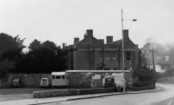
An enlargement of the previous photo, featuring the south-eastern flank wall of Far End House.
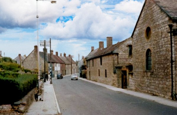
One of the Council's walking guides states the building at right was once Yeovil's prison. Of course it never was - it's certainly not marked as such on any of the old maps from Watts' map of 1806 onwards. Not only that, the town lock-up was the Blind House in the Tolle Hall in the Borough (the cells of which are still under the Borough) certainly between 1630 and 1849 when the Town House became the new town police station and lock-up. Also, the 1842 Tithe Apportionment and the 1846 Tithe Map clearly show that Higher Kingston was all houses, gardens and orchards. In fact the building was the rear of Far End House. A colourised photograph of the mid-1960s.