nine acres
nine acres
Another of Yeovil's fields disappears forever
Shown as the Lower South Field on Philip Byles' map of 1653, Nine Acres originally totalled 10a 1r 15p but minor boundary changes by Victorian times had reduced its area to 8a 3r 0p. The 1846 Tithe Award noted that it was used as pasture to graze livestock.
Nine Acres was bounded to the north by Twenty Acres (895), to the west by Linches (894), to the south by Lower Cowleaze (907) and to the east by Higher Cowleaze (905).
In 2014 Nine Acres was built on as part of the ever-expanding Wyndham Park.
maps
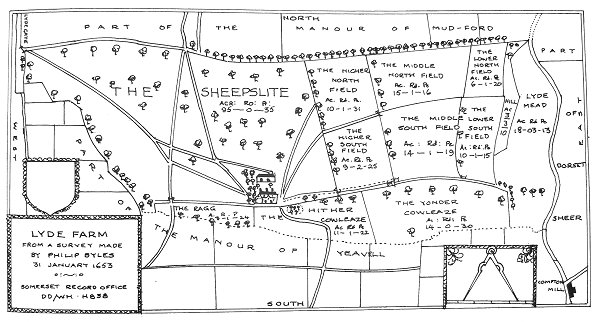
Philip Byles' map of Lyde Farm dated 31 January 1653. Nine Acres is shown as the Lower South Field, to the right.
Courtesy of
Steve Wills
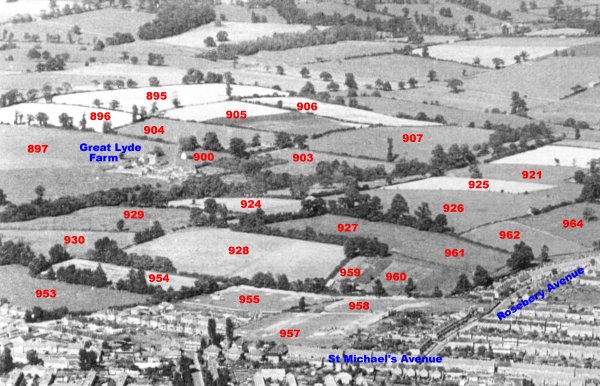
An aerial photograph of the Great Lyde area taken around 1953, with Parcel Numbers superimposed from the 1842 Tithe map.
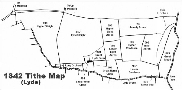
The Lyde area reproduced from the 1842 Tithe Map.
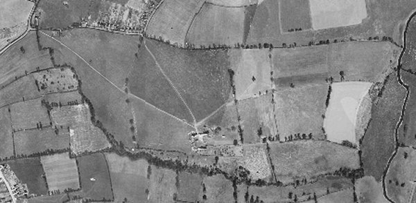
The 1946 aerial photograph of Great Lyde Farm
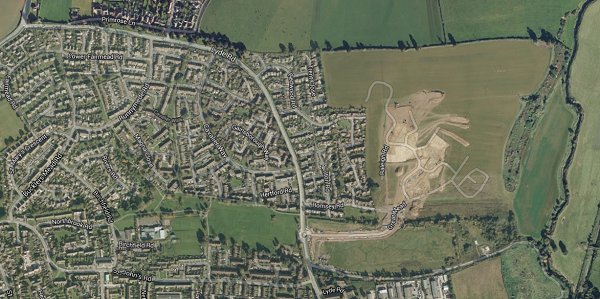
The same area today 'borrowed' from Google maps and taken around 2010 when the groundworks for Wyndham Park were being started.
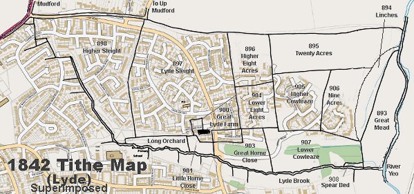
The 1842 Tithe Map superimposed over a modern map.
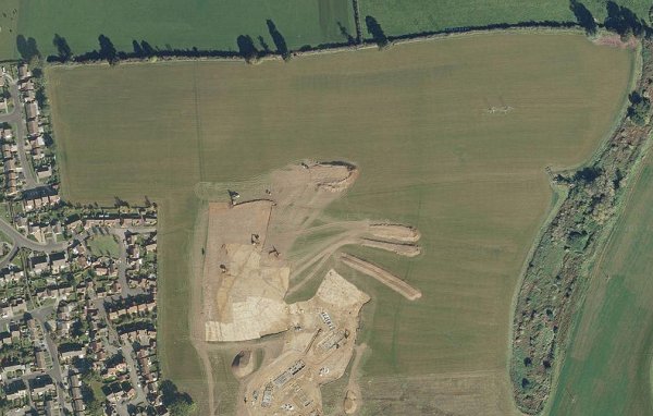
A closer Google Maps image of Nine Acres at lower right clearly showing its boundary with Twenty Acres to the north and Higher Cowleaze to the west. Taken during the early groundworks phase of the Wyndham Park development. It is currently (2014) being built on and already has Nelson Way occupying its southern half.
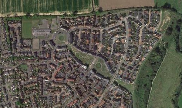
... and a more recent (2018) aerial view (courtesy of Mr Google) showing Nine Acres completely built on.