Quarry Ground
Quarry Ground
A field, probably a former quarry, within the great manorial East Field
There have been at least half a dozen quarries in Yeovil from Roman times onwards, producing Beacon Limestone - locally known as Yeovil Stone.
Quarry Ground (Parcel 953) was a large eight-acre field that had, presumably, been quarried at one time. In August 1850, Lower Lyde (Parcel 952) to the immediate north of Quarry Ground, was advertised for sale, having a "valuable Stone Quarry, and the Lime Kiln, Cottages and other Premises lately erected thereon".
At the time of the 1846 Tithe Apportionment, Quarry Ground was owned by by Captain William Jones Prowse of Enham House, Southampton, Retired Captain RN, son of George Bragge Prowse of Kingston Manor House and Lord of the Manor of Kingston. Quarry Ground was let to James Tucker. At this time, it was used as pasture for grazing livestock and measured 8a 0r 5p.
Quarry Ground was bounded on the west by Brickyard Lane (today's St Michael's Avenue), on the north by the southern spur of Higher Loydes (Parcel 950), Higher Lyde (Parcel 951) and Lower Lyde (Parcel 952). On the east it was bounded by the field access to Harbin's Ground (Parcel 930) and Fouracre Mead (Parcel 954), and to the south by Higher Hather Mead (Parcel 956) and Lower Hather Mead (Parcel 955).
By the time of the 1946 aerial photograph seen below, only the western edge had been built on with houses on the eastern side of St Michael's Avenue.
Today Quarry Ground contains the eastern two-thirds of Greenhill Road and the entirety of Heather Road and Erica Close.
For details on historic land measurement (ie acres, roods and perches) click here.
maps

This map, based on the descriptions in the 1589 Terrier and the 1846 Tithe Map of Yeovil shows the approximate boundaries of the Manors of Kingston and Hendford as well as the manorial three-field system used in Kingston.

A map of the great medieval East Field of Kingston Manor showing conjectured locations of several fields based on descriptions in the 1589 Terrier.
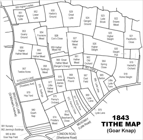
Drawn from the 1846 Tithe Map with field names added from the 1846 Tithe Apportionment, with Quarry Ground (Parcel 953) in the top left quadrant.
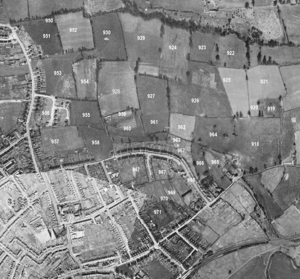
The 1946 aerial survey photograph (somewhat mis-aligned at bottom left) with parcel numbers of 1846 plotted on. At this time, Quarry Ground only has houses and gardens of St Michael's Avenue built along its western edge.
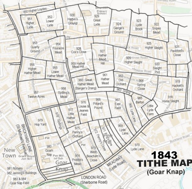
The 1843 Tithe Map overlaid onto a modern map of the area.
Gallery
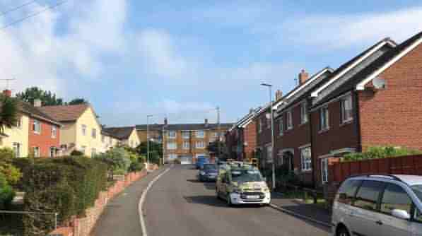
Heather Road in 2008 ('borrowed' from Mr Google), before the demolition of the houses at right and the building of Erica Close in 2011. At the far end are Johnson Flats which have been there at least since 1973 (when I lived in one of the flats for a few months when I first moved to Yeovil).
Heather Road, photographed in 2021.
Erica Close, photographed in 2021.
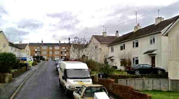
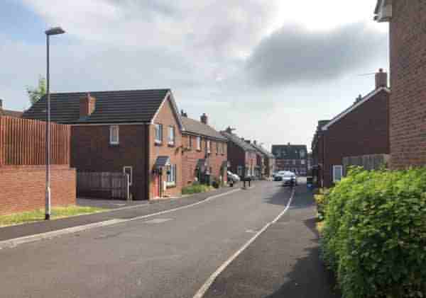
Looking west along the western end of Greenhill Road, at the junction with Heather Road - this would have been in the southern half of Quarry Ground. Photographed in 2021.