reckleford Cross
Reckleford cross
Site of an early wayside cross
Today's Reckleford originally started at the junction with Higher Kingston at the crossroads with Court Ash Terrace and what would become The Avenue in the west. From here it was known as Reckleford Hill as far as Goldcroft, beyond which it was known as Lower Reckleford, later just Reckleford, until it joined with Sherborne Road close to Sun House. Today's Market Street, on the other hand, was earlier known as Reckleford or Rackleford as shown on Watts' map of 1806 below.
At the junction of Market Street with Reckleford, the area was known as Reckleford Cross because in earlier times a wayside cross had stood there. Watts' map of 1806 shows the cross and is annotated 'Cross'. None of the 1831 maps variously drawn by Watts, Day or Madeley show the cross but Bidder's map of 1843 shows the cross, or perhaps just its remains, as a dot in the middle of the road. It is certainly not shown on the 1858 map of Yeovil or any maps thereafter.
In April 1916 Preb. EH Bates Harbin reported in Somerset & Dorset Notes & Queries the discovery of a "much-mutilated head of a cross" reckoned to be possibly of 13th century date. It was discovered during road widening at the junction of Reckleford and Sherborne road near Sun House Farm, some 500 yards away from its probable original location.
The block of Ham Hill stone was 16" wide, 14" high and 5" thick (410mm x 360mm x 130mm). Large pieces had broken off at both the top and the bottom and the sides were chipped. One face retained the outline of the figure of the Blessed Virgin Mary seated and holding her Child in her left arm. The other face originally contained the Crucifixion with the figures of the Virgin and St John on either side' but only the figure of the Virgin survived.
He reported that ".... when destroyed, the socket stone would do for the foundation of a house, the steps of the Calvary for the walls, the shaft for a gate post, while the head seems to have been utilised to fill up a rut in the road."
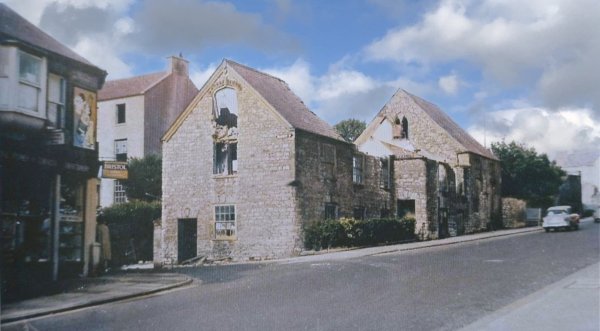
Nevertheless the cross gave its name to the immediate area, which became known as Reckleford Cross. Reckleford Cross House, the first large house almost on the corner of Market Street, became Reckleford Cross School - a small private school run by three spinster sisters, Ethel, Susan and Kathleen Chaffey.
map
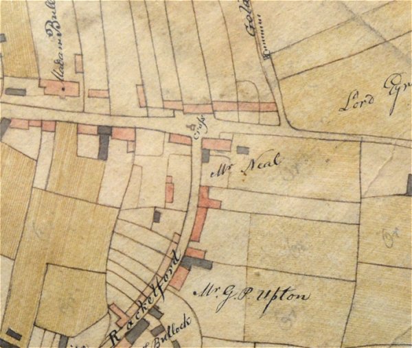
Edward Watts' map of 1806 shows today's Reckleford running across the top of the map and Rackleford (today's Market Street) running down from centre to lower left. At the junction, illustrated and clearly marked 'Cross' is the location of Reckleford Cross. The start of Gold Croft Lane (today's Goldcroft) is seen running off the map at upper right.
gallery
This colourised photograph dates to about 1965 and shows the junction of Market Street, at left, with Reckleford, as the buildings shown were being prepared for demolition. This whole area was known as Reckleford Cross since at one time a wayside cross stood in the middle of the road at this point.
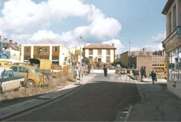
The area known as Reckleford Cross photographed in the 1960s from Market Street looking towards Reckleford and Reckleford House. Palmer's fish restaurant is on the right and directly ahead Market Street joins Reckleford. At left is untidy waste ground with cars parked on it with little change there in the last fifty years.