Rookery
Rookery
A field of the Newton Surmaville Estate
Rookery (Parcel 848), was a field forming part of the Newton Surmaville Estate that was not leased out as Newton Farm.
At the time of the 1846 Tithe Apportionment, Rookery was owned and occupied by George Harbin. It was recorded as pasture for grazing livestock and measured 6a 3r 22p.
Rookery (Parcel 848) was bordered on the east by the River Yeo, on the south by Newton Surmaville House (Parcel 847) and Middle Paddock (Parcel 840), on the west by Newton Road and Coppice (Parcel 849) and to the north by Crickets Ham (Parcel 850).
For details on historic land measurement (ie acres, roods and perches) click here.
maps

This map, based on the descriptions in the 1589 Terrier and the 1846 Tithe Map of Yeovil shows the approximate boundaries of the Manors of Kingston and Hendford as well as the manorial three-field system used in Kingston.
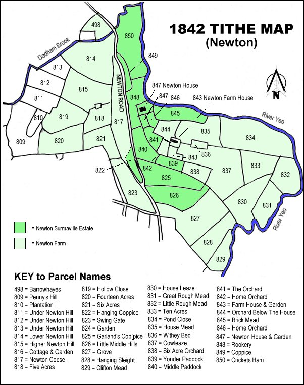
The 1842 Tithe Map showing the Newton Surmaville Estate shaded mid-green and the parcels of Newton Farm shaded light green. Rookery (Parcel 848) is at top centre.