Sealey's Mead
Sealey's Mead
A former part of the great West Field of Kingston Manor
Originally part of the great medieval West Field of Kingston Manor, Sealey's Mead (Parcel 1422) was a field west of Marl Close Farm and on the north of a field access track called Lower Larkhill Lane but today has become Stiby Road.
The 1846 Tithe Apportionment noted Sealey's Mead as 6a 0r 15p and used as meadow. The Apportionment noted that the owner was 'Henry Coward (now John Glyde)' and the tenant was Joseph Brooks.
Sealey's Mead was bounded on the north by Higher Larkhill Lane (Parcel 1411), on the west by Thorney Bush (Parcel 1420) on the east by Marle Close (Parcel 1424) and on the south by the field access track Lower Larkhill Lane.
Today the site of the former Sealey's Mead is occupied by the houses and gardens of both sides of Coronation Avenue from the roundabout at Stiby Road as far as the junction with Elliotts Drive and Thatcham Park.
For details on historic land measurement (ie acres, roods and perches) click here.
maps

This map, based on the descriptions in the 1589 Terrier and the 1846 Tithe Map of Yeovil shows the approximate boundaries of the Manors of Kingston and Hendford as well as the manorial three-field system used in Kingston.
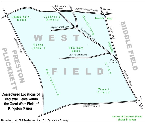
A conjectural map of the great West Field of Kingston Manor showing ancient sub-fields, most likely common fields, within the overall bounds of West Field.
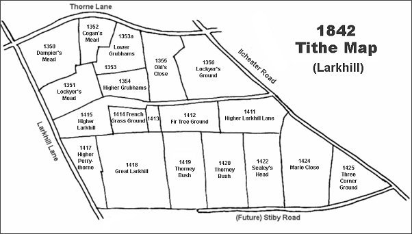
The Larkhill area reproduced from the 1842 Tithe Map. Sealey's Mead is towards bottom right.
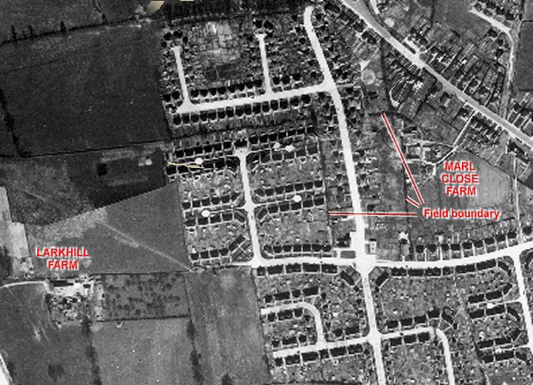
The 1946 aerial photograph - the former Sealey's Mead lay right of centre with the newly-built Coronation Avenue running off-centre through it from the roundabout at Stiby Road. The former field boundaries are still discernible in the photograph - running between the end of the Marl Close development and the back gardens of the western properties in Coronation Avenue and parallel on the other side of Coronation Avenue behind Marl Close Farm.
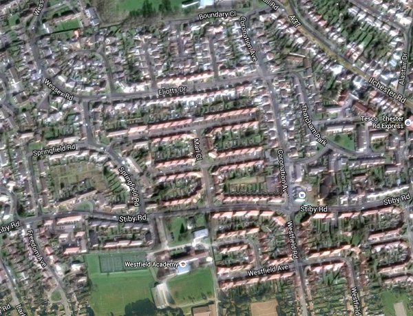
The same area today 'borrowed' from Google maps.
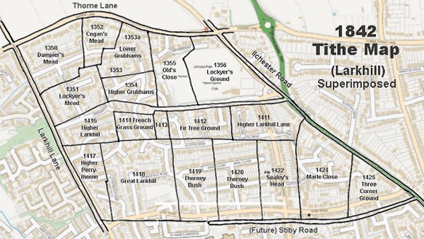
The 1842 Tithe Map superimposed (slightly out at the bottom) over a modern map.