water towers
water towerS
Water Tower, Ashford
Grove
In 1897 a huge underground reservoir was constructed on the top of Summerhouse Hill with a capacity of one and a quarter million gallons and another was sited on Hendford Hill, of 800,000 gallons capacity. These supplied Yeovil by gravity until both were replaced in 1955 with the construction of Sutton Bingham reservoir.
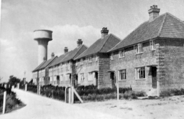
However in the 1930s (?) with the continual expansion of the town, it was not possible to gravity-feed properties in the area of the the Hundredstone Corner on Mudford Road. Because this is the highest point in Yeovil, and higher than Summerhouse Hill, it was necessary to pump water to a bulk water tank, then gravity-feed to the new local homes that were being built in Glenthorne Avenue and Ashford Grove.
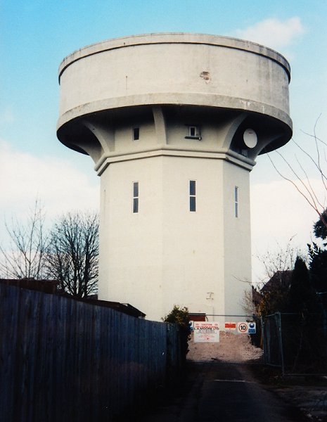
Consequently a water tower was built at the end of Ashford Grove, accessed via a 45m long access track, although frequently known as the Mudford Road water tank. It was a clear skyline landmark visible, for instance, from the A303 above West Camel five miles to the north or from the Corton Denham Ridge, a similar distance to the northeast.
In June 1941, during the Second World War, an air reconnaissance of the water tower and its surrounding area was undertaken in order to establish the likelihood of its becoming a target for enemy bombers. The following report noted that "the Water Tower was readily observed.... from heights of 6,000 feet to 60 feet." Further, the report noted "That the concrete roads in the area not already camouflaged were very noticeable from all heights (see first photograph below), and the opinion was expressed that they should all be camouflaged completely, that is, both parts of Glenthorne Avenue, Elmhurst Avenue, Ashford Grove and Allingham Road." As a result of the report, the Corporation instructed the Borough Surveyor to put in hand the camouflaging of the roads with creosote.
This water tank was demolished in 2005.
Water Tower, Springfield Road
A similar, but
smaller and
narrower, water
tower was sited
in Springfield
Road, although
this was built
in the middle of
a field years
before
Springfield Road
itself was
built. The tower
is present on
the 1946 aerial
photograph of
Yeovil (last
photograph
below) but at
this time Stiby
Road had only
been built from
Ilchester Road
as far as Marl
Close and the
water tower was
in a field at
the end of the
northernmost
western 'arm' of
Marl Close.
Gallery - Ashford Grove water tower
Courtesy of
Peter Jackson
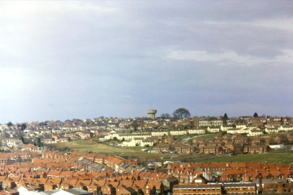
The Ashford Grove water tower dominated the skyline from all directions, this photograph was taken from Summerhouse Hill in March 1979.
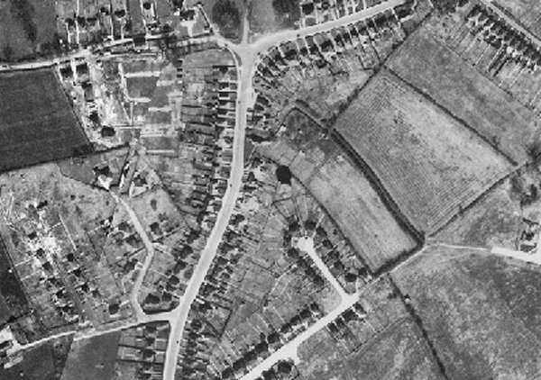
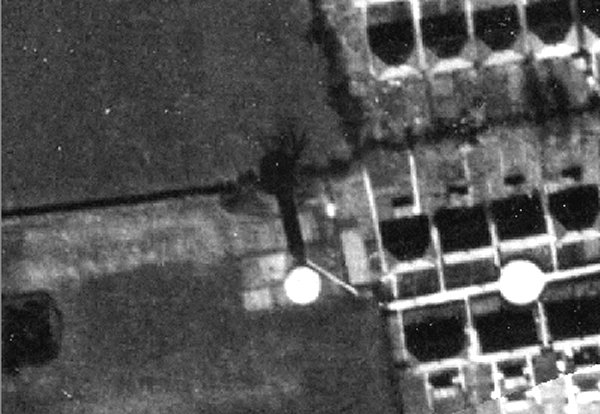
At dead centre of
this 1946 aerial photograph
is the black,
circular shadow
of the Ashford
Grove water
tower. Mudford
Road sweeps up
the centre of
the photograph
before running
off to the
right. At very
top centre is
the Hundred
Stone. At bottom
centre
newly-constructed
Glenthorne
Avenue has only
been built as
far as Ashford
Grove, at the
top of which the
access track to
the water tower
is seen.
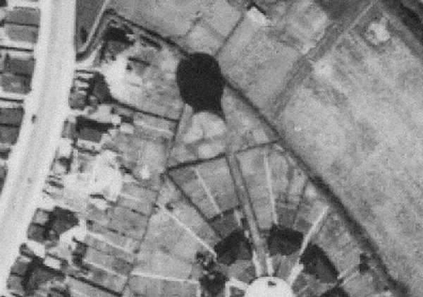
An enlargement of the centre of the previous 1946 aerial photograph with the water tower at centre and its dark shadow above it. The access track is visible running from the turning circle at the end of Ashford Grove.

Photograph
(colourised) by
Geoff Bowler,
courtesy of Sue
Bowler
The water tower seen from Ashford Grove, photographed in 1969.
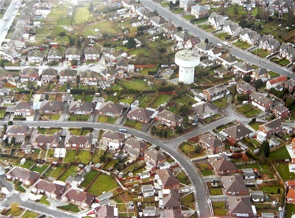
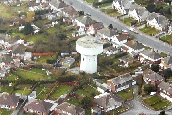
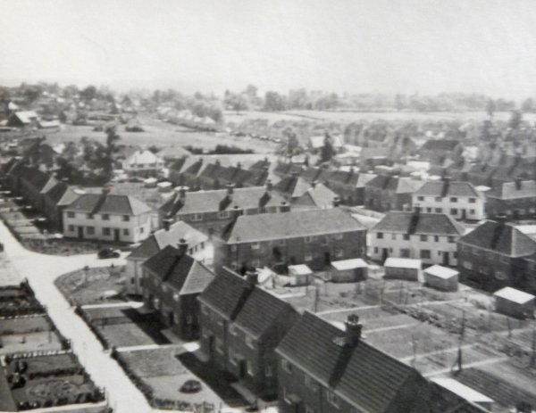
The Ashford Grove water tower seen in its wider setting in this aerial photograph of 1993. Mudford Road is at top right while High Lea curves around lower left. Ashford Grove runs towards the water tower at top left.
A closer look, cropped from the previous photograph.
Courtesy of
Vivien and John
Cornelius
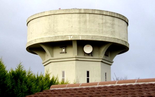
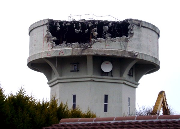
The water tower photographed in March 2005, shortly before demolition began.
Courtesy of
Sarah Dennett
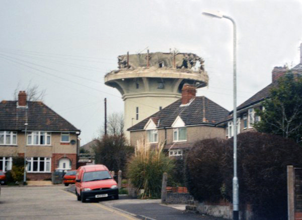
The water tower photographed from High Lea in 2005, just months before its demolition.
Courtesy of
Sarah Dennett
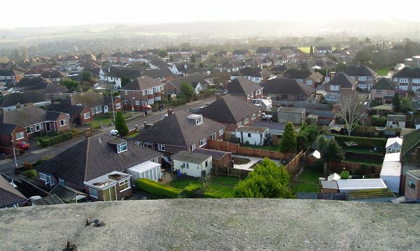
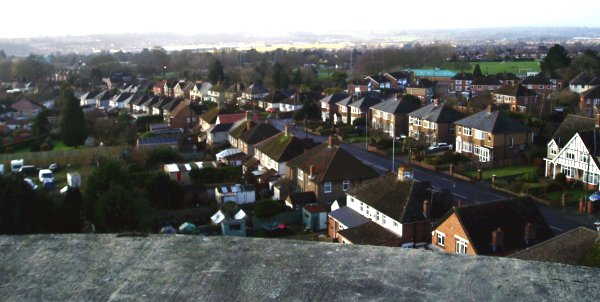
Not exactly an aerial photograph, but close. The view southeast, across High Lea, from the Ashford Grove water tower. Photographed in 2005.
Courtesy of
Sarah Dennett
The view southwest, across Mudford Road and beyond to Westland, from the Ashford Grove water tower. Photographed in 2005.
Courtesy of
Sarah Dennett
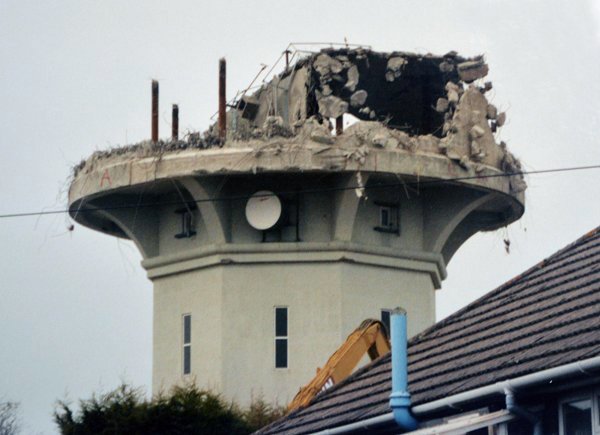
Again, photographed from High Lea in 2005, as demolition begins.
Courtesy of Jack
Sweet.
This
photograph
features in my
book "Lost Yeovil"
Demolition of the tank gets well under way.
Courtesy of Jack
Sweet
The top part of the structure, the actual water tank, slowly disappears.
Gallery - Springfield Road water tower
The long, thin shadow and water tower at the centre of the photograph are in a field later to become part of Springfield Road in this 1946 aerial photograph. At right is newly-built Marl Close. The white circle in Marl Close is a turning-circle in the road.
Courtesy of South Somerset Heritage Collection
The taller, slimmer Springfield Road water tower, photographed in the 1950s.
Courtesy of South Somerset Heritage Collection
Marl Close, seen from the Springfield Road water tower. Again, photographed in the 1950s.
Courtesy of Rob
Baker
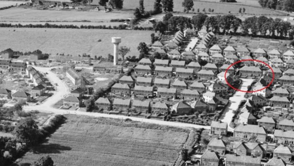
This aerial view of 1953 shows the Springfield Road water tower left of centre, with the houses of Springfield Road under construction to its left. To the right is the newly-built Marl Close estate and circled in red is the junction shown in the previous photograph from the top of the tower. Stiby Road runs across the bottom of the photograph.