arnold's close
Arnold's Close
An ancient field of the great Manor of Kingston's Middle Field
Arnold's Close was bounded on the north by Nobles Nap (1401), on the east by Marsh Lane, to the south by Piccadilly (1403) and on the west by Lower Oxen Furlong (1405).
The 1842 Tithe Map and the 1846 Tithe Award refer to Parcel 1402 Arnold's Close as pasture and records that it was 4a 1r 0p.
Today the former field known as Arnold's Close is completely filled with housing of Marsh Lane to the east and the Combe Park to the west.
map
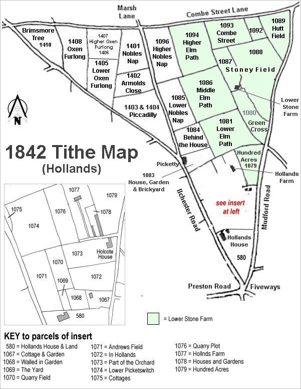
The Hollands area reproduced from the 1842 Tithe Map. Higher Oxen Furlong is toward top left.
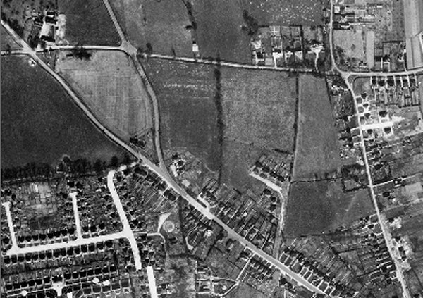
The 1946 aerial photograph showing Arnold's Close at lower right - at this time still a field with what appears to be a small paddock in its northeast corner.
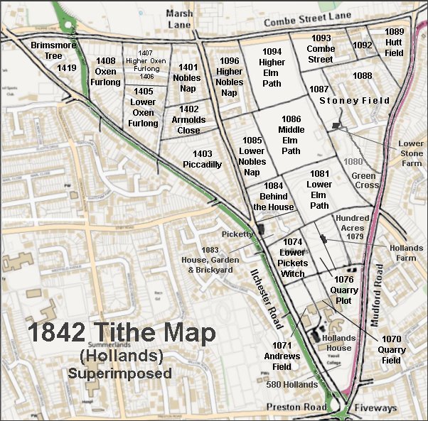
The 1842 Tithe Map superimposed over a modern map.