Nobles Nap
nobles nap
An ancient field of the great Manor of Kingston's Middle Field
It has been suggested (Goodchild) that the name Nobles Nap may have originated with reference to the annual rent of a Noble; current in England until the seventeenth century as a gold coin worth one third of a pound, or six shillings and eight pence. This would seem to make the rent inordinately expensive but not only that, but in 1743 the field in question was known as Chaplin's Nap. It is therefore more likely that the name refers to a later owner called Noble. The 'nap' part comes from the Old English hnaep, for rising ground or the crest of a hill as, for instance, at Goar Knap.
Nobles Nap was originally one large field spanning both sides of Combe Street Lane and was originally part of the great Middle Field of Kingston Manor. It was later subdivided into five fields; two to the north of Combe Street Lane and three to the south. Those to the south being Nobles Nap (1401), Higher Nobles Nap (1096) and Lower Nobles Nap (1085). Those to the north of Combe Street Lane were Little Nobles Nap (Parcel 1099) and Great Nobles Nap (Parcel 1100).
The original large field called Nobles Nap was a site of burials of suicides, at least until the early nineteenth century. In its edition of 9 May 1814 the Sherborne Journal reported "A girl of the name of Sherstone, 20 years of age, servant to Mr Isaac Mullins, farmer of Yeovil (actually a glove manufacturer) put a period to her existence on Monday morning last, by taking a portion of arsenic; the Coroner's Jury sat on Saturday on the body, and brought in their verdict 'felo de se' (felon of himself). She was buried at the Cross Roads near the town. No cause is assigned for her committing this rash act, except a notice from her employer to quit his service for inattention to his afflicted mother." People who committed suicide were often buried at this crossroads. Another such place of interment was Corner Close, at the junction, or corner, of West Coker Road and Dorchester Road. An Act of 4 George IV (1823) directed that for the future a felo de se may be buried in the unconsecrated portion of a churchyard between the hours of nine and twelve at night and expressly states "without any stake being driven through the body". The driving of a stake through the body of a felon or suicide, was to prevent the ghost from "rising to the face of the earth again." In its edition of 5 January 1753, the Derby Mercury reported; "Last Saturday sen'night one John Adams, of Yeovil, in the County of Somerset, was found hanging in a Stable at the Sign of the Crooked Fish at Frome... ordered to be buried in the common Highway, and to have [a] Stake drove through [his] Body."
Nobles Nap (1401) was bounded on the north by Combe Street Lane, to the east by Marsh Lane, on the west by Higher Oxen Furlong (1407) and Lower Oxen Furlong (1405), and to the south by Arnold's Close (1402),
The 1842 Tithe Map and the 1846 Tithe Apportionment recorded Nobles Nap as being 5a 1r 3p and noted as 'wood and pasture'.
The field, at one time, had a fenced-in pond. In September 1886, Albert Edwards, a Yeovil tradesman, committed suicide and his body was found when the pond was dragged.
Today the former field known as Nobles Nap is completely filled with housing of Combe Street Lane, Marsh Lane and the central section of Combe Park.
map

This map, based on the descriptions in the 1589 Terrier and the 1846 Tithe Map of Yeovil shows the approximate boundaries of the Manors of Kingston and Hendford as well as the manorial three-field system used in Kingston.
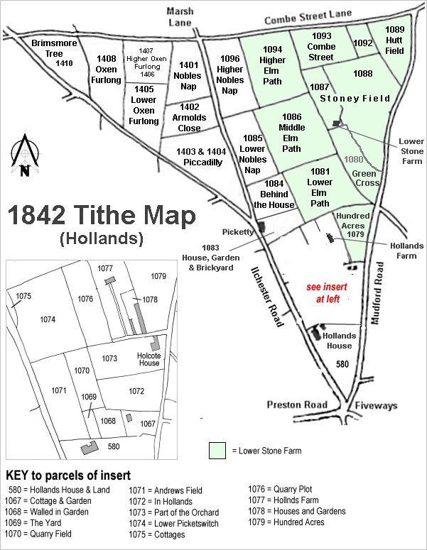
The Hollands area reproduced from the 1842 Tithe Map. Nobles Nap it just left of top centre.
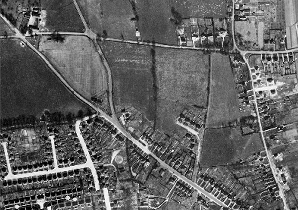
The 1946 aerial photograph showing Nobles Nap at centre right with houses of Marsh Lane occupying the eastern edge..
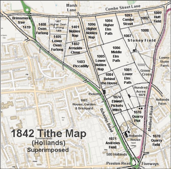
The 1842 Tithe Map superimposed over a modern map.