Drang (1)
Drang (1)
A lane-width field
There are several fields in Yeovil called Drang - this, one of two close to Little Lyde Farm, one in New Town (Parcel 994) and a further example off Lower Larkhill Lane. FT Elworthy in his "West Somerset Word Book" records that 'Drang-Way' was a passage or narrow alley, invariably between two walls, while FW Matthews in his "Glossary of the West Somerset Dialect" recorded that Drang, or Drong, was a narrow way between high hedges or walls or earth banks. The word is probably a British survival of the Welsh dre meaning a street or road.
This particular Drang (Parcel 866) was a field access track leading off Meadway (today's Lyde Road) and had once been part of a sub-field of the great medieval East Field of Kingston Manor called Meadway, or Medway, which in today's terms stretched along Lyde Road from the junction with Sherborne Road as far as the Lidl store and stretched along Sherborne Road from the junction with Lyde Road to beyond the railway line.
By the time of the 1743 Terrier, the large medieval sub-field Meadway had been broken up into several smaller fields, or parcels and Drang ran between two of these - Great Medway (Parcel 865) to the south and Jacob's Medway (Parcel 867) to the north, in order to reach Medway (Parcel 868) to the east.
The 1846 Tithe Apportionment noted that Drang was owned by John Tanner Whiteley Pitcher ('natural' son of William Row) and the tenant was John Brook the Younger. The Apportionment noted that it measured 0a 1r 26p and was used as pasture although its real purpose was to give access to Medway (Parcel 868) also owned and occupied by Pitcher and Brooks.
By around 1900 Drang had been absorbed into Great Medway and during the 1920s houses of the southwestern side of Camborne Grove were built there.
For details on historic land measurement (ie acres, roods and perches) click here.
maps & Aerial photographs

This map, based on the descriptions in the 1589 Terrier and the 1846 Tithe Map of Yeovil shows the approximate boundaries of the Manors of Kingston and Hendford as well as the manorial three-field system used in Kingston.

A map of the great medieval East Field of Kingston Manor showing conjectured locations of several fields based on descriptions in the 1589 Terrier.
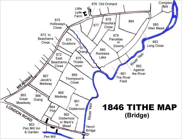
This map is based on the 1842 Tithe Map with field names chiefly added from the 1846 Tithe Apportionment.

ThThe 1842 Tithe Map superimposed (roughly) over a modern street map. Bearing in mind the relatively primitive surveying equipment of the 1840s they weren't all that far out.