new town
new town
Urgently needed housing for the expanding town
Kiddle's Lane (today's Eastland Road) has been around for centuries but little more than a country lane running through open fields. The earliest developments in the area were concerned with the gloving industry and the brick making industry. During the nineteenth century the population of Yeovil expanded rapidly, from 5,590 in 1821 doubling to 10,425 in 1881, Vickery, commenting in 1856, stated that "the number of inhabited houses in 1841 was about 1,441, uninhabited and in building 173" and, as seen elsewhere on this website, much of the town's housing stock was of a very poor condition and today would be classed as slums. During the nineteenth century, as the expanding gloving and leather industries meant that the town prospered, the shortage of housing became a considerable and ever-increasing problem.
The first major building programme, all speculative, created to overcome this problem was built around Kiddle's Lane and was named originally 'Kiddle's Town' and then 'New Town'. There were already a couple of cottages in Kiddle's Lane, close to Reckleford, but the first housing proper began to be built during the 1870s and 1880s - all as speculative housing that was built on what was literally a 'green field' site - as seen in the first photograph below.
The first terrace of houses to be built, in 1870, was named Clifton Terrace and lined the eastern side of Kiddle's Lane from Mount Pleasant to Gordon Road.
North Terrace was built on a greenfield site in 1871 by Samuel Cridland, a local builder and mason, as a T-junction terminating the northern end of Kiddle's Lane and, at this time, was the northernmost part of ‘New Town’, hence its name. To its west, north and east were open fields. When built it was actually outside the municipal boundary and didn't come within Yeovil until the 1904 boundary extension. At the time of construction both ends of the terrace were dead ends, which the west end still is, and the road (presumably never adopted by the Highways Authority) remains un-surfaced today. The east end now joins with Grass Royal which was still a track at least into the mid-1880’s. The first houses in Grass Royal were Morton Terrace. The cul-de-sac off Grass Royal, now called Royal Close, was originally called Ferney Road.
Mount Pleasant had been a narrow track with a rope walk running along its eastern side and even before the road had been made up a pair of houses (photographed below) had been built in 1884 and a terrace of houses, Mount Pleasant Terrace, had been built along the western side of the road by 1886. Jubilee Terrace and Wayside Terrace, both built by Samuel Cridland on the western side of Kiddles Lane, were built in 1887 and 1889 respectively.
The Council began its first major housing project of fifty (or 150, depending on your source) council houses at New Town in 1912 thus creating Westville, Southville and Eastville.
maps
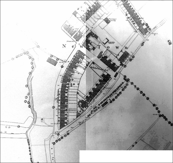
This map (stitched together from pretty poor copies - apologies) is the 1886 Ordnance Survey of New Town. At left the Milford Brook runs through open fields with Kiddles Lane (today's Eastland Road) running up from the bottom left to the word 'New' where it joined Gordon Road. Newly-built Clifton Terrace are the only houses in Kiddles Lane, apart from a short row of cottages off the bottom of the map. At centre Mount Pleasant Terrace has been built even though the road itself is still only a track and on its southeastern side is the rope walk. Gordon Road runs between Kiddles Lane and Mount Pleasant, with the newly-built Nelson Inn on the corner. The three-sided structure above the 'To' in Town is a disused brick kiln, part of the once extensive brickworks in the vicinity. At top right is North Terrace, built in 1871. To its right, the track running off to the top right corner of the map would eventually become Grass Royal.
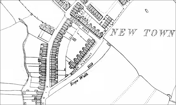
This map, based on the 1901 Ordnance Survey, shows the rope walk alongside Mount Pleasant with a building at the top and another half-way. Much of the site would have been in the open air as shown in the second photograph below. Note that by this time Smith's Terrace, one of Yeovil's earliest 'infill' housing sites had been built on the site of the old disused brick kiln.
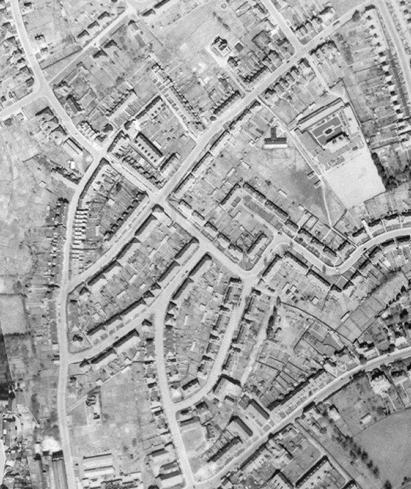
The 1946 aerial photograph of New Town. The road pattern is now all but similar to today's.
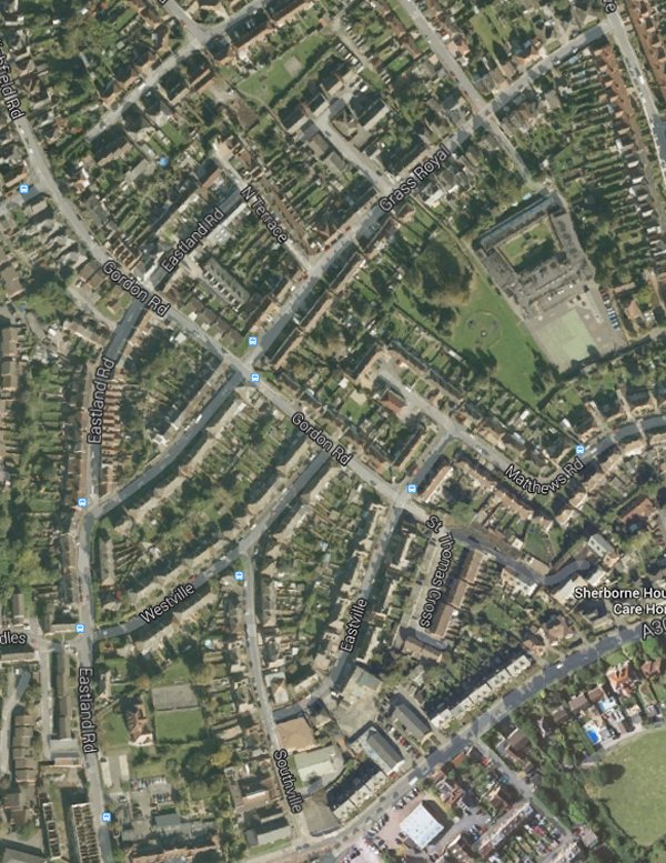
Today's aerial view (nicked from Google Maps) - I've left the street name overlay on to identify which street is which.
gallery
From my
collection
-
This
photograph
features in my
book 'Yeovil From Old Photographs'.
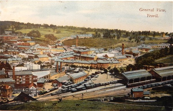
In the top half of this postcard, Kiddles Lane (today's Eastland Road) runs left of the chimney with fields either side!!! Behind the chimney and set within a truly rural landscape is New Town and the dark hedgerow in front of the houses marks the site of the Mount Pleasant rope walk that extended to the trees at right.
This postcard, taken from Summerhouse Hill, dates to about 1905 and shows, at centre, the chimney of the Eastland Road brickworks with its associated buildings clustered around its base. To its left is the leather works built by William Bide (recogniseable by the double roof with a row of six black windows). Running along the bottom of the photograph is Station Road with the Alexandra Hotel at bottom right.
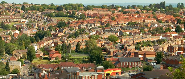
New Town today, seen from the top of Summerhouse Hill. This is roughly the top part of the photograph above that was just open fields. At extreme bottom left is Bide's leather works with Eastland Road to its right and curving right towards the centre of the photograph with houses in Westville, Southville and Eastville taking up much of the lower right. Photographed in 2013.
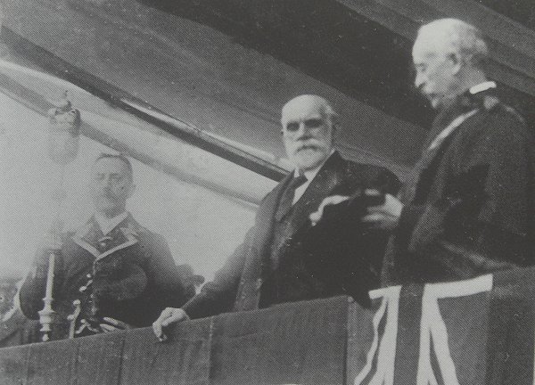
John Burns MP (centre) performing the opening ceremony of Yeovil's first 50 council houses at New Town in January 1912. John Boll, in his role as mayor, is at right and mace-bearer Henry Jesty at left.
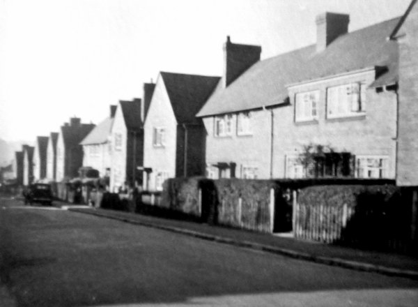
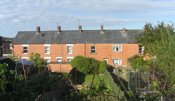
Council houses in Eastville, photographed in the early 1950s.
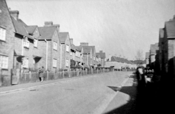
Eastville, photographed in the early 1950s.
Clifton Terrace, the first housing to be built in Kiddles Lane during the early 1870s. Photographed in 2013.
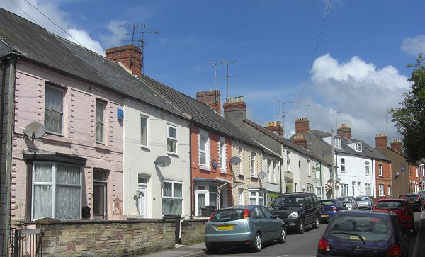
North Terrace, built in 1871 and has never had the road adopted, hence it is still un-surfaced even today. This was the northernmost part of New Town when built. Photographed in 2014 from the Grass Royal end.
The two houses at left, with a datestone of 1884, were the first to be built in Mount Pleasant followed within two years by the terrace of housing to the right called Mount Pleasant Terrace. All the houses faced the rope walk. Photographed in 2014.
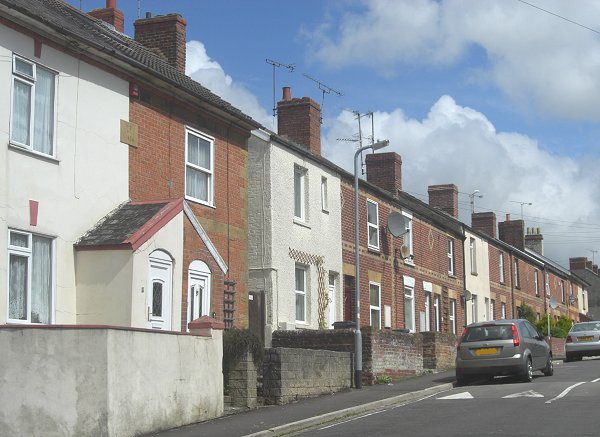
Morton Terrace was built in the early 1880s and were the first five houses in what is now Grass Royal. When the houses were built the road was simply a trackway. Photographed in 2014.
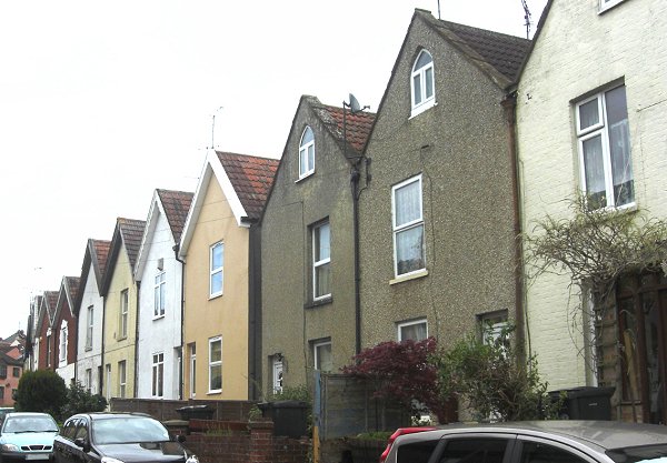
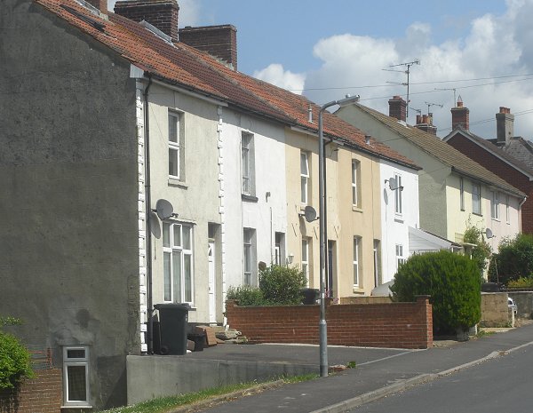
The early housing of Kiddle's Lane, now Eastland Road. None of these houses appear on the 1886 map - indeed Jubilee Terrace and Wayside Terrace, shown here, were built in 1887 and 1889 respectively by Samuel Cridland. Photographed in 2013.
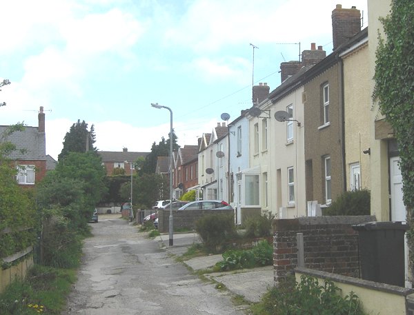
Smith's Terrace seen from North Terrace. This was one of Yeovil's earliest 'infill' housing sites and had been built on the site of the old disused brick kiln. It does not have a road, just a simple access track at the rear. Photographed in 2014.