Lower Little Larkhill
Lower Little Larkhill
A former part of the great West Field of Kingston Manor
Originally just a part of the great medieval West Field of Kingston Manor, Lower Little Larkhill (Parcel 1444) was a field of Larkhill Farm and was a long narrow field to the immediate south of a field access track called Lower Larkhill Lane that would become today's Stiby Road.
In her will dated 4 December 1817, Mary Coward formerly Strong, wife of grocer George Coward, wrote "I give and devise unto my loving Husband the said Henry Coward my two Closes of Land called Higher Lark Hill and Lower Lark Hill in Yeovil aforesaid containing about seventeen Acres (purchased in fee by the late Samuel Strong) of Messiors Glyde and Watts and given to me by my late Uncle Richard Strong his Heirs and Assigns...".
The 1846 Tithe Apportionment noted Lower Little Larkhill as 1a 2r 0p and used as pasture for grazing livestock. The Apportionment noted that the owner was William Jones Prowse and the tenant was James Pope.
Lower Little Larkhill was bounded the field access track called Lower Larkhill Lane, to the west by In Higher Perrythorne (Parcel 1445), to the south by Drang Ground (Parcel 1442) and to the east by the field called Lower Larkhill Lane (Parcel 1443).
By the time of the sale of Larkhill Farm in 1931 Lower Little Larkhill and Lower Larkhill Lane had been combined to form a larger field. Today these former combined fields are still grass to the north and south but Westfield Academy has been built across the centre of the combined fields.
For details on historic land measurement (ie acres, roods and perches) click here.
maps & Aerial Photographs

This map, based on the descriptions in the 1589 Terrier and the 1846 Tithe Map of Yeovil shows the approximate boundaries of the Manors of Kingston and Hendford as well as the manorial three-field system used in Kingston.
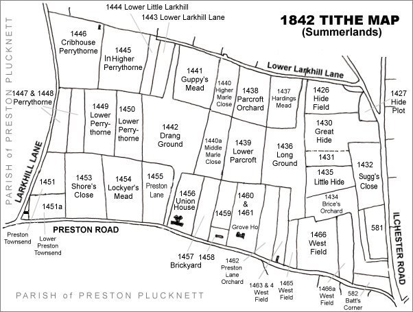
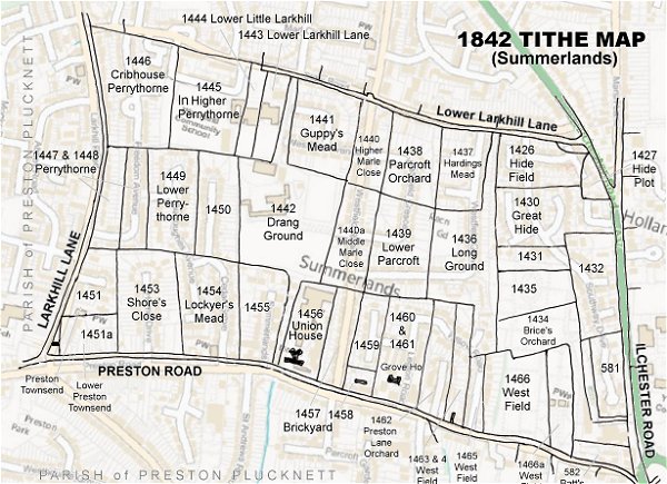
The Larkhill area reproduced from the 1842 Tithe Map. Lower Little Larkhill is towards top left.
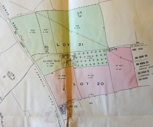
By the time of the 1931 sale of Larkhill Farm the size of the farm had been much reduced to just over 22 acres, including the now-combined Lower Little Larkhill and Lower Larkhill Lane.
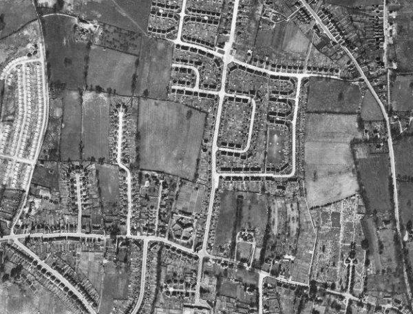
The 1946 aerial photograph - the combined Lower Little Larkhill and Lower Larkhill Lane is left of centre with the newly-built Westfield Place and Westfield Avenue to its immediate right and the incomplete Stiby Road at its top right corner.
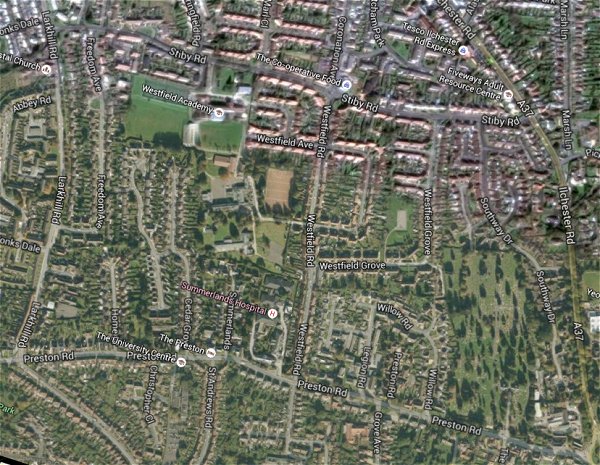
The same area today 'borrowed' from Google maps.
The 1842 Tithe Map superimposed (only very slightly out at the bottom) over a modern map.
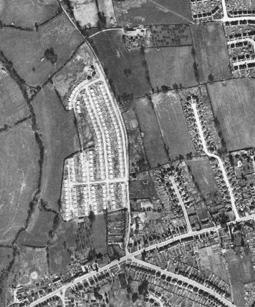
This 1946 aerial photograph clearly shows the development of the Larkhill Road 'prefabs' left of centre. Much of this section of Larkhill Road would be built in 1946 by Italian prisoners of war. Running across the bottom of the photograph is Preston Road and from the junction with Larkhill Road and running to the bottom right corner is Preston Grove. The combined Lower Little Larkhill and Lower Larkhill Lane is at top right corner.