Orchard
Orchard
A field within the Manor of Hendford
Orchard (Parcels 785 and 786) was originally a field within the Manor of Hendford and to the immediate north of Aldon Farm.
At the time of the 1846 Tithe Apportionment, both parcels of Orchard, recorded as 'Cottage and Orchards', were owned and occupied by glove manufacturer Charles Greenham. Both parcels were recorded as arable for growing crops and together measured 3a 0r 30p.
Orchard (Parcels 785 and 786) was bordered on the north by Penny's Mead (Parcel 783), on the east by New Pond (Parcel 784), to the south by Plantation 3 (Parcel 807) and to the west by Tucker's Mead (Parcel 787).
Today, the former Orchard is the hillside to the immediate south of Goldenstones Leisure Centre and forms a part of the Yeovil Country Park.
For details on historic land measurement (ie acres, roods and perches) click here.
maps

This map, based on the descriptions in the 1589 Terrier and the 1846 Tithe Map of Yeovil shows the approximate boundaries of the Manors of Kingston and Hendford as well as the manorial three-field system used in Kingston.
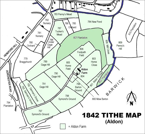
The 1842 Tithe Map showing the Aldon area and the parcels of Aldon Farm shaded light green. Orchard (Parcels 785 and 786) are at top Centre.