Yeovil Country Park
Yeovil Country Park
Yeovil's priceless treasure
Yeovil Country Park is Yeovil’s priceless treasure, a beautiful, peaceful, nature-filled haven, so close to the town. It is a 127-acre countryside site that wraps around the southern and eastern sides of the town, with a range of varied landscapes.
Designated in 2002, Yeovil Country Park comprises several distinct, but linked, areas dealt with individually below, and each area has different land features and characteristics. Yeovil Country Park entered the Green Flag Award Scheme in 2005 and has been awarded Green Flag status every year since, due to its high standard of maintenance and community engagement. It received Country Park accreditation from Natural England in 2009.
Map of Yeovil Country Park
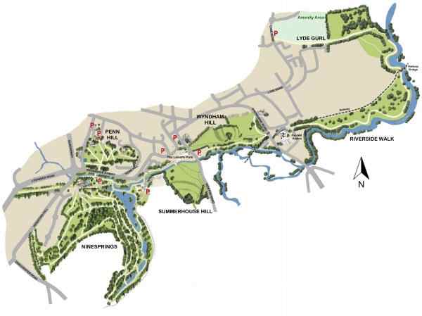
A map of the entire Yeovil Country Park. Many sections are enlarged below.
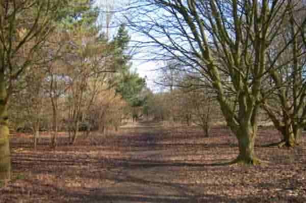
Railway Walk
The original route of the railway between Pen Mill Station, Yeovil Town Station and continuing towards Taunton, was made into an amenity path and incorporated into the National Cycle Network. It is known as Railway Walk, and forms part of Yeovil Country Park. The walk links many parts of the park - Ninesprings, Summerhouse Hill, Wyndham Hill and leads to Riverside Walk.
Railway Walk begins in the west at Lysander Road, opposite McDonald's, as a footpath running east towards Hendford Hill where it passes under the Hendford Hill road bridge over the former railway line. It then continues into the lower Ninesprings valley and runs past Goldenstones and then between Dodham Brook and the lower Ninesprings lake.
From Ninesprings, Railway Walk crosses the spur of Addlewell Lane and continues past the new housing in Tanyard Way where it joins the southern spur of Old Station Way (this bit was originally the end of Stars Lane - who knows why they had to change it?). Railway Walk then skirts the car park of Yeo Leisure Park, passes under the Newton Road bridge and then skirts the Yeo Leisure Park overflow car park.
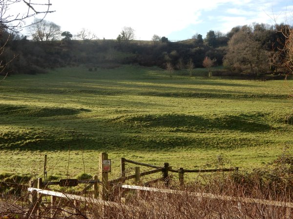
At the end of the overflow car park, Railway Walk continues by skirting the southern flank of Wyndham Hill and continuing to Sherborne Road.
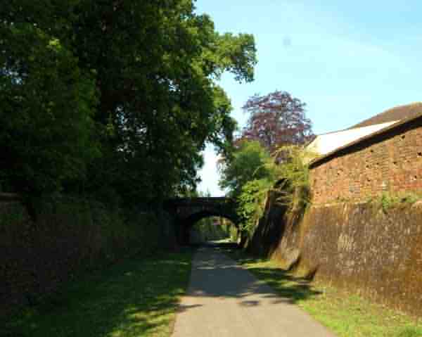
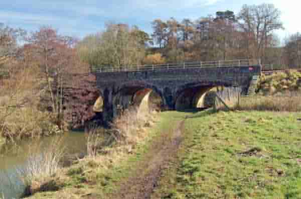
Looking west along Railway Walk near its western end. The bridge is Hendford Hill road bridge and from here Railway Walk continues on towards the start of the walk at Lysander Road.
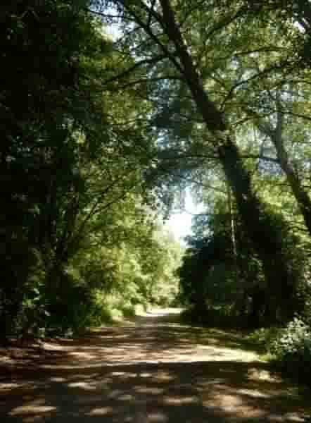
The stretch of Railway Walk, between the Yeo Leisure Centre overflow car park and Sherborne Road. This photograph, looking east, shows the stretch of the path skirting Wyndham Hill (on the left). The River Yeo is beyond the trees on the right.
Ninesprings
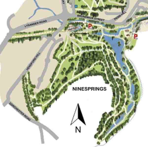
A map of Ninesprings, showing the series of man-made lakes that descend the wooded valley to the right, and the extensive woodland blending to hillside meadow with its network of footpaths.
Ninesprings is, essentially, a broad-leaved woodland hillside and valley of some twenty acres on the south east edge of Yeovil. There are, of course, nine springs supplying water to small streams and ponds. The water issues into Dodham Brook and, ultimately, to the River Yeo.
Ninesprings was developed as an ornamental park for the Aldon estate during the early nineteenth century and includes walks, bridges, grottoes, springs and lakes.
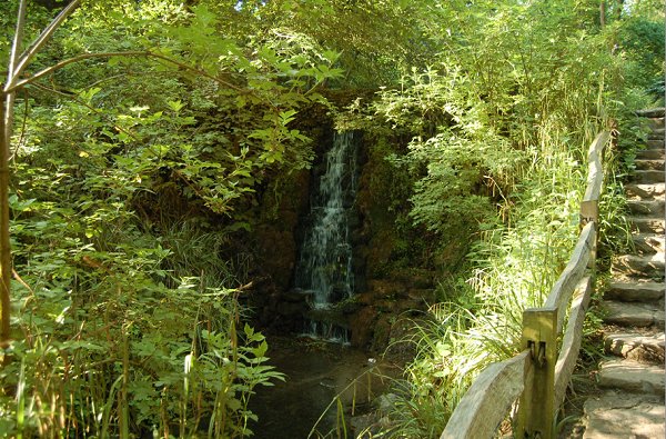
A cascade, photographed from the stream-side walkway.
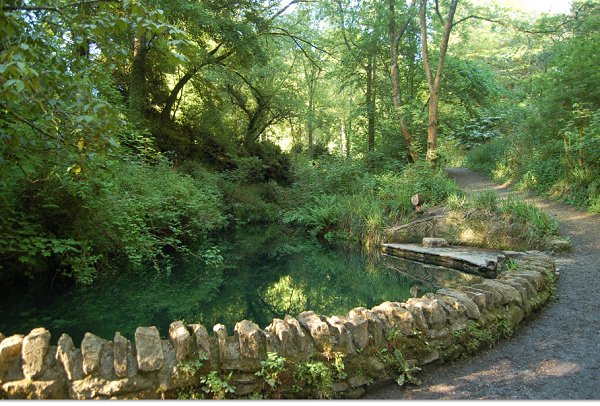
A man-made lake.
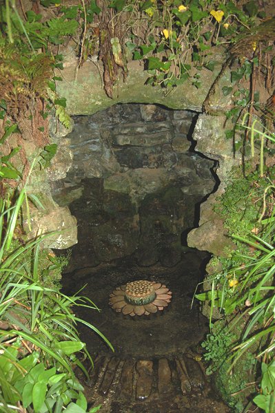
A nineteenth century grotto housing one of the nine springs.
Ninesprings lake seen from Railway Walk (see above) - the footpath running along the bed of the old Yeovil to Taunton railway.
Pen Hill Park
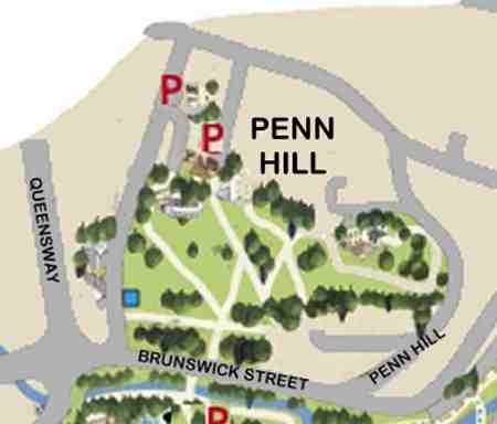
Penn Hill is surmounted by Penn House (seen right of centre). A footpath from Penn Hill (the road) skirts the house and gives access to the park, which runs down the western slope of the hill to the area bounded by Brunswick Street, Hendford and the rear of Maltravers House and the Octagon. Access is also from Brunswick Street.
Penn House is a fine late 18th century town house, now flats, set in its own extensive grounds and built by and for Peter Daniell, high on Penn Hill between South Street and Brunswick Street. When it was built it was the only building on the hill
Penn Hill Park is predominantly on the western escarpment of Penn Hill, within the confines of Peter Daniell's original estate grounds, and is crowned by mature specimen trees and grassed areas that provide an area of open space running down to Hendford. The park extends around Penn House as a path and joins Penn Hill (the road) at its junction with St Nicholas' Close.
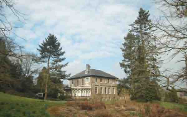
Penn Hill Park comprises part of the estate of Penn House and, as seen here, skirts the house.
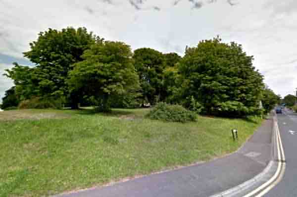
The south-western corner of Pen Hill Park, at the junction of Brunswick Street (at the right) and Hendford.
Summerhouse Hill
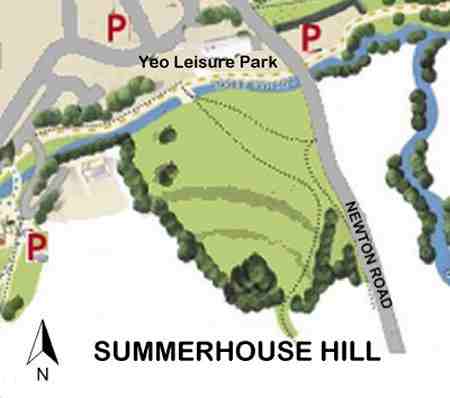
The map shows Summerhouse Hill flanked by Newton Road to the left and Dodham Brook running along the foot of the hill. Access to Summerhouse Hill is from Yeo Leisure Park, Newton Road or, from the south, Two Tower Lane and Constitution Hill.
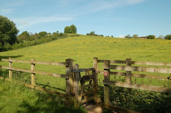
Originally part of the Newton Surmaville estate, Summerhouse Hill lies on the immediate southern edge of the town. The summit stands at 353 feet (107.6m) making it the highest point in Yeovil. The steep walk to the top is well worth the effort and you are rewarded with spectacular views across the town and to the countryside beyond. On a clear day it is rumoured that you can see the Bristol Channel to the north (I haven’t yet, even with powerful binoculars). More easily visible are the north Dorset Downs to the south, the hills at Montacute to the east, the Exmoor Hills on the horizon to the northwest, the Mendip Hills to the north and the Corton Denham ridge to the northeast.
Traces of medieval farming practices still exist today on the lower slopes of Summerhouse Hill in the form of lynchets. On the summit is the Summer House, also known as the Round House, which was built by the Harbin family of Newton Surmaville.
The legacy of medieval farming practices - the remains of lynchets on the side of Summerhouse Hill.
This photograph
features in my
book "A-Z
of Yeovil"
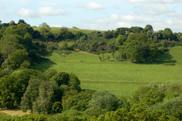
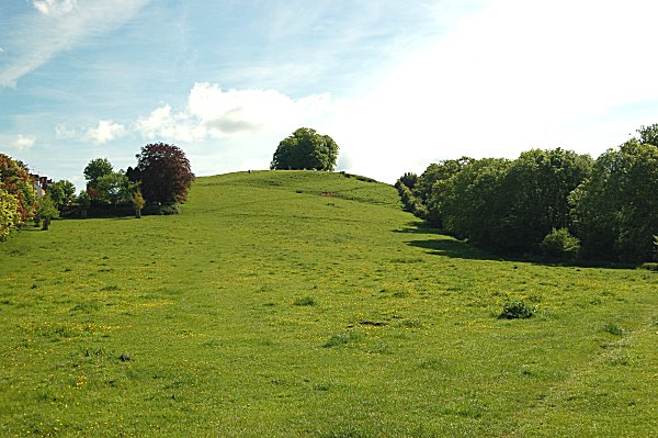
Summerhouse Hill seen from Wyndham Hill. The Summerhouse is visible above the trees at extreme left.
Wyndham Hill
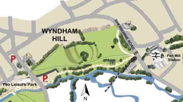
The map of Wyndham Hill shows the hill bounded by Sherborne Road at right, with Pittard's leather factory and Pen Mill railway station at the extreme right. Wyndham Hill is bounded by Newton Road at the left, to the south by the River Yeo and Dodham Brook, with Railway Walk running from the Yeo Leisure Park overflow car park at bottom left, to the pedestrian-controlled crossing at Sherborne Road.
To access the next section of Yeovil Country Park, Riverside Walk, it is necessary to cross Sherborne Road and walk towards Sherborne as far as, and then into, Flushing Meadow just beyond Pittard's factory. At the end of Flushing Meadow is access to the Riverside Walk section.
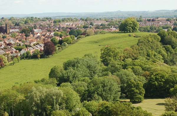
Wyndham Hill, now bordered on three sides by concrete, development and car parks, lies on the immediate southern edge of the town with the River Yeo and Dodham Brook to its south. It always offers a quiet place to relax as more people tend to visit nearby Summerhouse Hill with its spectacular views.
Like Summerhouse Hill, Wyndham Hill was originally part of the Newton Surmaville estate. The lower, western area is known as Wyndham Field, while the summit of the hill has been known as Pen Hill, Kingston Penn, Windmill Hill and Victoria Hill. It only got its present name in the 1890s and was named as such for the first time in the 1891 census. Crowned by its four lime trees, the summit of the hill is recogniseable from many parts of Yeovil. The lime trees were planted to celebrate Queen Victoria's Silver Jubilee in 1862, although contemporary photographs show that 25 trees were planted at the time.
For the history of the Wyndham Action Group, fundamental in the preservation of Wyndham Hill and the creation of Yeovil Country Park - click here.
The western flank of Wyndham Hill seen from Summerhouse Hill. The lower greensward running to Newton Road is known as Wyndham Field.
The western flank of Wyndham Hill, the lower part known as Wyndham Field, seen from Newton Road. At the very bottom of the right corner is a trace of the former Penn Way.
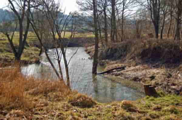
Dodham Brook, seen at lower right, joins the River Yeo. Photographed from Railway Walk as it skirts the southern slope of Wyndham Hill.
The eastern flank of Wyndham Hill seen from Railway Walk.
Riverside Walk & Lyde Gurl
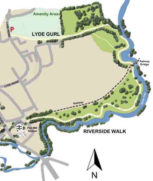
The map showing the location of Riverside Walk and Lyde Gurl - the final part of Yeovil Country Park. The parking area off Lyde Road, just before the Lyde Road / Great Mead roundabout, is an ideal location to start your exploration of this section of the park.
Riverside Walk
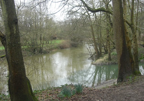
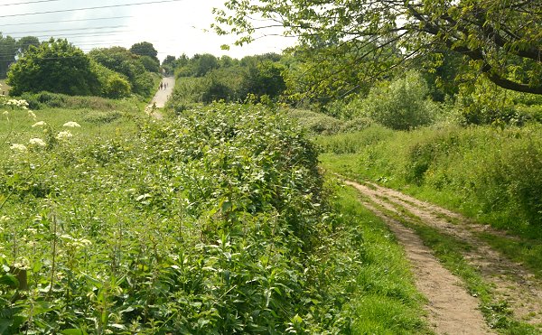
Riverside Walk, as it's name suggests, follows the meandering River Yeo as it heads north towards Mudford. However, this is not just a single footpath, but several footpaths that diverge and meet up again while passing through the most diverse of Yeovil Country Park's landscapes - including woods, scrub, grassland and marsh. This section of the park, which many consider to be the most interesting, is also the least visited - making it the ideal place to enjoy the flora, fauna and vistas in peace and quiet.
The entrance to the Riverside Walk section of the park is from the end of Flushing Meadow, described above. The footpath initially runs for a quarter of a mile sandwiched between Pen Mill Sewage Treatment Works (fortunately not often blessed with the fragrance you might expect) and the railway line to the north-east of Pen Mill Station. It then widens out and the various paths are encountered offering a variety of routes through this section - riverside, woods, etc.
After the railway bridge, an optional path crosses a field, which, although not strictly part of Yeovil Country Park, offers an interesting route through a (sometimes very wet) marshy area with an interesting variety of flora.
As Riverside Walk leaves the side of the river, you enter the Lyde Gurl area.
One of the paths of Riverside Walk runs alongside the river, with views across to Dorset on the opposite bank.

Paths passing through grass area with newly-planted trees converge before entering a young wood. The Rive Yeo is off-photo to the right. Another path, off photo to the right, runs alongside the river and avoids the wood.
One of the paths passes through the wood.
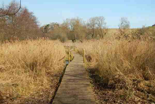
On leaving the wood, a long footbridge crosses the stretch of marshy ground. The marsh can be avoided by taking the path adjacent to the river.
Looking south to the railway bridge. The path can get particularly muddy in wet conditions on the other side of the bridge.
Lyde Gurl
'Gurl', also found as goyle, goil, goyal and guile, is a Somerset dialect word meaning a ravine, gully or steep-sided narrow valley usually with a stream running down it. Lyde Gurl was the valley formed by Lyde Brook, which formed the southern boundary of Lyde. Indeed the name Lyde itself derives from the Old English hlyd or hlyde meaning a steep-sided watercourse which, of course, neatly describes Lyde Gurl.
In the 1970s, Lyde Gurl was used as a refuse tip and the valley was gradually filled and covered over with topsoil. Birchfield Park was the result to the west of Lyde Road, by the roundabout with Great Mead, and the grassed amenity area was the result to the east. Part of the original valley contours are still discernible to the south of Nelson Way.
Lyde Brook itself was culverted during the landfill operations, but the last few yards set within the steep-sided 'gurl' are still exposed as it enters the River Yeo, close to the Riverside Walk footpath.
The footpath continues alongside the grassed amenity area south of Great Mead, to the car park at Lyde Road close to the roundabout.
This photograph
features in my
book "A-Z
of Yeovil"
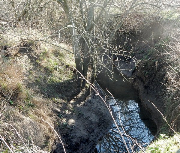
Note the steep sides of the 'gurl' as this short length of Lyde Brook approaches the River Yeo.
This photograph, looking west, was taken from close to the Rive Yeo (behind me) and the remaining exposed section of Lyde Brook (off-photo at right). The hill seen in the distance with people walking up the track is chiefly made-up ground after the valley was used as landfill.
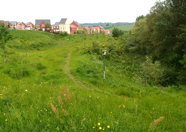
Looking back towards the River Yeo and the new housing of Wyndham Park. Although there has been much in the way of landscaping earthworks in the area, note the steep sides of the valley that originally reached as far as Birchfield Road in the west. This is the only remaining part of the valley - Lyde Gurl - that wasn't completely used as landfill. Note the green post at centre - this is a vent to allow any potential gas build-up from the landfill to escape.