Penn Way
Penn Way
An old track across Wyndham Hill
Penn Way, also known as Penneway, was a track across the lower western slopes of present day Wyndham Hill which was earlier known as Kingston Penn, Windmill Hill and Victoria Hill - it only acquired its present name in the 1890s and was named as such for the first time in the 1891 census.
Penn Way commenced close to the Newton Road site of the later Penstyle Turnpike gatehouse, (today the site of Ivel Court) apparently as a track for a short distance before continuing as a footpath, roughly following along the route of today's Railway Walk, to Yeovil Bridge.
The 1589 Terrier makes three references to Penneway ".... upon the south side of Vennel from Forestreet bridge to Penneway.... one Acre next Penneway.... the North side of Kingston Penne (today's Wyndham Hill) from Penneway to Yeovil bridge....".
The 1633 Survey of Kingston recorded "Reynold Courtney and Joan his wife and Giles their son hold by indenture dated 14 May 1609 granted by Edward late lord Stourton in consideration of the surrender of a lease and a fine of 40s, a cottage with garden and plot of ground in Kingston [the manor, not the street] called Pennway; to hold for the lives of Reynold mort, Joan his wife mort, and Giles 40 their son. Rent 12d." The cottage referred to almost certainly became the alehouse known as the Sun Inn.
A lease dated 1 April 1654 between Sir William Stourton and John Bullocke the Elder of Kingston juxta Yeovil, butcher, referred to ".... cottage with garden in Kingston at Penn Way occupied by Wm Forward, Miller, Dec’d and Daniel Courtney.... ".
A lease dated 4 April 1673 between Sir William Stourton and John Cary of Bridport, Gent, refers to a "Messuage or dwelling house called The Sun now used as a common Inn with a garden plot within the Manor of Kingston near Yeovil at a place called Penn Way was in occupation of Elizabeth Cary, widow Dec’d, now of John Cary held in consideration of the deaths of William Forward and John Bullocke for 99 years on the lives of John Cary, Ruth Cary, wife of John Cary."
Just before his death Wyndham Harbin (1761-1837) of Newton Surmaville acquired today's Wyndham Hill.
On his map of 1831 Watts noted Penn Way as "Foot Path to Pen Mill &c" and it is shown, albeit un-named, on Bidder's map of 1843. The 1842 Tithe Map shows that Penn Way still existed at that time even though the Sun Inn had long since disappeared.
Today there is very little trace of Penn Way, just a shadow of the footpath across the field.
maps & Aerial Photograph
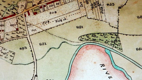
A section of the 1842 Tithe Map showing Penn Way running across the centre of the image.
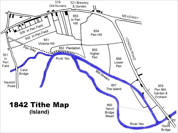
This map is based on the 1842 Tithe Map with field names chiefly added from the 1846 Tithe Apportionment.
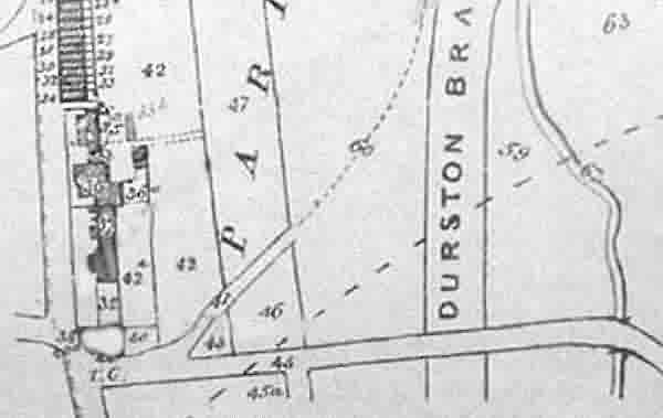
Hickes & Isaac's map of 1858 clearly showing Penn Way.
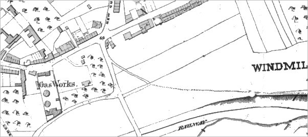
Another map of a similar vintage showing the line of the new railway right of centre and Newton Road running across the bottom of the map. Pennway is clearly seen crossing two fields as a lane before becoming a footpath (shown as a dotted line).
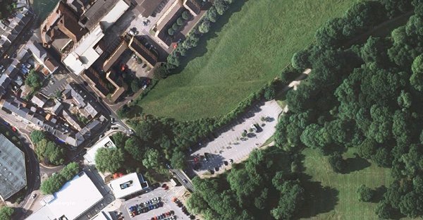
The line of the footpath earlier known as Penn Way is still discernible on this modern aerial photograph.
Gallery
This photograph
features in my
book 'Secret Yeovil'.
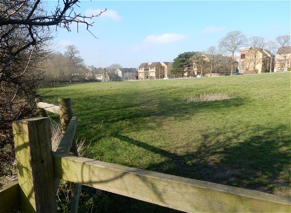
The footpath section of Penn Way is just seen at centre, running across Wyndham Hill towards Newton Road. Photographed 2016.