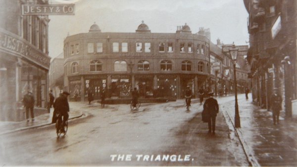
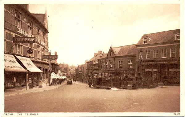
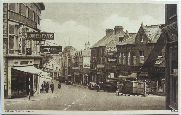
the triangle
the triangle
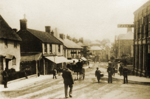
Formerly Vennell's Cross, the easternmost entry into the town
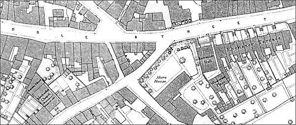
The area known today as the Triangle is where Middle Street, South Street, Vicarage Street, Stars Lane and Fore Street (Lower Middle Street) met and in earlier times was the easternmost point of the Borough of Yeovil.
In 1440 it was referred to in a document as Fynelscrosse and in another document some twenty years later as Vennel's Crosse. It was known for many years as Vennell’s Cross and it seems certain that it was the site of a medieval cross; perhaps a preaching cross for peripatetic monks or a wayfaring cross for the comfort of travellers at, what was of course, the entry point into the town from the direction of London.
The name Vennell may have derived from a person or, as Leslie Brooke indicated, it is more likely that the name arose from the Latin word venella meaning a lane (a reference to Turnstile Lane - see below).
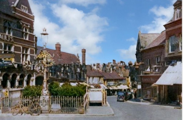
It was originally called the Triangle because it was a small triangular piece of land containing buildings, shown on all known maps up to and including the 1886 Ordnance Survey, that was bounded by Middle Street on the north, South Street to the south and a small lane, known as Turnstile Lane, running between Middle Street and South Street. Its western side is now marked by the building built for the Yeovil & District Co-operative Society in 1910 which now faces east across the open space we call the Triangle today.
The Borough Council bought the land in 1896 and the area was cleared of buildings to create the open space we know today.
The underground toilets, almost centrally-place in the Triangle, were built in the 1920s and closed and dug up in August 1971 (see Gallery). Today's bandstand was built in the 1990's.
|
Yeovilians
remember... |
maps
Map based on the 1886 Ordnance Survey shows the area now known as The Triangle to be built up. Indeed it wasn't until the opening years of the twentieth century that the buildings were demolished and the area cleared.
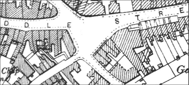
The same area seen on a map based on the 1901 Ordnance Survey showing the area known as the Triangle cleared of buildings.
gallery
From my
collection
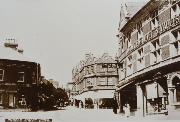
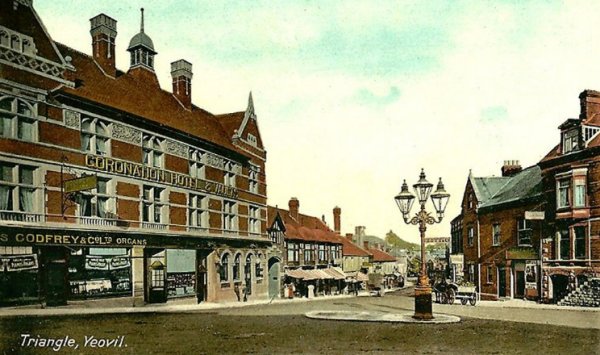
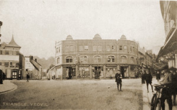
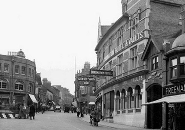
This is the earliest photograph I know showing the Triangle. It was taken between about 1900 (when the Coronation Hotel at right was built) and 1910 when the building at far left was occupied by the Yeovil & District Co-operative Society.
From my
collection
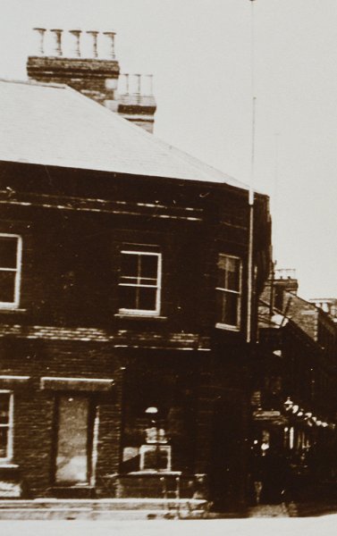
Originally this building, most likely the premises of Charles Foan from the 1830s to the 1850s, was on the northwest corner of Turnstile Lane. The eastern side of Turnstile Lane was demolished between 1886 and 1901, while this building was occupied by the Yeovil & District Co-operative Society and later replaced by their new shop and offices building (that survives today and appears in most of the images below) by 1913.
Courtesy of
Lynne & Tony
Cove
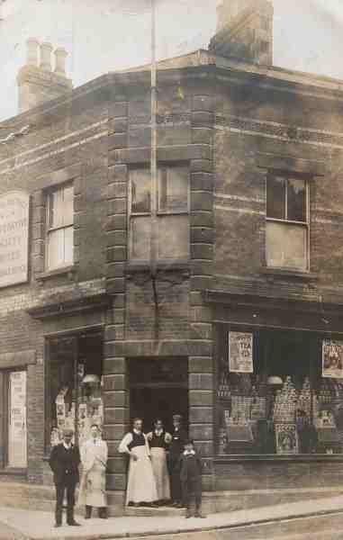
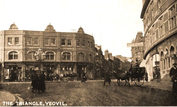
Photographed on 28 May 1908, this building is the precursor to today's building in the Triangle that was most recently the Turkish restaurant. It was on the corner of Middle Street (running off to the right in this photo) and Turnstile Lane (running off to the left). The triangle of buildings on the eastern side of Turnstile Lane, opposite this building, were torn down around 1900 to create today's open space known as the Triangle. The man In the middle of the three standing in the doorway is Dennis Moore.
Courtesy of Jack
Sweet -
This photograph
features in my
book 'Yeovil From Old Photographs'.
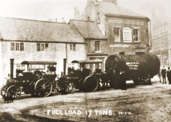
The buildings that were originally the west side of Turnstile Lane photographed on 23 March 1910. By this time occupied by the Yeovil & District Co-operative Society. The double tractor unit pulling the 17-ton load was owned by Sibley & Co.

Courtesy of Jack
Sweet
An enlargement of the previous photograph showing the signage of the Yeovil & District Co-operative Society.
Courtesy of
Carolyn Crompton
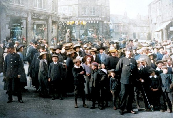
A colourised photograph by Witcomb & Son taken around 1914 of a crowd in the Triangle, looking towards Vicarage Street.
From my
collection
-
This photograph
features in my
book 'Yeovil From Old Photographs'.
The Triangle in the 1920s, taken from a postcard.
From my
collection
The Triangle, looking down Lower Middle Street, in a postcard of about 1940. Note the underground toilets at right.
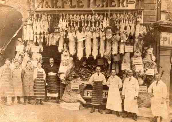
This photo dates to around 1910 and shows Fletcher's the butchers in the building immediately next door to the Coronation Hotel (at extreme right is the edge of Godfrey's piano store set into the ground floor of the Coronation).
W & R Fletcher Ltd, was a New Zealand company with freezing works in Australia as well. They were sending mutton and lamb to the UK in the 1880s and opened cold stores to wholesale to butchers. By 1910 they had 417 shops, mainly in the south of England, as there was resistance to this so-called foreign meat. Union Cold Storage bought them out in 1912 and used the name W&R Fletcher until the 1960s in Yeovil. In 1922 UCS bought a small company of seven shops and a market stall trading as J H Dewhurst. They later traded in Princes Street, on the corner of Church Street. The company went into liquidation in 1995.
From my
collection
The Triangle, looking down Lower Middle Street, in a postcard of about 1944. Note the underground toilets at right, now with black and white markings painted on so that traffic would stand a better chance of seeing it in the blackout.
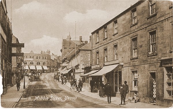
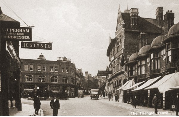
A postcard of around 1912 of Lower Middle Street looking towards the Triangle with the new Co-operative Society building built in 1910.
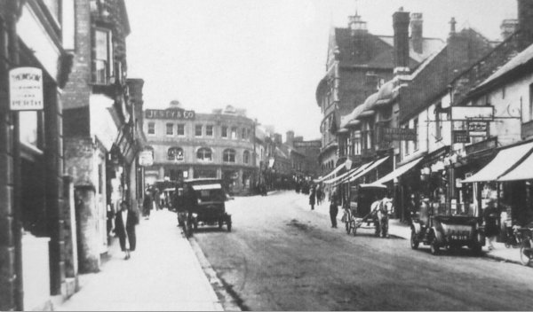
Pretty much the same view, this photograph dates to about 1925. (The Jesty & Co sign is suspended from a building to the left and is not on the Co-op building).
For comparison with the previous photograph, this one dates to January 1985 and looks towards the Triangle from Lower Middle Street. Which Yeovil do you prefer - 1925 or 1985?
This
photograph
features in my
book "Lost Yeovil"
The earliest photograph I've found of this part of Middle Street, photographed around 1890 and looking east from the Triangle. Thomas Jesty's furniture emporium is at extreme right and immediately beyond it are the short front gardens of Ebenezer Terrace. In the distance is seen the triple-gabled offices of the gasworks (now premises of St Margaret's Hospice). At extreme left the cottage with a small front garden was soon to be demolished and replaced with the block of shops (see next photo) surmounted by a series of four small domes seen in a photograph lower down this page. The two blocks of shops at centre, with the awnings, remained until the 1960s.

Courtesy of the
Western Gazette
A nice photograph of the triple head Sugg lamp (with suspicious-looking dog), in the Triangle outside the workshop end of Thomas Jesty's store, photographed around 1905.
A hand-coloured postcard dating to 1905 and looks down Middle Street from the Triangle. At left is the Coronation Hotel and Vaults and to the right is the large three-light Sugg gas lamp which was removed when the underground toilets were built - the location is now the bandstand.
I have six different postcards all using this image that were posted between 1909 and 1917, including one on which the stamp box on the reverse reads "Affix Halfpenny Stamp" which dates the postcard to before 3 June 1918, when the price rose to one penny.
From my
collection
This postcard dates to 1912 and shows the area of the Triangle completely free of obstructions. Note the three-lantern Sugg lamp to the left.
A postcard of about 1920, before the construction of the underground toilets.
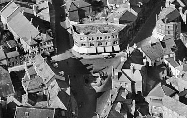
An aerial view of the Triangle dating to 1928 with the Co-operative Society's building and underground toilets in the centre. Note the old Palace Theatre at top left, on the corner of South Street and Stars Lane.
From my
collection
- This
colourised
postcard
features in my
book 'Yeovil
From Old
Photographs'
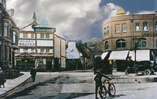
A postcard of 1927 with the completed toilets in front of the Co-op building with the Palace Theatre seen at extreme left.
This
photograph
features in my
book "Lost Yeovil"
By the time of this postcard of the 1930s, the underground toilets had been built in the Triangle.
The three gas-fired Sugg lamps were replaced by a single electric light, seen in this colourised photograph, in the mid-1920s and the same happened at the junction of High Street and Princes Street. Since the Co-op is in the old Jesty's building at extreme right this photo must be after about 1954, but because the Coronation Hotel is still standing at extreme left it must be before about 1964.
This late 1930s or early 1940s photograph is taken from the Triangle and looks up Middle Street with the Coronation Hotel & Vaults at right and the Co-operative building, later Porter Black's, at left - in front of which the underground toilets are decorated in mock Art Deco ziggy-zaggy black and white presumably so that cars don't drive into it, presumably in the blackout - as if.
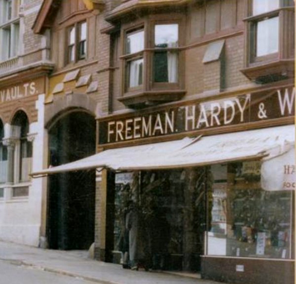
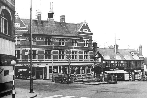
This colourised photograph of the 1950s, shows the entrance to Whitby's glove factory in the Triangle - set between the Coronation Hotel and Freeman, Hardy & Willis' shoe shop.
The Co-op building (later to be Porter Black's) is still there as are the old underground toilets in this photo of the late 1950s. The Coronation Hotel at right is lacking its signage. Note that the black and white Art Deco painting on the toilets has gone - presumably because traffic didn't bash into it after all.
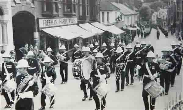
The band of the Royal Marines parades in the Triangle as part of the Centenary of Yeovil Corporation Celebrations on 3 July 1954.
From the Cave
collection (colourised). Courtesy of South Somerset Heritage Collection
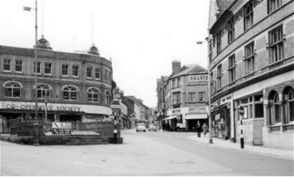
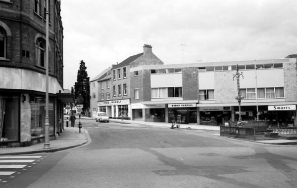
Looking across the Triangle in this 1958 photograph towards Stars Lane and South Street. The building at right is no longer occupied by the Co-operative Society and the toilets are at left.
Photograph
(colourised) by
Trevor Hussey,
courtesy of Mrs
Anne Hussey
Almost the same view as the previous photograph, but this dates to 1990.
A photograph of the 1950s looks north across the Triangle from South Street towards the underground toilets and the Coronation Hotel & Vaults beyond.

From the Cave
Collection
(colourised),
Courtesy of South Somerset Heritage Collection
And there it was - gone! The Coronation Hotel being demolished, circa 1965.
A 1960's photograph of the Triangle. The lovely building that was the Coronation Hotel has been replaced by Yeovil's unsightly concrete legacy of the 1960s. The underground lavatories remain at this time.
This photograph
features in my
book 'Now
That's What I
Call Yeovil'
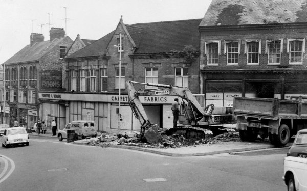
The Triangle toilets in August 1971.
The malodorous underground lavatories were closed in the early 1970s and this photo was taken during August 1971. Based on this photo, I always thought that the the toilets were completely dug up and the hole filled in - go to the bottom of this page and you'll see that I was wrong.
Looking across the Triangle in August 1971.
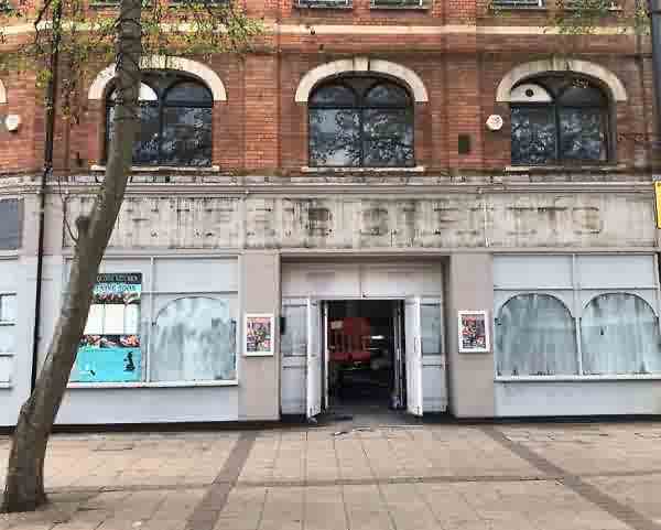
During conversion works, the sign of a previous occupant of the old Co-op building is revealed - Harris Carpets, who (I think) were occupiers in the late 1970s. Photographed in 2018.
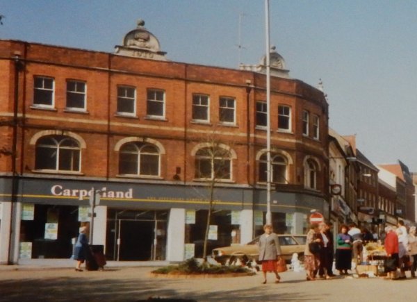
The old Co-op building occupied by Carpetland in 1990 - note that the roofline decorative elements are present at this time.
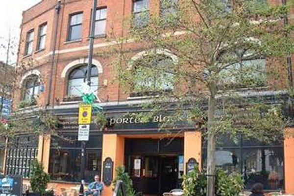
Photographed around 2000 as Porter Black's Irish theme pub.
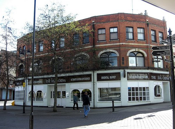
Photographed in 2012 as a Chinese restaurant.
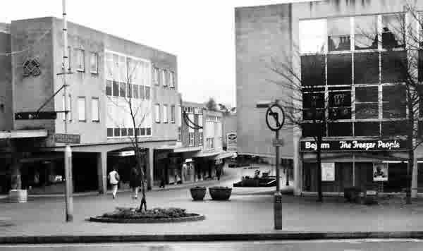
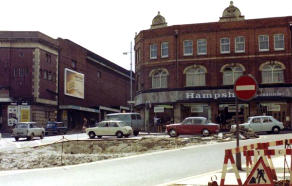
Looking down Lower Middle Street from the Triangle in the 1970s or 1980s. At right is Bejam's. Bejam was an acronym for Brian, Eric, John, Apthorp and Millie; the names of the Apthorp family members who founded Bejam. In 1989 Bejam was bought by its rival Iceland.
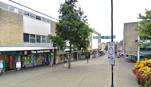
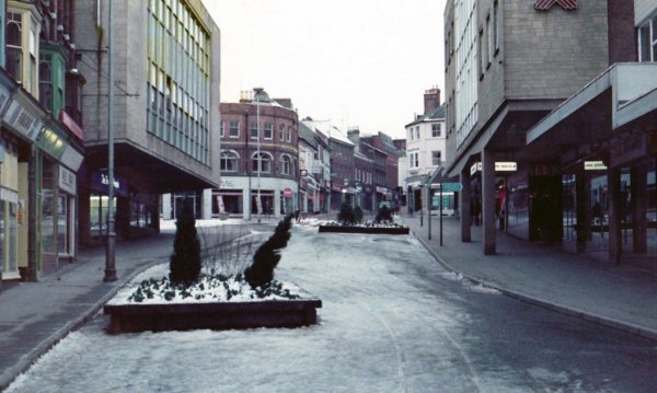
Looking down Lower Middle Street from the Triangle. The flower-bedecked bandstand at far right replaced the underground lavatories (much nicer) and the featureless mass of 1960s concrete and reconstructed stone cladding replaced some wonderful old buildings - you can decide for yourself on the merits/demerits of 1960's architecture. Photographed in 2009.
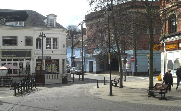
Photographed in 2013 - compare this with the pre-Wood's Wine bar photograph above.
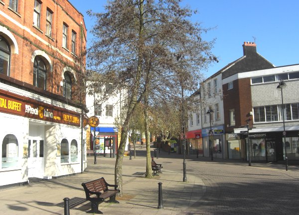
Again photographed in 2013 and looking towards the junction of Middle Street and Vicarage Street - very pleasant at 7am on a warm Sunday morning.

The new-look Triangle approaching completion. Photographed 22 December 2024.
The 2022 Excavation (A "Time Team Special")
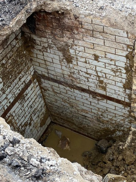
From the summer of 2022 the Triangle is going through a re-vamp. During the works a possible cellar was uncovered outside the Entertainer built on the site of the Coronation Hotel, which itself was built on the site of the Blue Ball Inn. Personally, I think that if it does turn out to be a cellar, it is likely to pre-date both the Coronation and the Blue Ball (it may be just a coal hole or even part of the Victorian sewerage system - time will tell). It should also be remembered that most properties in Middle Street had cellars which, despite local legends, did not link up.
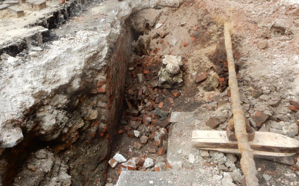
The following photographs were taken on 27 July 2022.
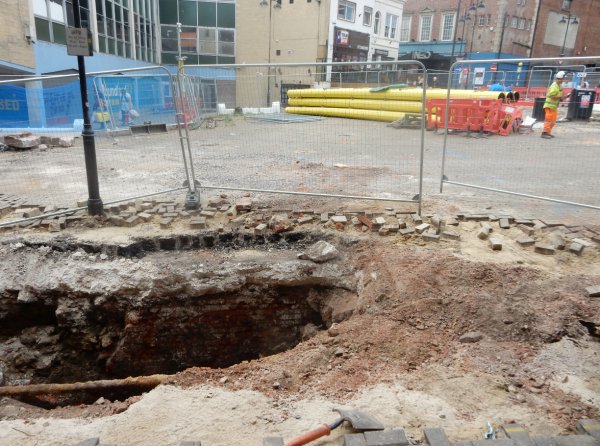
Taken from outside the Entertainer shop and looking across the Triangle, this photograph shows the relative position of the excavation.
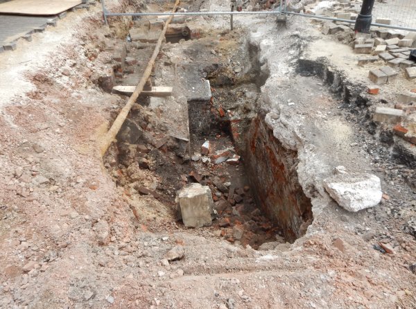
Looking along the excavation from the western end.
Looking towards the western end of the excavation.

Looking into the excavation from the western end. Notice the lump of stone in the centre.
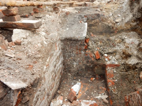
Looking into the excavation from outside the Entertainer shop.
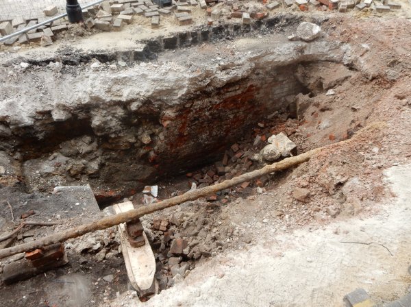
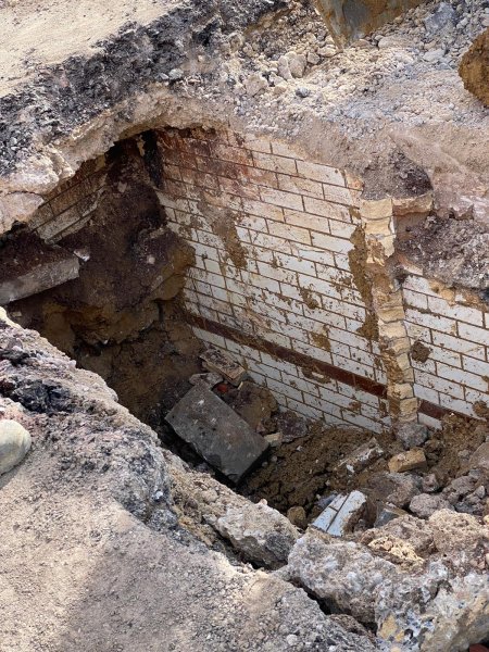
Looking into the excavation showing the depth excavated so far in comparison with the modern ground level seen at the top left of the photograph. The lump of stone seen in the photograph before last is now seen to be carved.
A better view of the carved stone.
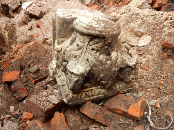
It turns out that the stone is an upturned column capital carved with an acanthus leaf design. It would have formed part of the window in the bottom right corner (looking from the Triangle) of the Coronation Hotel and Vaults - see various photographs above.
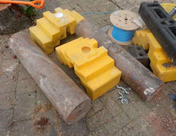
Two of the (red marble ?) columns that were a feature of the window were found in the excavation.
Many thanks to the site manager who took these photos for me.
![]()
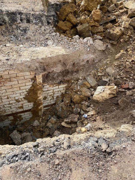
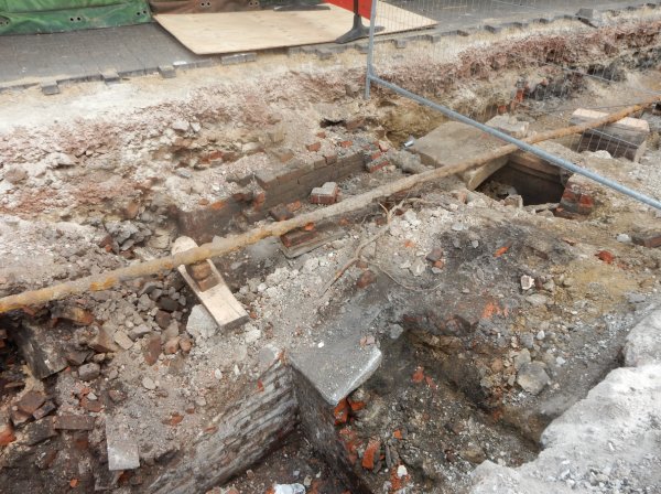
During the works a small section of the original road surface of Turnstile Lane was unearthed, showing it to be composed of stone setts.
The following photographs were taken on 27 July 2022.
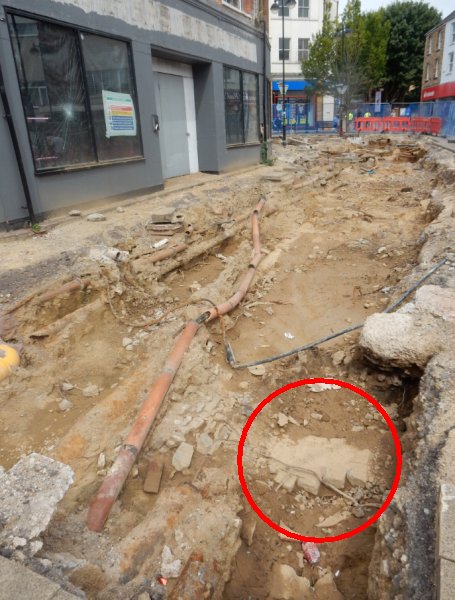
The excavation outside what had originally the Co-op building of 1913. The excavations reveal the original road surface of Turnstile Lane, circled red, was some two or three feet below today's surface level.
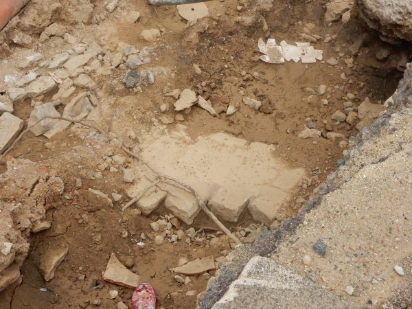
A close-up of the stone setts that made up Turnstile Lane's road surface.
![]()
After me believing (based on a couple of the photos above) that the toilets in the Triangle were dug out and the hole was backfilled, it appears that the fittings were removed and the whole of the underground lavatories were capped over. The following three photos, all taken in October 2022, were sent to my by Owen Martin of SWH Contracting.