princes street
princes street
Formerly Cattle Market
Like many of Yeovil’s streets, Princes Street hasn’t always been named as such. Indeed it was actually less straightforward than that, simply because of former ancient boundaries which meant that various parts of the street fell within the three ancient manors of Yeovil Borough, Hendford and Kingston. Even though it had lain within the ancient Manor of Yeovil Borough the eastern side of what is now Princes Street, from High Street to Church Street, was called Hendford. On its eastern side from Church Street to North Lane, having once been in the Manor of Kingston, the street was called Kingston and continued as such to Fiveways. The western side however, from Westminster Street all the way to Park Road, had also once been in the Manor of Hendford and consequently the road here was considered to be Hendford. So, when it was built in 1730, Old Sarum House was actually the last house in Hendford.
Indeed, Princes Street retains more of the fashionable houses of the seventeenth and eighteenth centuries than any other part of Yeovil, although all are now converted to shops or offices. All are listed separately under their own Princes Street addresses in the P-index of this website.
On Watt’s map of 1806 the street was named as Cattle Market, indicating the particular business that was carried out in the street on market days here before the building of the cattle market between Reckleford and Market Street.
|
The Western Gazette, in its edition of 22 February 1924 that recalled John Plowman's recollections of '75 years ago' (that is, around 1850) - "Posts and small railings lined the pavements through Princes Street, and a pig market was regularly held in the roadway." |
During the late seventeenth to early nineteenth centuries the area became more genteel and the home to gloving magnates, solicitors, doctors, and the like. Cattle Market was clearly not a salubrious enough name for those residing in it, so it became Princes Street. It was presumably named in honour of Prince Albert and probably at some time between his marriage to Queen Victoria in 1840 and his being formally granted the title of Prince Consort in 1857. It was most likely the latter since the 1851 census still refers to it as Cattle Market.
In any event, by the time of the 1886 Ordnance Survey both sides of the road were considered to be in Princes Street which, as today, started at the junction of Hendford and High Street and ended by Park Road on the western side and Court Ash on the east, after which it continued as Kingston until the widening of Reckleford closed the road at this point.
gallery

This colourised photograph of Princes Street dates to around 1875 and is one half of a stereoscopic pair. It was taken from the junction with High Street and looks north. At the time Henry Marsh Custard was running his bookshop / printer's / stationers which was situated in the three-storey building to the left of the cart in the photograph. The narrow lane seen between Custard's building and the building at extreme left was colloquially known as Custard's Lane and later widened to become Westminster Street. The imposing building at right, once a private residence known as Mayfair, was the hairdressing salon of Frank Gaylard, and home to the 'Yeovil & District Toilet Club', between the 1870s and 1920s. The two-storey building at extreme right, on the corner of Princes Street and High Street, was the home and furniture shop of Henry White. Between Gaylard's and the rear entrance to the Mermaid Hotel was, for decades, the premises of the Plowman family of harness and saddle makers.

The southern end of Princes Street, in a colourised photograph of around 1895.

... and a comparison photograph of 24 May 2024 showing that all the buildings in the previous photograph remain today.
From my
collection.
This
colourised image
features in my
book 'Yeovil
- The Postcard
Collection'.
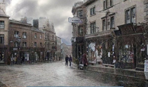
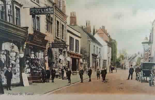
This postcard by William Beale Collins dates to about 1900. At extreme left is just seen the edge of Lindsay Denner's shop and next to it are the remaining shops before he took them over. The two men at centre are standing outside Stuckey's Bank (demolished before 1918) and between the bank building and Genge's shop is the narrow entrance to Porter's Lane (later widened to become today's Westminster Street). William Beale Collin's own printing and bookselling premises are seen at extreme right.
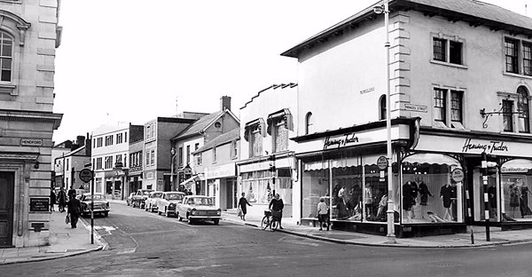
.... and seen in the mid-1960s - Porter's Lane has now been widened to form Westminster Street. Genge's shop is now Hening & Tudor ladies' clothing shop.
This colourised photograph
features in my
book 'Yeovil
From Old
Photographs'
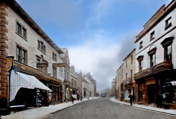
This photograph was taken by Yeovil Photographer Jarratt Beckett and published in his 1897 book "Somerset viewed through a Camera". At far left, with the awning, was Strong's Dining & Tea Rooms also known as the Princes Cafe. Next door to this was Collins, the printer and stationer, and then Cole & Sons. On the right is seen the new shopfront to Frank Gaylard's hairdressing salons. Between Gaylard's and the rear entrance to the Mermaid Hotel was, for decades, the premises of the Plowman family of harness and saddle makers.
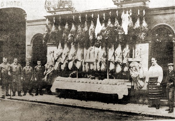
This photograph was taken in 1910 and shows Mr JH Burrows (second from right) and his staff outside his butcher's shop, Hinton Farm Meat Supply, in Princes Street right next to the rear entrance to the Mermaid Hotel seen at extreme left.
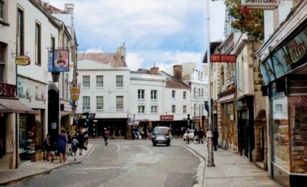
.... and looking back the other way, towards High Street, in a colourised photograph of the mid-1960s.
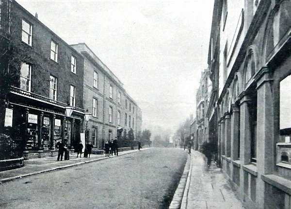
A view further down Princes Street, also published in Jarratt Beckett's 1897 book "Somerset viewed through a Camera".
From my
collection
-
This colourised
postcard
features in my
book 'Yeovil From Old Photographs'.
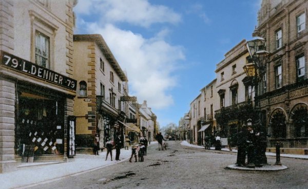
This postcard of Princes Street was used in 1905 although I have seen it as early as 1903. At left is Lindsay Denner's "gentleman's and juvenile ready-made and outfitting establishment" at 79 Hendford, immediately next to the narrow entrance to Porter's Lane. Denner's shop would be demolished around 1919 for the widening of Porter's Lane into today's Westminster Street. On the opposite corner the building that had been Porter's printing works and bookshop is still there today and bears a blue plaque celebrating Porter's shop. At right is the Capital & Counties Bank building which opened in 1897.
From my
collection. This
image
features in my
book 'Yeovil
- The Postcard
Collection'.
A postcard of Princes Street, dating to around 1905, produced by William Beale Collins and showing his premises at left.
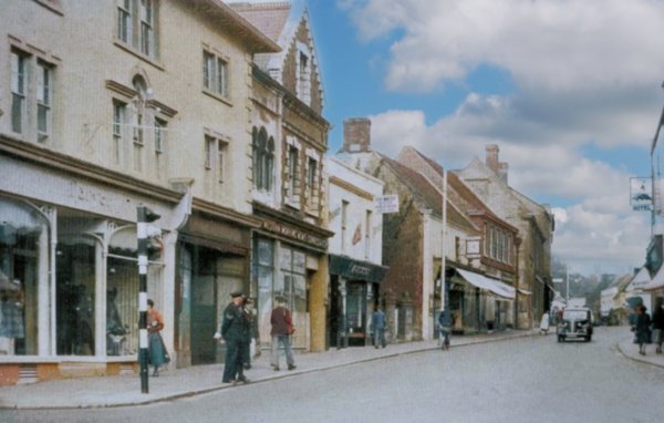
... and the same view, but in a colourised photograph of around 1955.
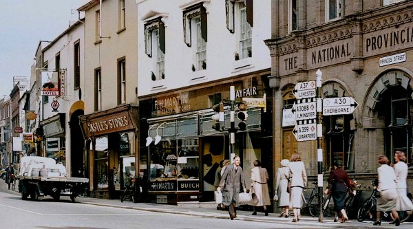
A colourised photograph of October 1952, showing the first few shops on the eastern side and southern end of Princes Street.
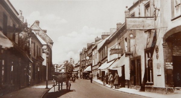
Princes Street in a postcard of 1935. At extreme right is the garage entrance to the Mermaid, but look at the shops next door - now re-fronted on the ground floor and currently occupied by Chant's estate agent.
Courtesy of
Clive Dalzell
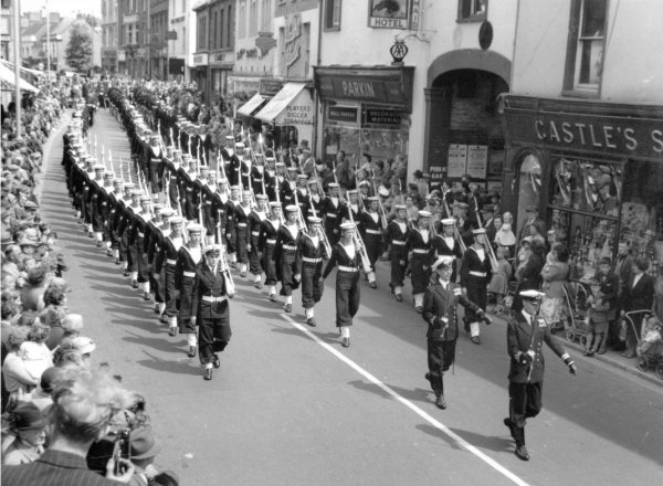
This parade of Naval ratings, with Lt Cmdr Robert Eric Dalzell (Clive's dad) marches past the rear entrance of the Mermaid Hotel around 1955.
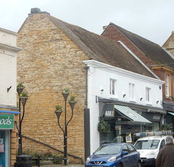
During the 1840s and 1850s this was the house of yeoman and gentleman John Newman and his wife Jane. Photographed in 2017.
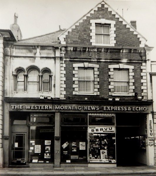
Nos 3 and 5 Princes Street, photographed (I think) in the 1960s.
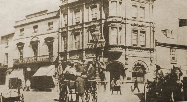
Courtesy of
Colin Haine
The junction of Princes Street at left and High Street at right around 1900 when horse-power meant horse-power.

The corner of Princes Street, at left, and High Street, at right, in a colourised photograph of 1906.
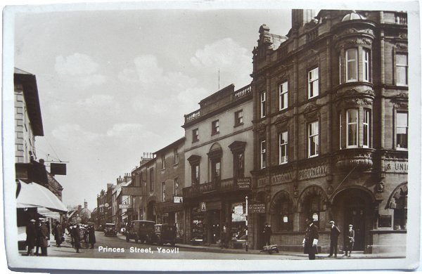
From my
collection
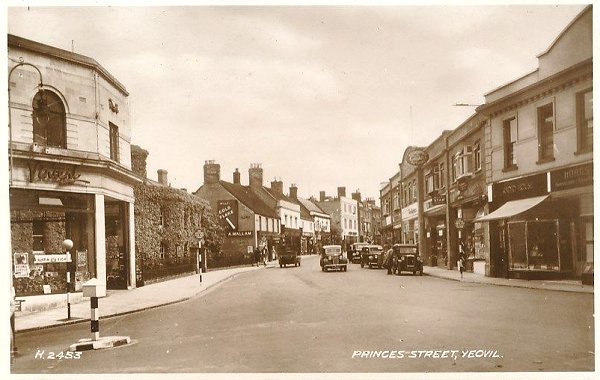
I'd guess this postcard of the southern end of Princes Street dates to the 1930s. Note the traffic policeman at bottom right patiently waiting for some traffic.

From the Cave
Collection
(colourised),
Courtesy of South Somerset Heritage Collection
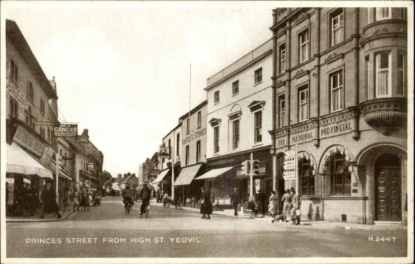
The junction of Hendford, Princes Street and High Street shown in the 1950 Yeovil Guide (but taken much earlier). The Capital Counties bank on the corner is now the National Provincial bank.
From my
collection
A postcard dated 1949. Note that the traffic light poles are no longer black and white stripes - or was this earlier? At left Genge's store is on the corner of Westminster Street. Next to the National Provincial bank the building known as Mayfair, that used to house Frank Gaylard's hairdressing salon, is now divided into two shops; that to the left (with the awning down) being occupied by butchers D & D Lawrence (later FH Martin, butcher) while that to the right (behind the traffic light) was vacant at this time, later the Mayfair dress shop.
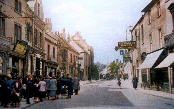
A colourised photograph of the mid-1920s showing the southern end of the western side of the road - little changed today. Princes Street at this time had two-way traffic.
From my
collection
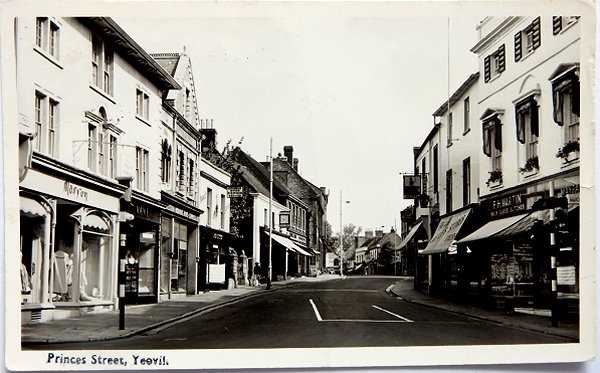
A postcard by HA 'Jack' Cooper, of the southern end of Princes Street dated 1958. The shops on the left hand side are - left to right - Maryon (dress shop), Vane (looks like a jeweller), can't make out the next two although the second is a shoe shop offering a shoe repair service, Finally, the building with the awnings down is Perris's (now Ask Italian restaurant). On the right hand side - right to left - is Mayfair (I think a dress shop), FH Martin ('high class butcher') then a small grocery store but I can't make out the name, followed by the rear entrance to the Mermaid Hotel.

Princes Street in a colourised photograph of around 1960.
Courtesy of
Geoffrey White
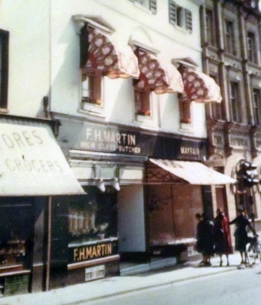
The building known as Mayfair was, for many years Frank Gaylard's hairdressing salon and home to the Yeovil Toilet Club. By the 1950s the building had been divided into two shop premises; FH Martin butchers and Mayfair dress shop.
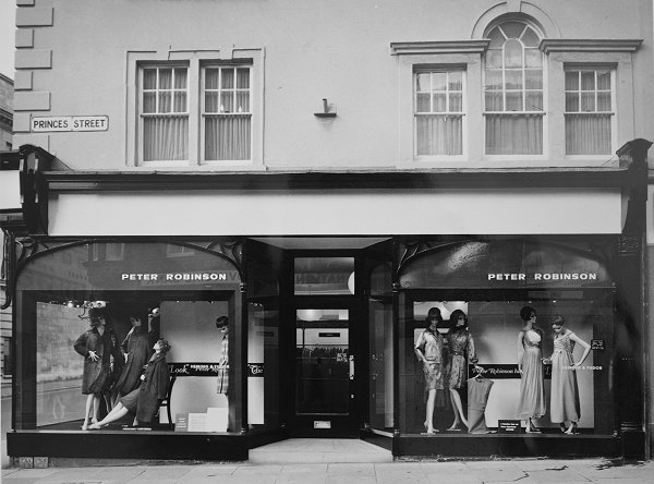
Courtesy of Jack
Sweet
Photographed in the 1970s, this is the shop on the corner of Westminster Street seen above.
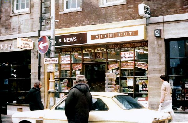
John Old's house, at centre, but in this colourised photograph of around 2000, of the western side of Princes Street, it is occupied by R&B News.
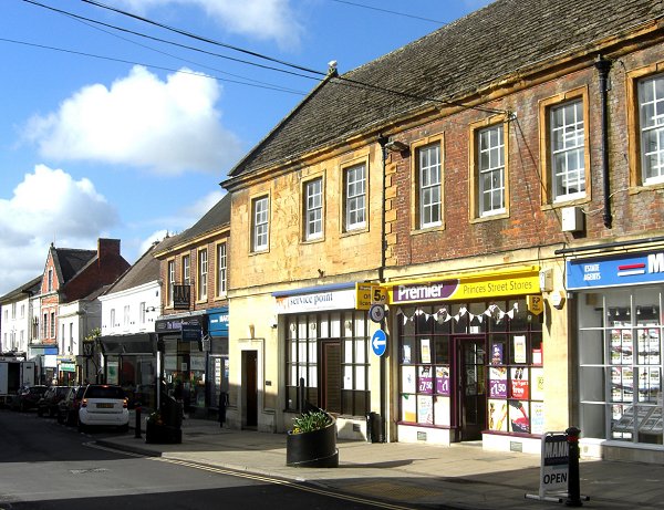
Again, John Old's house, at centre, set in the Princes Street streetscape, western side. Photographed in 2013.

A colourised photograph of 1942, seen from Church Street. Who remembers the Chelsea Tea Rooms?
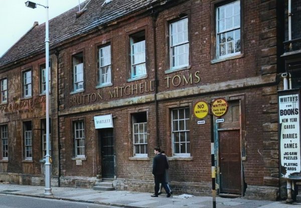
From the Cave
Collection
(colourised),
Courtesy of South Somerset Heritage Collection
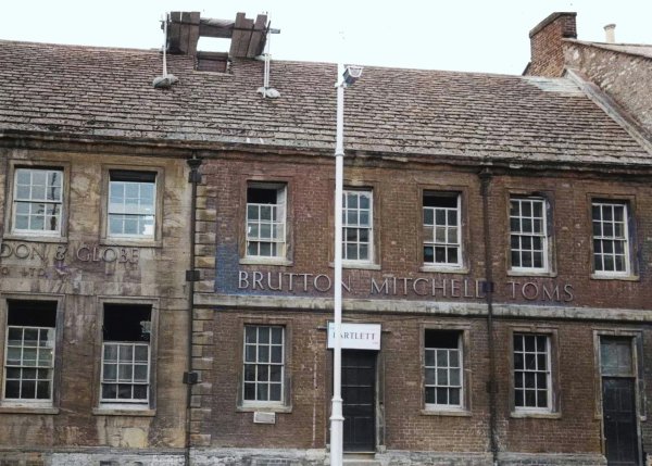
The same building as the previous photograph, but photographed in the 1960s when it was the offices of brewers Brutton Mitchell Toms.
From the Cave
Collection
(colourised),
Courtesy of South Somerset Heritage Collection
... and from a slightly different angle.
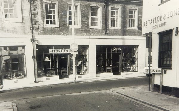
The same building again, but looking from Church Street around 1970, by which time shops had been insterted..
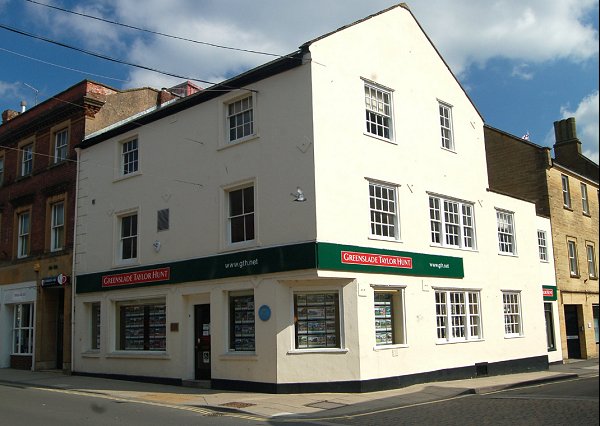
The same building as the Chelsea Tea Rooms above, on the corner of Church Street, seen from Princes Street and photographed in 2014. This was Yeovil's third Post Office between 1876 and 1902. In the 1940s, as seen above, it was the Chelsea Tea Rooms and in the 1960s it was premises of the Halifax Building Society.
From my
collection.
This
image
features in my
book 'Yeovil
- The Postcard
Collection'.
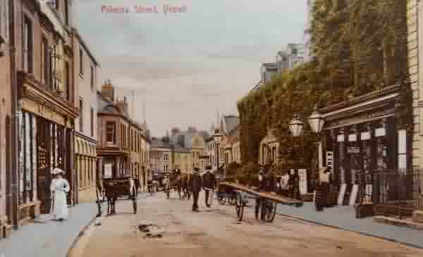
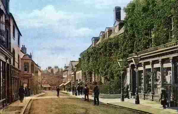
Princes Street in a postcard sent in 1912. It's nice to think that all these buildings are still with us.
From my
collection
-
The original photograph
features in my
book 'Yeovil From Old Photographs'.
Largely the same view as in the previous photograph, but this colourised postcard is dated 1905. It features Ebenezer Whitby & Sons' bookshop, printers and stationers at (now 31) Princes Street with a pair of single Sugg lamps outside.
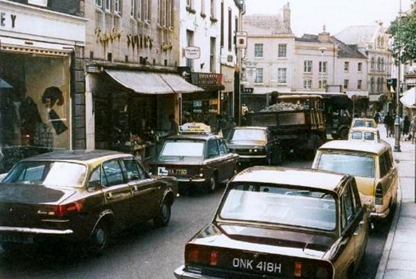
... and what a difference the development of transport has made in the past hundred years - as witness by this colourised photograph of 1970.
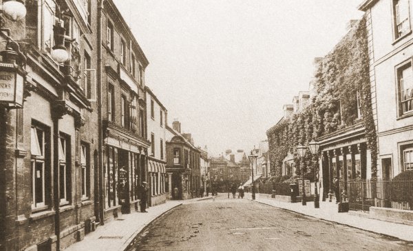
A photograph of the southern end of Princes Street, looking towards High Street, and dating to around 1900. All the buildings in this photograph survive to this day - the planners and developers must be holding their breath waiting to destroy these buildings like they've done to much of the rest of the town!
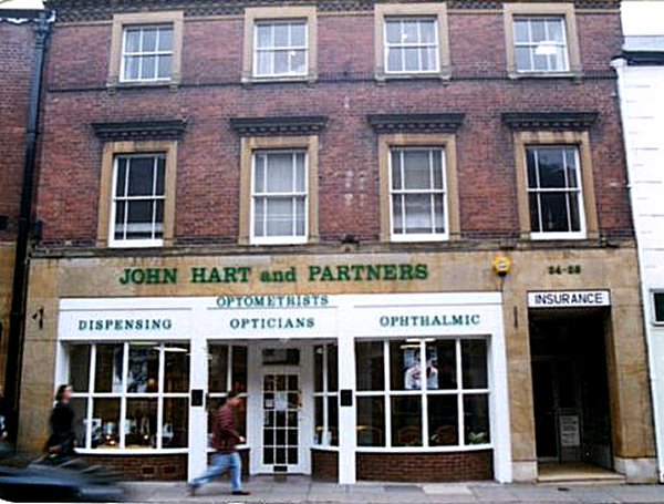
No 24 Princes Street (also seen at left in the previous photograph) and photographed, I would guess, in the 1980s.
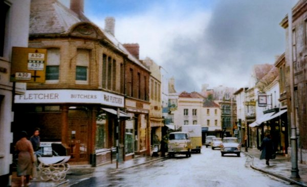
The butchers, W & R Fletcher Ltd, was a New Zealand company with freezing works in Australia as well. They were sending mutton and lamb to the UK in the 1880s and opened cold stores to wholesale to butchers. By 1910 they had 417 shops, mainly in the south of England, as there was resistance to this so-called foreign meat. Union Cold Storage bought them out in 1912 and used the name W&R Fletcher until the 1960s in Yeovil. In 1922 UCS bought a small company of seven shops and a market stall trading as J H Dewhurst. The company went into liquidation in 1995. Colourised photograph of the 1960s.
Courtesy of
Tracey Williams
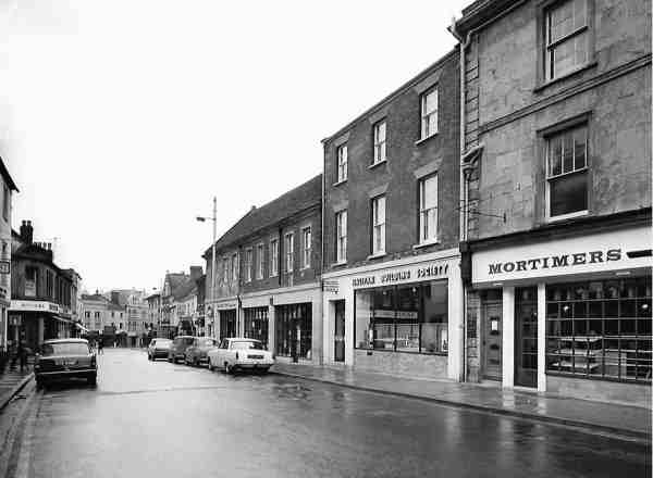
... and seen from slightly further north in the mid-1960s.

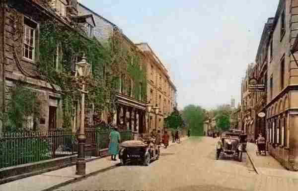
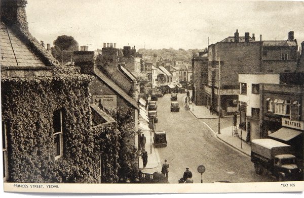
A colourised photograph of the northern end of Princes Street dating to around 1900. At right, at this time the Assembly Rooms were known as the 'Palace of Varieties' as indicated by the vertical sign attached to it. The three impressive three-storey residences at left, beyond Whitby's ivy-clad shop, are Wyndham House, Bryndene and Old Sarum House.
From my
collection.
The
original
image
features in my
book 'Yeovil
- The Postcard
Collection'.
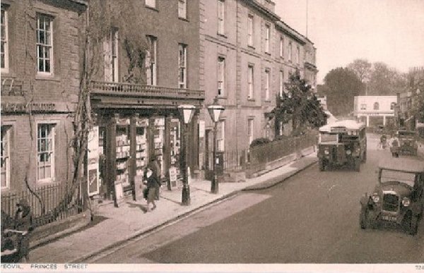
.... and almost the same view again in a colourised postcard of 1924 - note that Vincent's showroom has yet to be built.
This photograph
features in my
book 'Yeovil
From Old
Photographs'
A 1930s postcard of the same view. Wyndham House retains its small front garden and young tree, but notice how the post-box has gone and part of the pavement of the previous photograph has been whittled away in front of Whitby's shop premises. At the far end, on the right, are the newly built Vincent's showrooms on the corner of Court Ash.
Courtesy of
David Perry
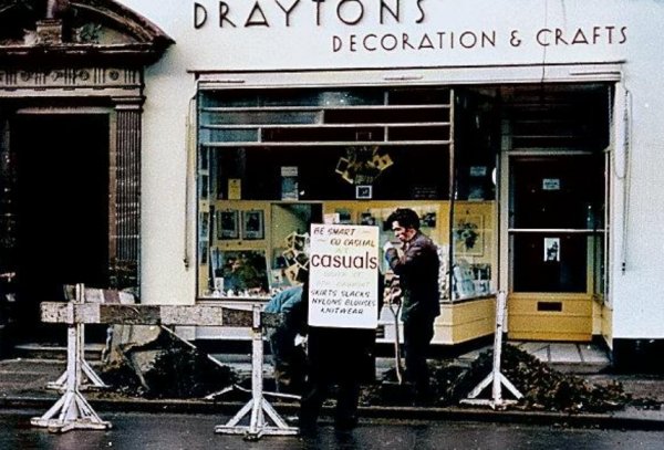
A sandwich-board man (remember them?) stops to chat with two contractor's workers outside Drayton's shop (now Bloor's Pet Stores) around 1963.
From the Cave
Collection
(colourised),
Courtesy of South Somerset Heritage Collection
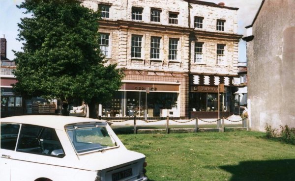
Old Sarum House, photographed in the 1960s from the grounds of Glenthorne House. At this time, the left two-thirds of Old Sarum House were occupied by Wessex Electric Co. and the right third was the Chessman coffee bar.
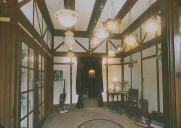
The interior of the Wessex Electric Co. showrooms in a colourised photograph of 1951.
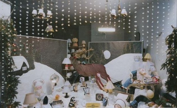
A colourised photograph of the 1951 Christmas decorations in the Wessex Electric Co. showrooms.

The entrance to Park Road seen from Princes Street in a colourised photograph of the 1960s. Old Sarum House dominating the picture at left, the former home of Yeovil's first mayor, John Ryall Mayo was the Chessman Café on the corner (later Prezzo which occupied the whole building, now a dental practice).
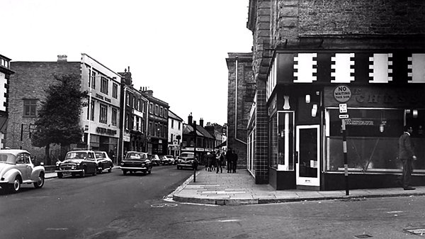
Looking south along Princes Street from Park Road, with the Chessman Café (later Prezzo, now a dental practice) in Old Sarum House at right. Photographed around 1965.
This photograph
features in my
book 'Now
That's What I
Call Yeovil'
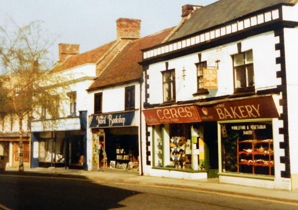
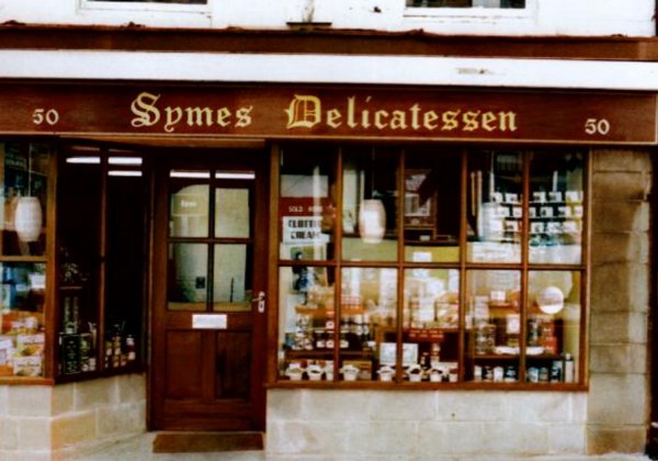
The earliest buildings in this area, numbers 40 to 52 Princes Street were built as four early eighteenth century (No 44 is seventeenth century) town houses, now subdivided into seven shop premises.
Courtesy of
Chris Symes
The frontage of Symes Delicatessen at 50 Princes Street. Photographed in the 1980s.
Courtesy of
Chris Symes
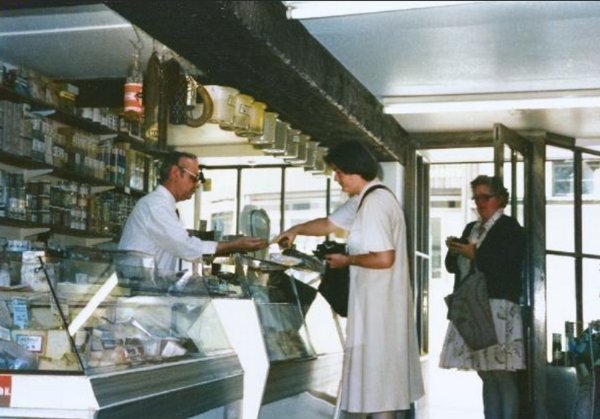
The interior of Symes Delicatessen, with Tom Symes serving customers, in a colourised photograph of the 1980s.
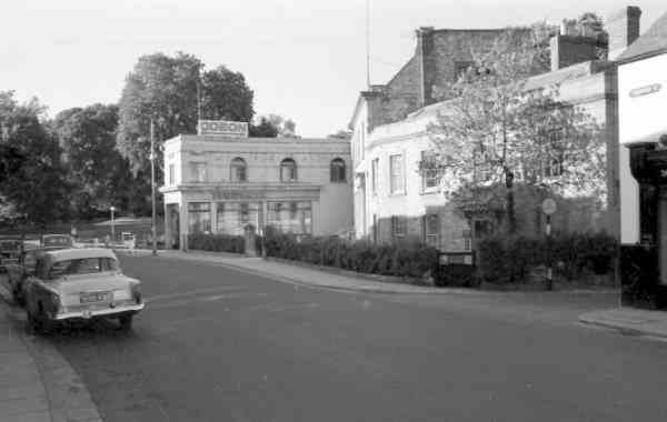
Looking north towards Bide's Gardens from the northern end of Princes Street in the mid-1960s.
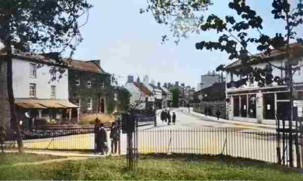
The original photograph
features in my
book 'Secret Yeovil'
This colourised photograph was taken from Bide's Gardens and shows the northern end of Princes Street / southern end of Kingston, with Court Ash running off to the left. At this time, before Reckleford was made a dual carriageway and Yeovil lost Bide's Gardens (the photographer of this photograph would today be standing on the southern carriageway of Reckleford as it approaches the hospital roundabout), Princes Street ended at North Lane on the eastern side (between the white flank wall and the ivy-covered Magnolia House left of centre) while the western side of Princes Street ended at Park Road (indicated on this image by the flank of three-storey Old Sarum House visible just right of centre).
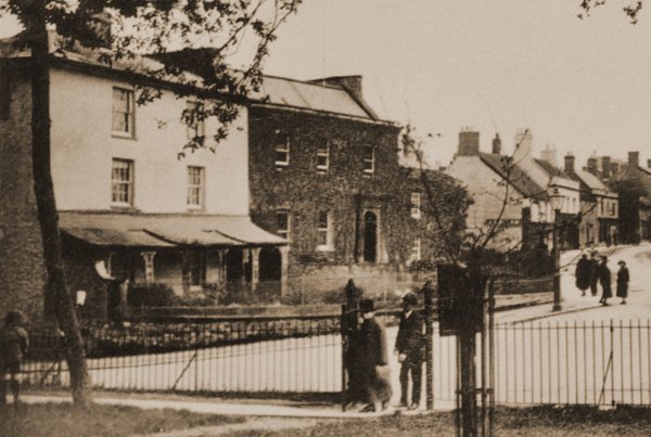
The photograph most likely dates to the early 1920s, yet is probably one of the earliest of this location as witnessed by the building at far left, next to Mansion House and enlarged below, which pre-dates the 1930's Vincent's (now Batten's) building of the previous photograph, on the corner of Court Ash (running off to the left), we are all so familiar with. At right is the shop-front of the sales rooms of Hill & Boll's carriage works.
This photograph
features in my
book 'Yeovil
From Old
Photographs'
An enlargement of part of the above photograph with Edward Watts' home at left.
Edward Watts, a surveyor, map maker and land valuer, rented the property for £20 a year. When Samuel Purchase, the owner of the property, was declared bankrupt in 1828 the property was sold off and it is assumed that Edward Watts purchased it at this time since he was recorded as the owner when he sold it in 1835 - when it was described as "substantially erected within a few years". The description of the property from the notice of sale in 1835 notes that it was a "comfortable and convenient Dwelling-House situate in Kingstone, in Yeovil, comprising breakfast, dining and drawing-rooms of good dimensions; six large bed-rooms, two kitchens, cellars, brewhouse, and other domestic offices, together with the Lawn in front and garden, stable and gig-house behind the said dwelling-house, late in the occupation of Mr Edward Watts."
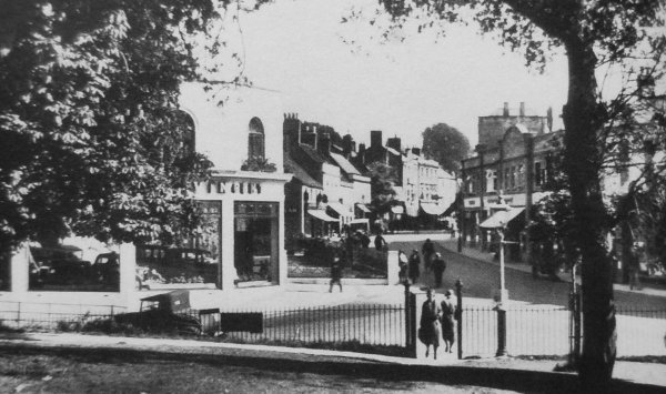
The same view taken from Bide's Gardens in the 1930's looking down to Court Ash running off to the left and Princes Street at centre. Note the spanking-new Vincent's building at left built on the site of Edward Watts' former home.
From my
collection
The northern end of Princes Street seen in a postcard of the 1950s.
From my
collection
- This
colourised
postcard
features in my
book 'Yeovil
From Old
Photographs'
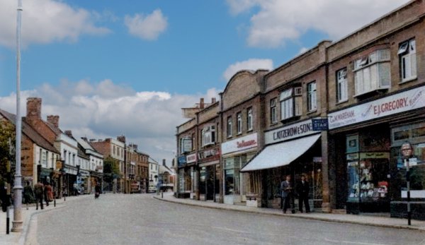
The northern end of Princes Street seen in a postcard dated 1961 (although the serial number 'V7781' dates the photograph to between 1942 and 1952). The three shops at right were Kitzerow & Sons (shoe shop), C&M Wareham (confectionery & cigarettes) and EJ Gregory (fruiterer & florist).
Thanks to Roger Willmott who recalled "Although we lived in Tintinhull, my mother always bought her fruit and vegetables from Gregory's and my Clark's shoes from Kitzerow's. Kitzerow's had an X-ray machine that you placed your feet in so you could see how well the shoes fitted. Would never be allowed today." Thanks to Stella Trent "Loved Kitzerow, during the war they sold American shoes, for some reason the name Joyce shoes comes to mind." and to Patricia Ann Smith "Kitzerow's had a beautiful old rocking horse in the children's department."

This colourised photograph of the early 1960s is moving further along than the previous photo and doesn't look like this now. The building at the right was demolished. The white building at the centre had its domed parapet removed and the shop on the right within this block is now the last shop in Princes Street - occupied since 1939 by Hayne the butcher.
From my
collection
An unusual view of Princes Street taken from the roof of Vincent's car showroom (now Batten's). The postcard is dated 1962. In Old Sarum House the Jolly Farmer Café became the Chessman Café by the mid-1960s (now Prezzo).
From my
collection
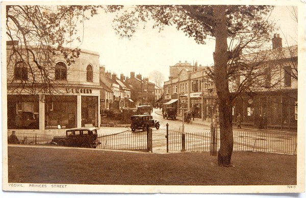
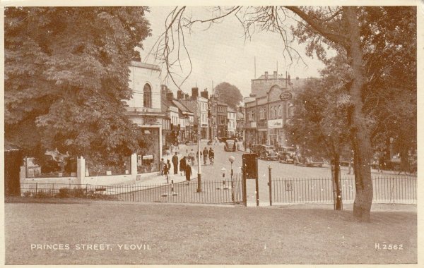
A postcard dated 1933 showing the Princes Street entrance to Bide's Gardens. Note the cars in Vincent's showrooms at left.
From my
collection
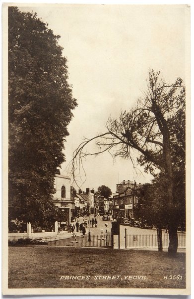
A postcard (I'm guessing from the late 1940s), looking down the northern end of Princes Street and showing the Princes Street entrance to Bide's Gardens.
From my
collection
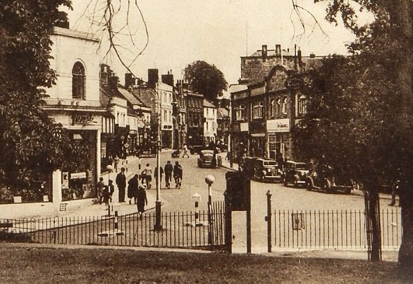
The central section of the previous postcard enlarged. Note the new pedestrian crossing in Court Ash in black and white striped wartime blackout markings.
From my
collection.
This
image
features in my
book 'Yeovil
- The Postcard
Collection'.
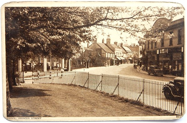
A postcard dated November 1942 showing the Court Ash / Princes Street / Kingston junction from Bide's Gardens. The shop with the car parked outside was Tilzey's photographic studio.
From my
collection
.... and a postcard of 1952.
From my
collection
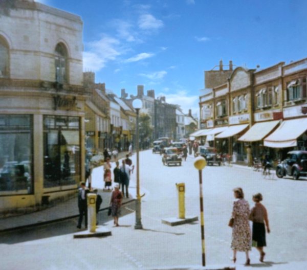
.... and a colourised postcard of around 1955 because the entrance to Court Ash had got nice new bollards.
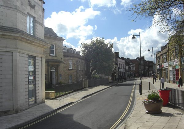
... and seen today, with a newly surfaced street and pavement. Photographed in 2023.
Photographed by
Geoff Bowler,
courtesy of Sue
Bowler
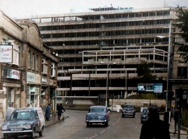
In this colourised photograph of 1969, the new hospital takes shape. At this time the Reckleford extension had not been finished and it was still possible to drive from Princes Street to Kingston. It's amazing how a long telephoto lens can make a building look much bigger than it actually is.
Courtesy of the
Western Gazette
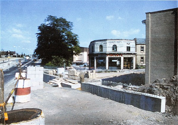
The construction of Reckleford obliterated the change from Princes Street to Kingston in 1975.
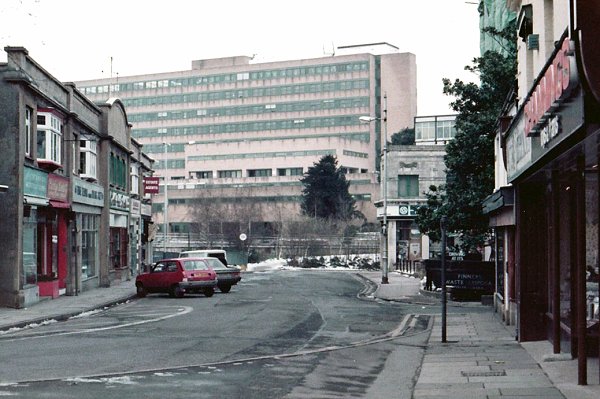
This photograph dates to January 1985 and looks towards the hospital. This area was originally the end of Princes Street and the start of Kingston but the termination was brought about by the extension of Reckleford.
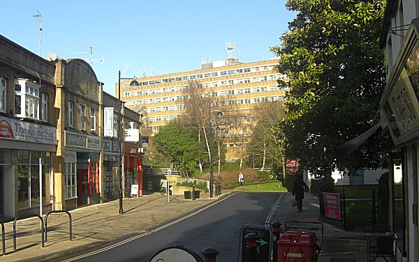
.... and pretty much the same view in 2014.