Sugg's Close
Sugg's Close
A former part of the great West Field of Kingston Manor
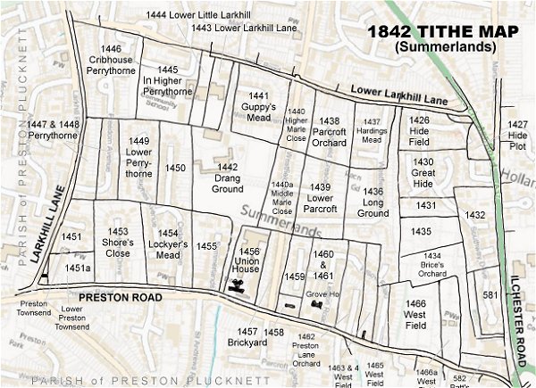
Originally part of the great medieval West Field of Kingston Manor, Sugg's Close (Parcel 1432) was a rectangular field alongside the west side of Ilchester Road and lying halfway between Lower Larkhill Lane (today's Stiby Road) to the north and Preston Lane (today's Preston Road) to the south. We no longer know who Mr Sugg was (the Sugg family really only begin appearing in local records from the beginning of the nineteenth century) but 'close' is the normal word for what is generally called a field, that is, an enclosed (hedged or fenced) area, most often one created by enclosure in about 1822.
It was mentioned in the 1743 Terrier as being 6 acres of arable land "from Chaplain's Nap to Thorne Lane (next to Butt's Corner)". Although shown and numbered on the 1842 Tithe Map, surprisingly (although not uniquely) it was not mentioned in the 1846 Tithe Apportionment. It was, however, recorded in the 1847 Church Rates Book.
Sugg's Close was bounded on the north by Great Hide (Parcel 1430), on the west by Great Hyde, Little Hide (Parcel 1435) and Brice's Orchard (Parcel 1434), to the south by an un-named plot (Parcel 581) and to the east by Ilchester Road.
As seen on the 1926 Ordnance Survey map below, in the 1920s Sugg's Close was used as a football ground. By 1946 one house had been built in its northeast corner. Today the former Sugg's Close contains houses and gardens of Ilchester Road and the southern end of Southway Drive.
For details on historic land measurement (ie acres, roods and perches) click here.
maps & Aerial Photographs

This map, based on the descriptions in the 1589 Terrier and the 1846 Tithe Map of Yeovil shows the approximate boundaries of the Manors of Kingston and Hendford as well as the manorial three-field system used in Kingston.
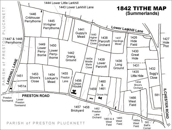
The Larkhill area reproduced from the 1842 Tithe Map. Sugg's Close is centre right.
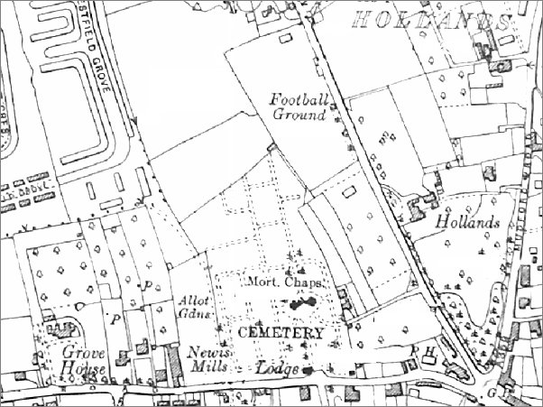
Map based on the 1926 Ordnance Survey with Sugg's Close is at top centre - at this time used as a football ground.
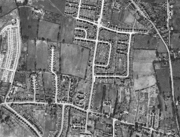
The 1946 aerial photograph - Sugg's Close is at centre right, with a house plot in its northeast corner.
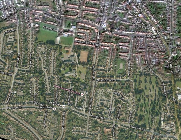
The same area today 'borrowed' from Google maps.
The 1842 Tithe Map superimposed (only very slightly out at the bottom) over a modern map.