townsend
townsend
Townsend, sometimes written as Town's End, as its name suggests is at the eastern edge of the town however the name has been applied to different parts of the road over time. The earliest mention of Townsend in the records was in 1589.
Essentially that part of London Road, now called Sherborne Road, extending from the junction of Reckleford and Sherborne Road as far as Wyndham Street is the only part that has been called Townsend for the past several hundred years.
Nevertheless although its eastern end has always been the Reckleford / Sherborne Road junction, the name Townsend was applied throughout most of the nineteenth century to what is now Lower Middle Street as far as Central Road and even as far as Stars Lane on occasions.
map
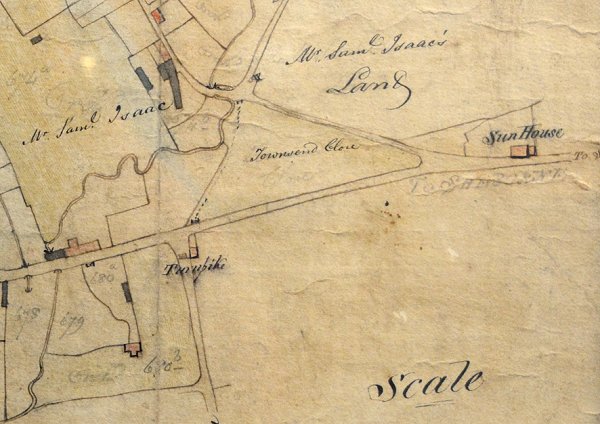
Edward Bullock Watts' map of Yeovil of 1806 shows Townsend Close at centre, completely devoid of buildings.
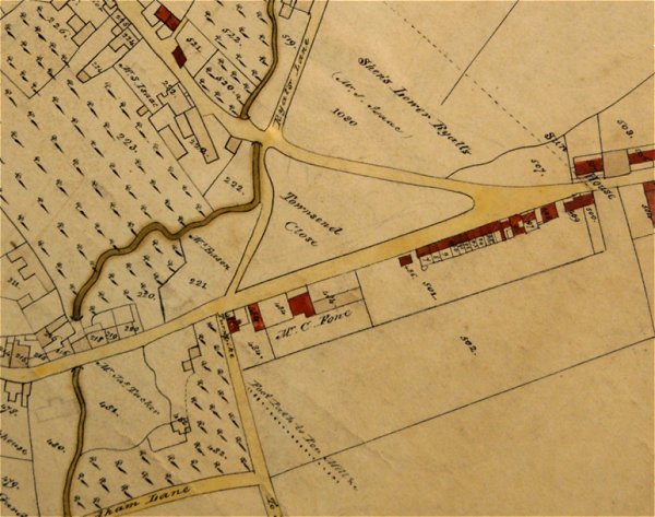
The same area on Watts' map of 1831 showing the build-up of properties along the southern side of Townsend.

This map is based on the 1842 Tithe Map, showing that by this time the former Townsend Close had been sub-divided and built on. Parcels 525 and 526 were both described as 'Houses & Gardens' both owned by Luke Tabor with Charles Hawkins as the tenant of both Parcels. Parcels 527 and 528 were both described as 'Cellar, Yard and Garden'. Both were owned and occupied by Joel Hardy.
gallery
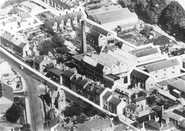
This interesting aerial photograph, probably taken during the early 1960s, shows the junction of Reckleford and Sherborne Road at lower left with Townsend running along to bottom right. The house at the junction (now a pedestrian / flowerbed area) is at lower left, the Duke of Wellington at lower right and the industrial units between the Sherborne Road houses and Wyndham Hill at top right.
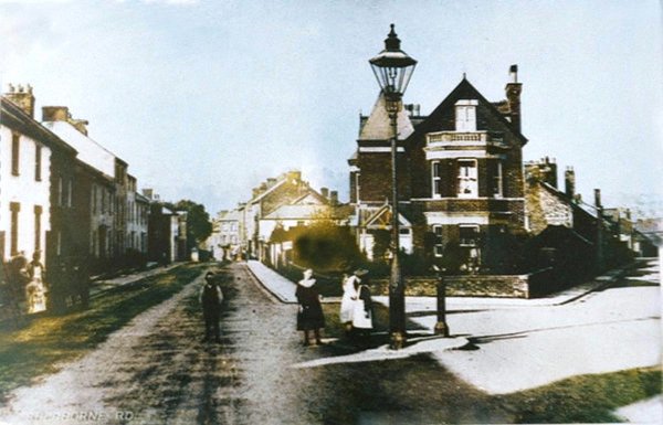
This
colourised photograph
features in my
book 'Yeovil From Old Photographs'.
This is probably the earliest photograph of Townsend and dates to about 1890. It is taken from Sherborne Road with that part of the old London Road, known as Townsend, running off to the left and Reckleford runs off to the right. This view is completely unrecogniseable today with the large house on the corner now the site of gardens, pedestrian walkways and traffic lights, while the row of houses at left were demolished in the 1990s. Note the single, large Sugg lamp.
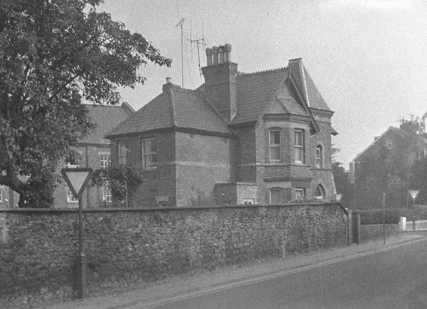
The same corner house seen from Townsend, probably in the 1960s.
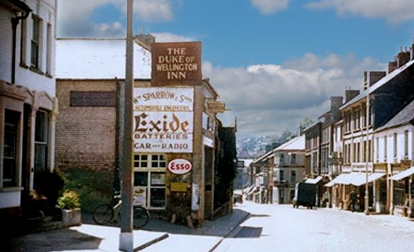
This colourised photograph, taken about 1950, looks down Sherborne Road, past Sparrow's garage towards the Elephant and Castle, right of centre, at the junction of Lower Middle Street and Wyndham Street. The Duke of Wellington is at extreme left.
Courtesy of
Chris Rendell.
This
photograph
features in my
book "Lost Yeovil"
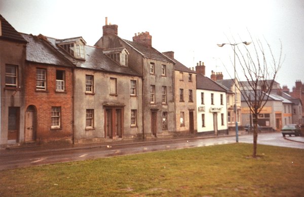
Opposite the 'corner house' above, these houses were the first to be built along the south side of Townsend and seen on the 1831 map above. Photographed around 1992 shortly before their demolition.
Courtesy of
Colin Haine
The eastern end of the run of buildings on the south side of Townsend, photographed in the early 1900s.
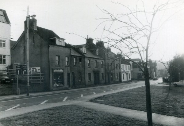
Courtesy of
Steve Tucker
Townsend looking west, photographed around 1991.
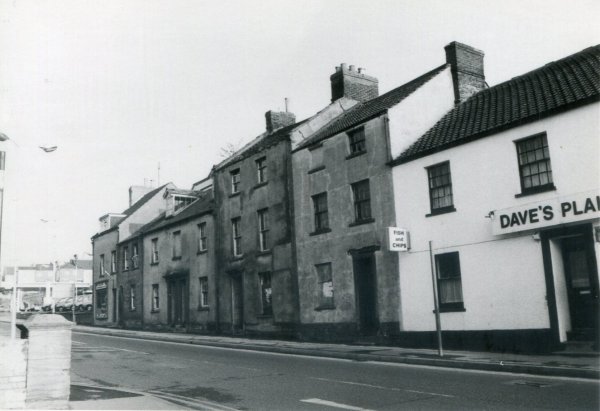
Courtesy of
Steve Tucker
Townsend looking east, photographed around 1991.
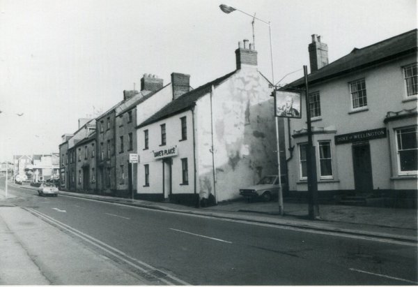
Courtesy of
Steve Tucker
Townsend looking east again but taken from a few yards further west, and now including the Duke of Wellington. Photographed around 1991.
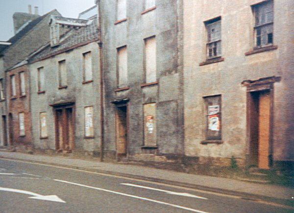
Courtesy of
Vivien and John
Cornelius
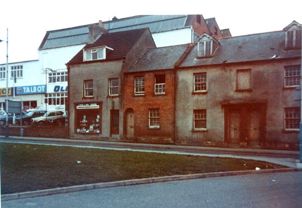
The same buildings, just a bit further along, photographed in 1992 just before demolition.
Courtesy of
Colin Haine.
This
photograph
features in my
book "Lost Yeovil"
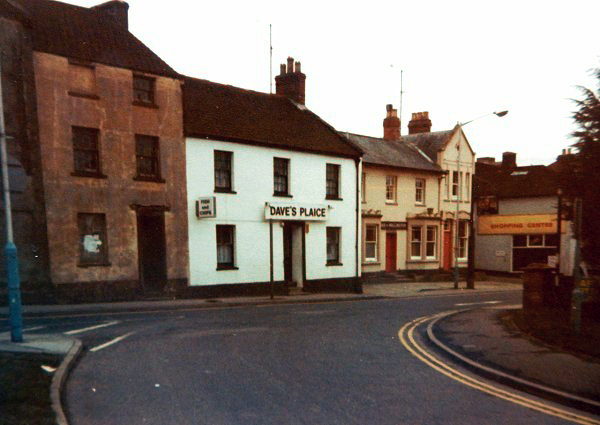
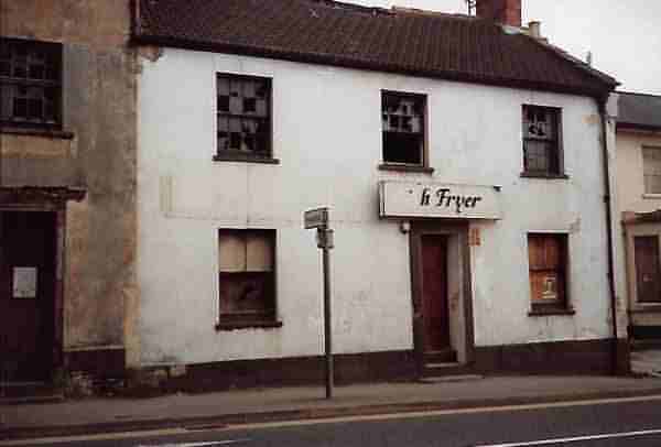
The western end of the run of buildings on the south side of Townsend, photographed in the early 1990s. To the right of Dave's Plaice fish & chip shop is the Duke of Wellington.
Courtesy of
Vivien and John
Cornelius
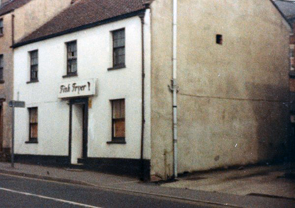
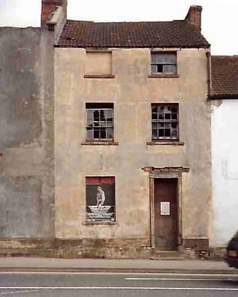
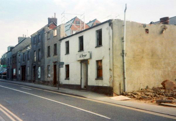
By 1992, just before demolition, Dave's Plaice had become the Fish Fryer.
![]()
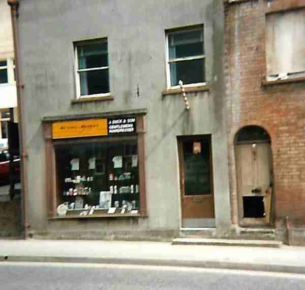
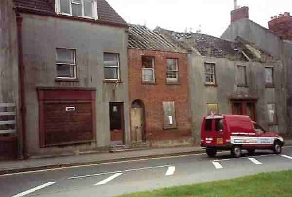
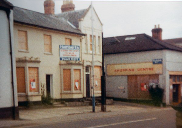
The following five photographs, courtesy of Rich Hooper, were all taken in 1992, shortly before demolition, and are sequenced from east to west (that is, going from Olds car showroom - see below - into town).

![]()
Courtesy of
Vivien and John
Cornelius
The Duke of Wellington and Cashman's Shopping Centre, just before demolition. Photographed in 1992.

A colourised view to the junction of Townsend (off to the left) and Reckleford (off to the right) from Sherborne Road in the mid-1960s.
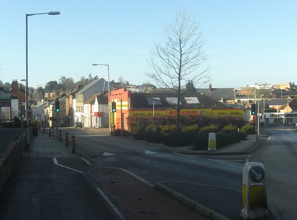
.... and pretty much the same view in 2014 less, of course, most of the buildings. The old Pankhurst's garage building is now the gaudy red and yellow National Tyres.
Courtesy of
Colin Haine
Demolition begins. The fish & chip shop was originally called Thorpe's, later Dave's Plaice. At extreme right the Duke of Wellington has already been demolished.
Courtesy of
Chris Rendell
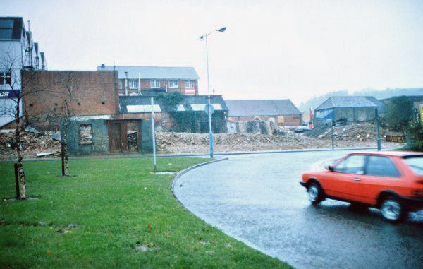
The demolition of the old houses on the south side of Townsend, circa 1983.
Courtesy of
Chris Rendell
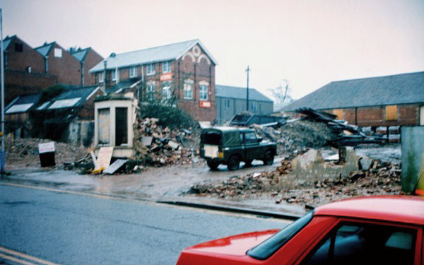
.... and from a slightly different perspective.

Looking along Townsend towards Sherborne in the mid-1960s. The Duke of Wellington is set back on the right where the dark transit van is pulling out.

A colourised photograph, again looking along Townsend towards Sherborne, but closer to the junction with Reckleford and the start of Sherborne Road, in the mid-1960s with Pankhurst's garage at centre.

Shops on the northern side, western end, of Townsend in the 1980s.
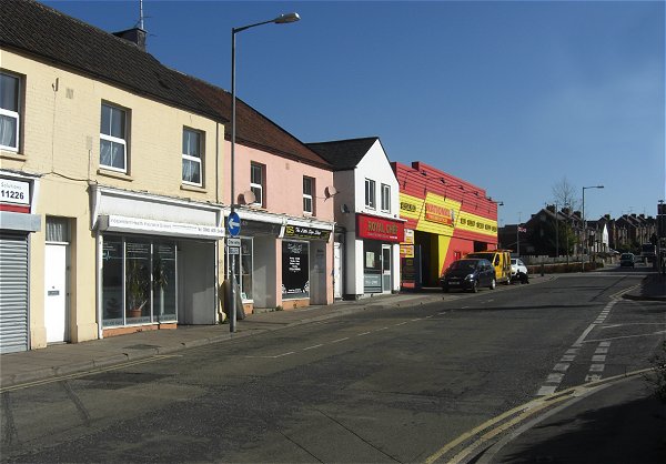
.... and almost the same view photographed in 2016.
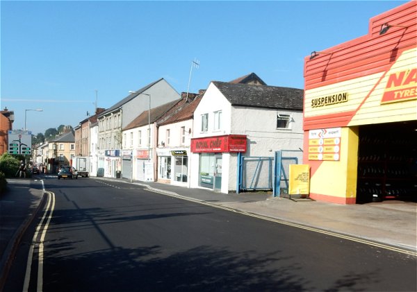
Looking west along Townsend. Photographed in 2016.

A colourised photograph of around 1960, looking along Townsend from the junction with Wyndham Street (running off to the left).
From Petter's to Olds to Aldi
During the summer of 2019, the site of the former Olds motor dealers buildings (former Petter's leather / glove factories), as well as other old glove factories behind, were demolished in order to create a new Aldi store. The following series of photographs capture the sequence over time.
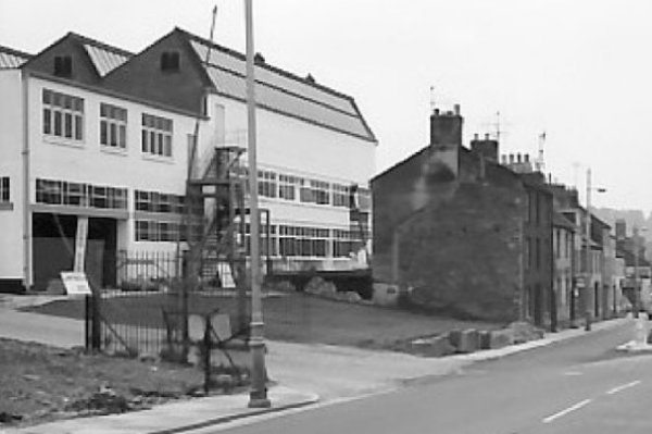
Photographed in the 1960s, the former Pittard's leather / glove factory lies vacant.
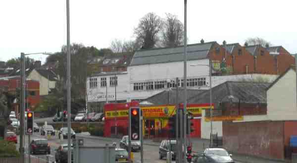
Seen from the junction of Goldcroft and Reckleford in 2013, the former Pittard's leather / glove factory buildings at centre was occupied by Olds car sales. The red brick building at the extreme left of the photograph was a new car sales showroom built in the 1990s.
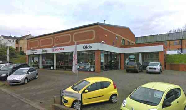
The 1990's car showroom. Photographed (courtesy of Mr Google) in 2016.

Moving on to 2017, the Olds' building is closed and boarded up.
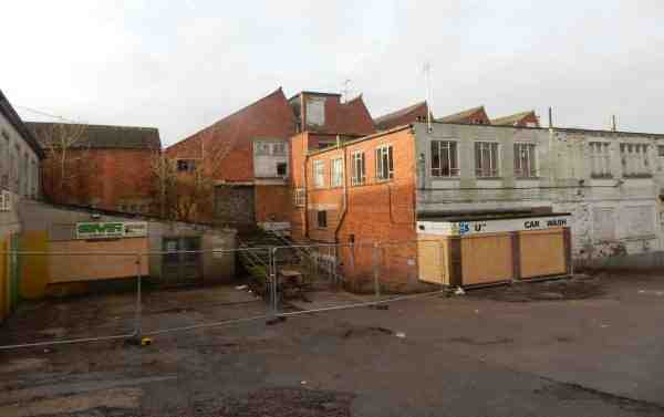
Buildings at the rear of the main building. Photographed in 2017.
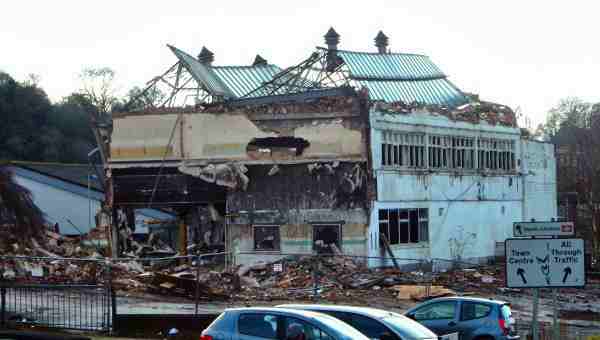
Demolition begins. Photographed 22 December 2017.
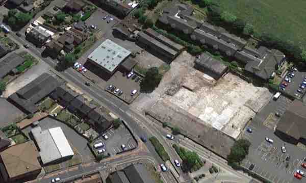
An aerial photograph of the site taken in 2017. The site of the demolished Petters / Olds building is the light area at right and the 1990's car showroom is the light square building towards the top, left of centre. Reckleford and Townsend join at the bottom centre, and continues as Sherborne Road to top left. The small former glove factories remain towards top centre.
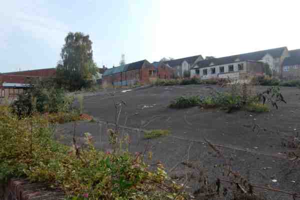
The main building of the former Pittard's / Olds' building removed - as seen from Sherborne Road. Photographed in 2018.
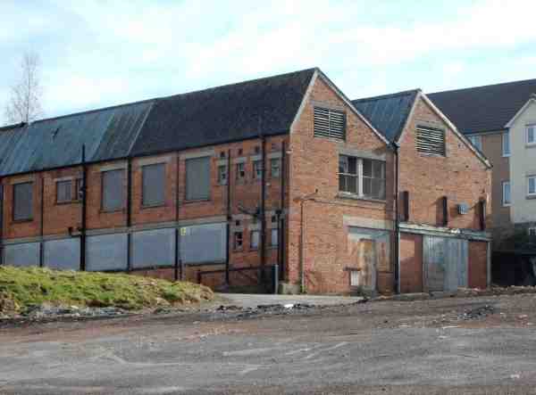
These derelict former leather / glove factory buildings face Reckleford from the rear of the site. Photographed in 2017.
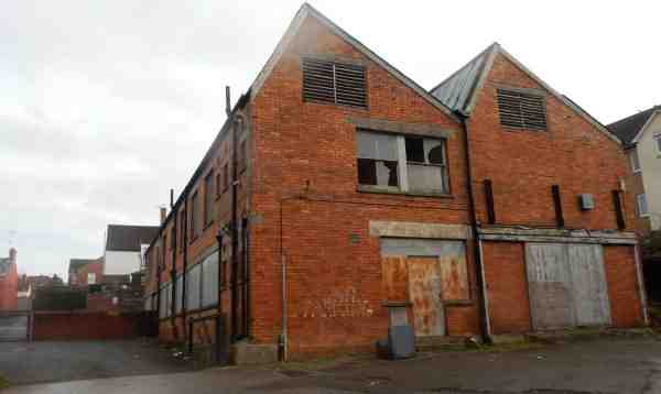
The factory buildings of the above photograph, seen end-on. Photographed in 2017.
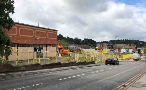
Mid-July 2019, and the site clearance for the new Aldi store is well under way. The purpose-built car showroom building at left was built during the 1990s.
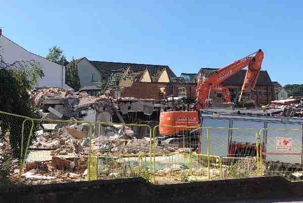
The car showroom building being demolished. Photographed July 2019.
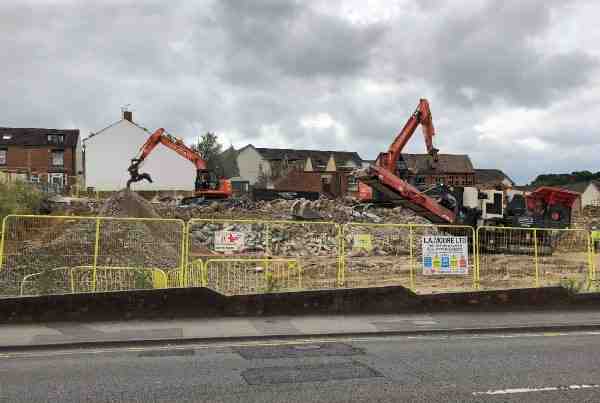
... and reduced to little more than a pile of dust. Photographed July 2019.
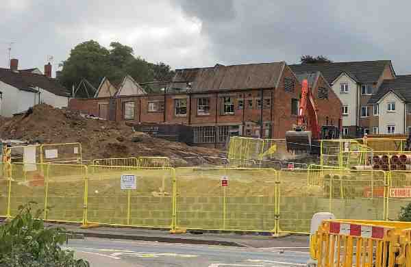
At the rear of the site, demolition begins on the former nineteenth century glove factory buildings (seen above), and disused for decades. Photographed July 2019.
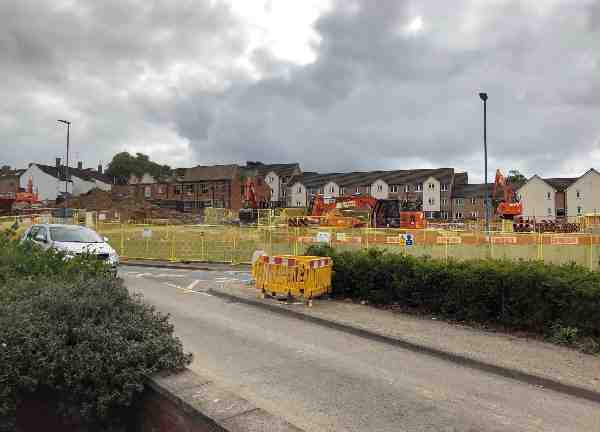
Much of the site seen from the junction of Townsend and Reckleford. Photographed July 2019.
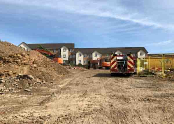
The old glove factory of the previous two photographs has gone and the site is now being partially leveled. Photographed 21 July 2019.
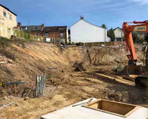
The site of the 1990's car showroom is now a massive hole in the ground. Photographed 21 July 2019.
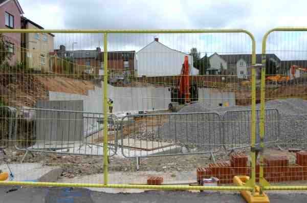
Work on the pre-cast concrete retaining wall continues. Photographed 6 August 2019.