waterloo gardens & waterloo
waterloo Gardens & waterloo
Huish
Waterloo Gardens was the name of a field, named on Watt’s map of 1831 and at the time owned by Mr Watts, which ran from Huish to West Hendford on the eastern side of what became Salthouse Lane - shown on the map as an un-named lane between the fields called Croft and Waterloo Gardens. It is not named on Watt's earlier map of 1806 because it was named after the Battle of Waterloo took place in 1815.
Waterloo Gardens later became the site of appropriately-named Wellington Street, which was named after the Duke of Wellington who commanded the victorious Anglo-Allied army at the Battle of Waterloo.
Waterloo Place
appears in the
1841 census and
its location in
the census
suggests it was
an alternative
name for
Waterloo Lane.
Waterloo was described in the 1851 census as “South Side of Huish from Custard’s Shop To Wellington Street” and clearly took its name the field called Waterloo Gardens. In fact Henry Marsh Custard's bookshop was in Hendford, on the corner of Westminster Street - at the time called Custard's Lane. The above description in the census implies that Waterloo also embraced the southern side of today's Westminster Street. The entries in Custard's Lane which appear separately in the 1851 census may therefore have been those properties on the north side of the lane.
Waterloo Lane, of course, ran from the junction of Westminster Street and Huish towards Hendford and was clearly named around the same time.
MAP
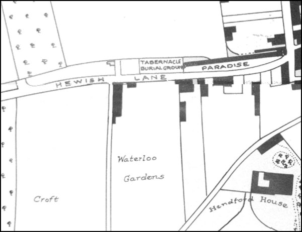
Map based on Watt's map of 1831 showing the field called Waterloo Gardens between Huish in the north and West Hendford to the south..