huish
huish
For generations nothing more than a field access track
The name Huish, spelt ‘Hewish’ on Edward Bullock Watts' maps of 1806 and 1831, was originally an Anglo-Saxon word ‘hiwisc’ meaning a household and would have been applied to an area of land of sufficient size to support one household. There is evidence that some of these family units may have functioned independently as farmsteads in the late Anglo-Saxon period. (Aston, 1988).
There was certainly a field in Yeovil called ‘Huwysh’ that was mentioned in a document of 1415 and in 1611 it was noted that the St Leonard’s Fair for cattle was held in the ‘field called Huishe in Hendford’ and was clearly part of the field system of the Manor of Hendford. Indeed, the common field called 'Hewish Field' stretched from Ram Park in the north, the boundary with the parish of Preston Plucknett in the west, today's West Hendford in the south and roughly as far as today's Clarence Street in the east. The parcels comprising the former great common field called Hewish Field are shown shaded green in the 1842 Tithe Map below. Hewish Lane (today's Huish) ran across this great common field.
For generations Hewish Lane (today's Huish) was nothing more than a narrow field access track that ran east-west across the common field.
Watt’s map of 1806 shows just one house situated along the lane which was described as "formerly a Barn Flax Shop and drying house but long since converted into a Public House called or known by the name or sign of the Chequers".
Bidder’s map of 1843 shows the lane flanked only by fields and orchards from about where the Beehive Inn is today all the way west. Huish terminated then, as now, at the bottom of Huish hill where it now becomes Preston Grove; although before Preston Grove (actually in the parish of Preston Plucknett) was built in the 1930's there were just fields as far as Preston Road with simply a footpath linking Preston Road with Huish. The only buildings shown were one or two isolated houses and the row of cottages named Paradise Row, now under Tesco’s car park by the corner of Westminster Street and Clarence Street. In the early part of the nineteenth century Huish was often referred to as Paradise Street.
Huish was called Hewish on Watt's maps of both 1806 and 1831, it was called Huish in the 1841 census and in the 1851 census was referred to as "Huish (called Paradise)". It was named Huish Lane in the 1891 census.
The general area was later known as Paradise and included much of Huish opposite Paradise Row and as far as Wellington Street. The name Paradise came from the fact that there was a burial ground belonging to the Calvinist Tabernacle in Tabernacle Lane to the immediate east of the old National School, now under the Tesco store.
Huish originally started at the junction of Porter's Lane, now Westminster Street, and Clarence Street but was, of course, bisected by the Queensway dual carriageway and was further modified by the construction of the Tesco complex such that the eastern part of Huish is now called Queensway Place.
Map
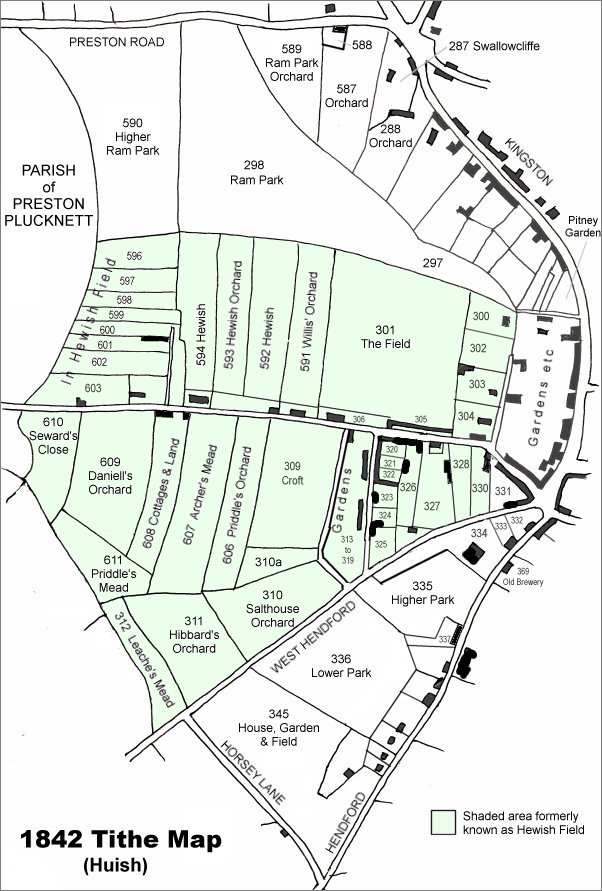
This map is based on the 1842 Tithe Map with field names added from the 1846 Tithe Award. The area shaded light green was originally the large common field called Hewish Field that had been formed out of the earlier medieval field called Northover. By the time of the 1842 Tithe Map, shown here, Hewish Field had been further sub-divided into many parcels as shown.
Hewish Lane (today's Huish) runs across the centre of the map.
gallery
From my
collection
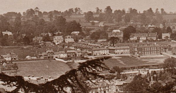
This photograph is taken from a postcard of 1934 viewed from Hendford Hill. Part of Huish, with an amazing amount of open space, runs across the centre of the image. At centre is seen the entrance to, and the rooftops of, Queen Street. At right is Huish School.

From the Cave
Collection
(colourised),
Courtesy of South Somerset Heritage Collection
This photograph was taken in the mid-1960's in Westminster Street. The bus is turning the corner into Clarence Street and the two-tone van to its left emerges from the end of Huish. At this time you could drive into Huish from Westminster Street as indicated by the road markings. Douglas Seaton's tower is fondly remembered as a landmark by older Yeovilians and right of centre is the Heart of Oak pub, now called the Westminster.
Courtesy of Jack
Sweet.
This
photograph
features in my
book "Lost Yeovil"
Looking back towards Westminster Street. Photographed in the late 1980s.
Courtesy of
Colin Haine.
This
photograph
features in my
book "Lost Yeovil"
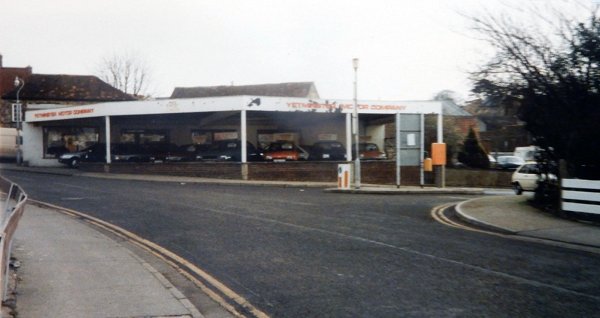
Yetminster Motors in Huish and alongside Waterloo Lane, photographed in the 1980s. The site is now Tesco's car park that backs onto West Hendford.
Courtesy of
Vivien and John
Cornelius.
This photograph
features in my
book "Now
That's What I
Call Yeovil"
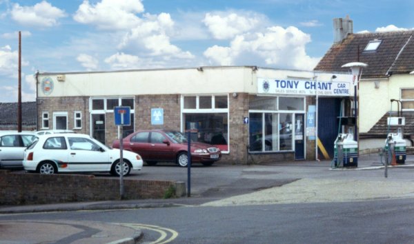
Tony Chant's Car Centre in Huish, on the corner of Richmond Road. Now, unsurprisingly, a block of flats is on the site. Photographed in 2005.
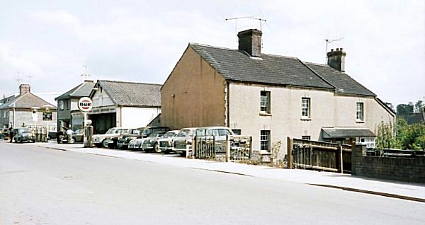
Looking back towards Richmond Road and Chant's garage in the mid-1960s.
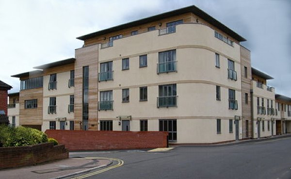
... and a couple of years later, Tony Chant's garage was replaced by Richmond Place flats.
This colourised photograph
features in my
book 'Yeovil
From Old
Photographs'
The salt-house from where the name Salthouse Lane derives. Probably photographed in the 1890s and seen from Huish with Salthouse Lane running off to the right.
From the Cave
Collection
(colourised),
Courtesy of South Somerset Heritage Collection
A horse-drawn milk delivery cart passes the crown in Huish in the 1960s. The houses at centre and left are Felix Place.
This
photograph
features in my
book "Lost Yeovil"
In this photograph of about 1970 only one house remains in Felix Place's western terrace behind the Crown. Huish runs across the photograph and the narrow street running from the side of the Crown towards the left centre of the photograph is Felix Place. Note the newly-constructed Wellington Flats at right.
From the
Cave
Collection
(colourised).
Courtesy of South Somerset Heritage Collection
Seen from the west in the 1960s. The swimming pool is off-photo at the right.
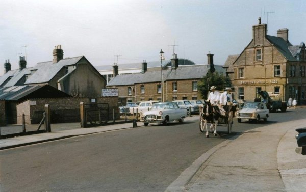
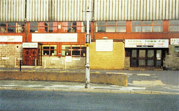
Looking along Huish in the 1970s with the Crown at left and Yeovil Town FC at right.
From the
Cave
Collection
(colourised).
Courtesy of South Somerset Heritage Collection
Huish Infants School, almost opposite the Crown Inn, photographed around 1965 from the Huish end of Salthouse Lane. The remaining school building is now incorporated into Tesco's.
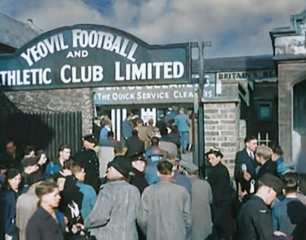
Fans queue to get into the Huish ground for the Yeovil Town v Sunderland match. The game was played on 29 January 1949 and was a tie in the Fourth Round of the FA Cup. Yeovil Town won the match 2–1, with Alec Stock and Eric Bryant scoring the goals for the winning side. The match is notable for being one of the few occasions in the history of the FA Cup where a non-league club has defeated a team in the top tier of English football.

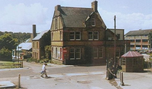
This photograph, from around 1955, was taken outside the Crown Inn (at left) and looks west.
Courtesy of the
Western Gazette
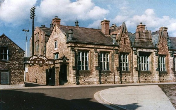
.... and nearly opposite the Crown Inn, a memory for thousands of Yeovil Town FC supporters, the entrance to the Huish ground with its famous sloping pitch.

From my
collection
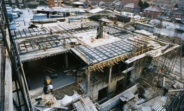
The 1991 demolition of the Yeovil FC stand and other buildings in Huish.
An unusual
photograph of
1972 showing
work is well
advanced on the
extension of the
telephone
exchange which
will house the
international
equipment. In
the distance the
Fairfield is
occupied with a
fair (later this
will have
Queensway
running partly
though it). At
top right is
'The Crescent'
also to be
partly destroyed
by Queensway.
This side of
that road,
ground works are
under way for
the building
which will house
the stand-by
engine to power
the exchange in
event of a
mains-fail.
Text courtesy of
John Penny
Courtesy of the
Western Gazette
A little further west along Huish and looking west in 1977. The building at left is the Post Office sorting office and the road running off to the right is Queen Street. The bottom half of this photograph is now where Queensway runs across, bisecting Huish.
Courtesy of the
Western Gazette
Almost the same view, but photographed in 1984 after Queensway bisected Huish.
Courtesy of Jack
Sweet. This
photograph
features in my
book "Now
That's What I
Call Yeovil"
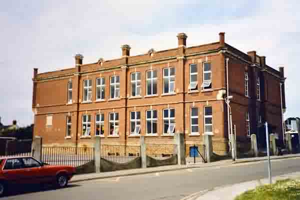
Huish Junior School photographed in 1986.
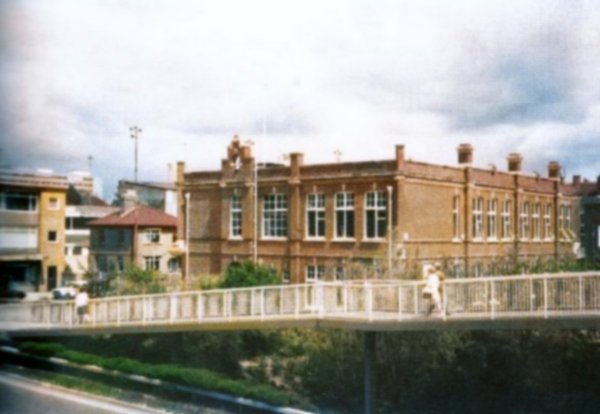
The infamous quarter-mile long Huish footbridge over Queensway, in a colourised photograph of around 1980.
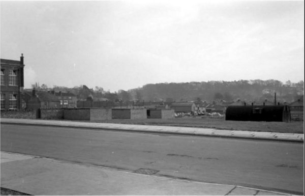
The Fairfield photographed in the 1960s (?) showing the three air raid shelters built for the children and staff of Huish school and, at right, an Army Nissen hut from when the Army occupied to southern end of Fairfield.
This photograph dates to about 1900 and shows the junction of Queen Street. The shop on the corner was also the Victoria Inn from about 1850.
From the
Cave
Collection
(colourised).
Courtesy of South Somerset Heritage Collection
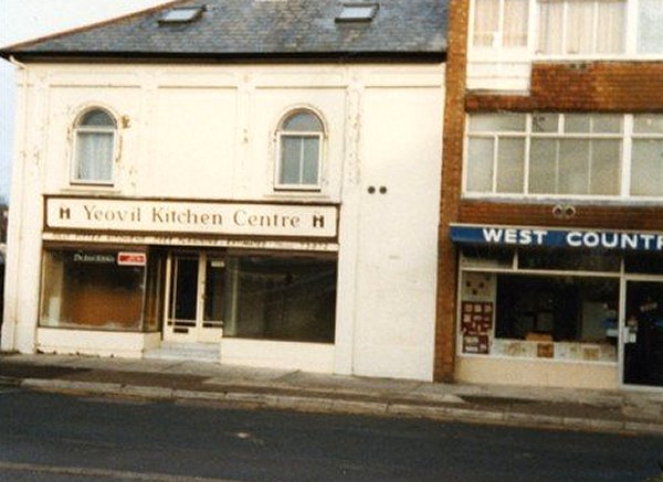
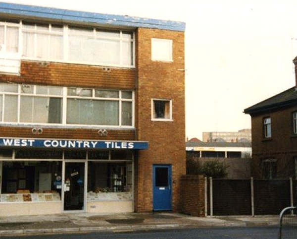
Demolition works in Huish, just along from Queen Street. It is thought that this photograph dates to the 1960s, and new shops would replace the demolition site (see the photos below depicting 'West Country Tiles' and 'Yeovil Kitchen Centre'). Nevertheless, most of the buildings in this photograph would disappear with the building of Queensway in the 1970s.
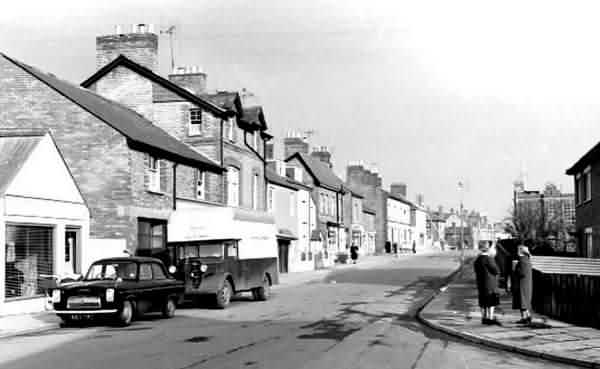
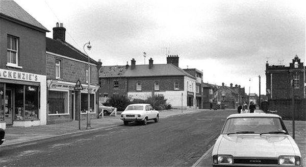
Huish photographed in the mid-1960s. This view, looking west along Huish from Richmond Road, has changed very little until you get to the white buildings right of centre. This was where Queen Street was - now there's just Queensway and the huge, huge footbridge.
This
photograph
features in my
book "Lost Yeovil"
Huish looking east and photographed in 1977. By this time the Victoria Inn had been demolished but the building at centre with the arched windows is the same building at the centre of the previous photograph but converted into a shop.
Courtesy of the
Western Gazette
.... and the same shop in the 1970s - now the site of the slip road from Queensway into Tesco's.
Courtesy of the
Western Gazette
.... and next door in the 1970s - now the site of the slip road from Queensway into Tesco's. I used to walk past these buildings every day on my way to work and didn't take a bit of notice of them - now that they're long gone it does bring back memories.
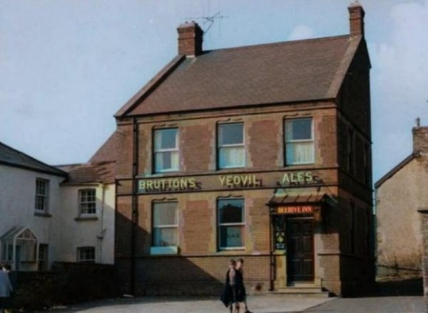
The Beehive Inn in a photograph (colourised) of 1960 by Charrington & Co Ltd's surveyors as part of a 'stocktaking' exercise of photographing Brutton's pubs prior to the brewery takeover.
Notice, at extreme right, the end wall of the cottages known as Beehive Gardens, the site of the cottages now forms part of the pub's car park.
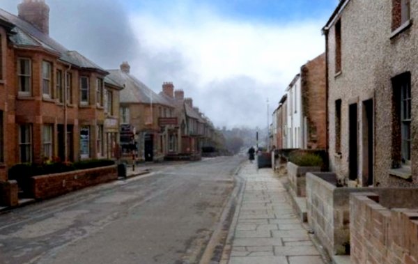
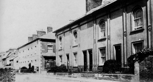
Taken in the mid-1960's, this colourised photograph was taken from the top of the hill looking west with Orchard Street, built by Levi Beer in the 1890s, at left. The scene has changed very little in the last fifty years, although the houses at left no longer have little front gardens and their windows are now right on the path overlooked by anyone - a good case for a decent set of net curtains unless, of course, you're an exhibitionist.
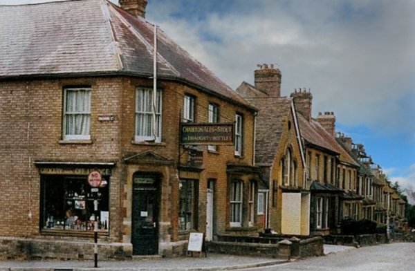
This colourised photograph
of
Montague's store,
dates to about
1955 and
although the
signage above
the window at
left reads
'Grocery and Off
License' the
hanging sign
reads 'Charlton
Ales and Stout
on Draught and
in Bottles'
indicating ale
could still be
drunk on the
premises or
customers could
bring their own
jug to be filled.
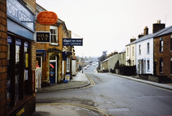
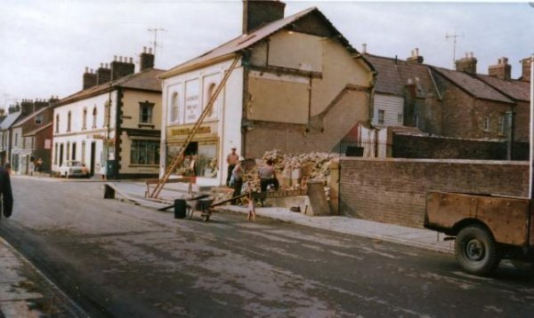
Huish seen from the junction with Orchard Street in 1987. Montague's shop is still going strong. In 1991 Ian and Myra Montague bought the Post Office on the opposite corner and moved it into their shop.
From the Cave
Collection
(colourised),
Courtesy of South Somerset Heritage Collection
...and looking back up the hill from the junction with West Street, built in 1906, at right, even less has changed in this scene during the last half-century.
From the Cave
Collection
(colourised),
Courtesy of South Somerset Heritage Collection
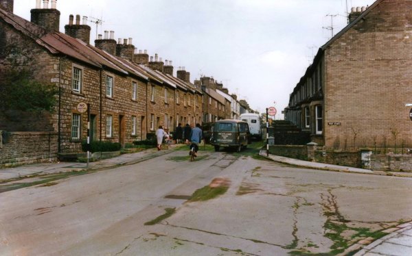
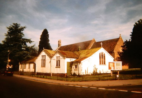
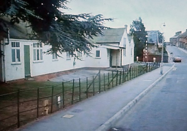
Huish at the junction with Grove Avenue, again in the mid-1960's. This was as far as Huish ever went and from this point onwards was fields until Preston Grove, at left, was built in the 1930's. Many older Yeovilians remember St Andrew's 'tin church' on the corner.
Courtesy of Jack
Sweet. This
photograph
features in my
book "Now
That's What I
Call Yeovil"
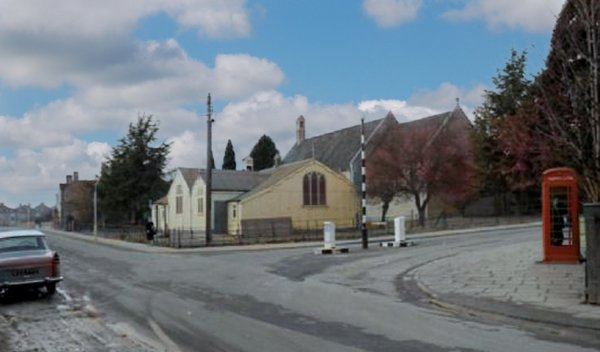
The famous 'tin hut' photographed during the 1980s.
The white tin hut that was St Andrew's Hall on the corner of Preston Grove and Grove Avenue, now with a brick replacement. At right is Huish. This, and the following photograph, are stills from the 1986 film "Frankie & Johnnie".
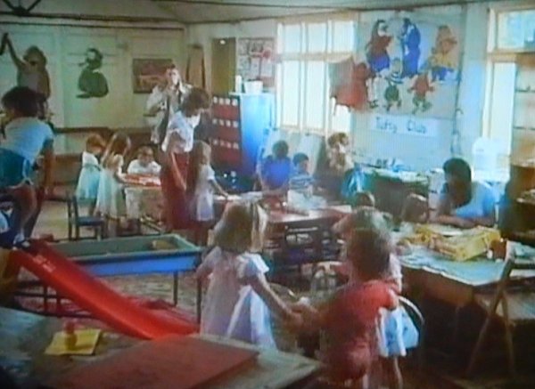
A scene shot inside St Andrew's Hall. Hywel Bennett is standing at the back.
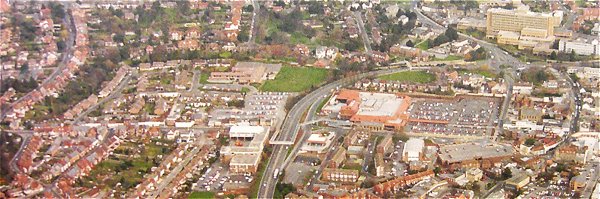
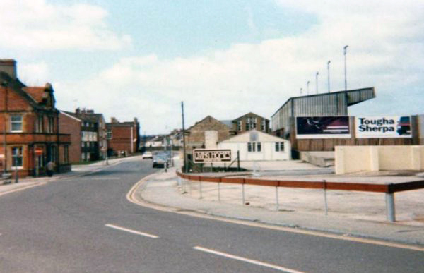
This aerial photograph shows the complete length of the original Huish running across the centre of the picture. At extreme left Grove Avenue runs off in the top left corner while at centre is Queensway with its infamous 'quarter mile' Huish footbridge. Centre right is dominated by the Tesco store and its car park with the old line of Huish, now called Queensway Place running across in front of Tesco as far as Clarence Street at the eastern edge of Tesco's car park. At top right is the hospital and the Queensway / Kingston / Reckleford roundabout.
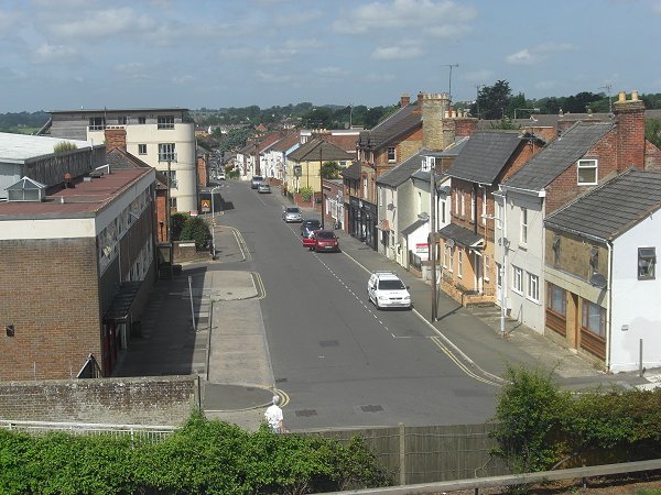
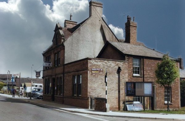
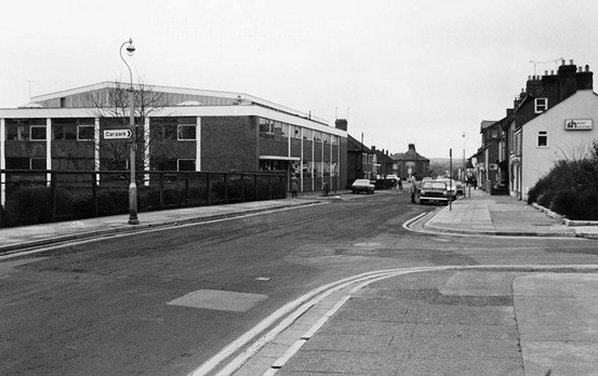
The remains of Huish, looking west from the Queensway bridge. Photographed in 2013.
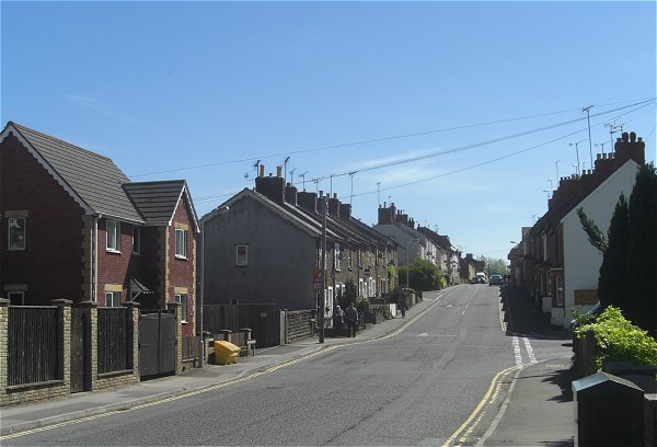
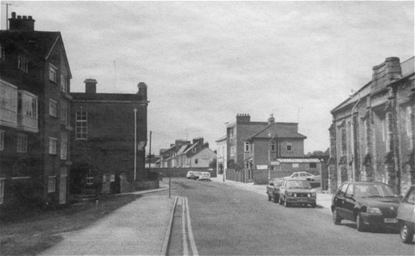
Looking back up Huish hill from the junction with Preston Grove in 2013.