Hollands farm
Hollands farm
A small farm in the Hollands area
Although the location of the farmhouse of Hollands Farm is known (see the 1946 aerial photograph below), that's about all the information I could find about Hollands Farm.
Certainly the fields to the north and northeast were part of Lower Stone Farm, while the parcels of land to the northwest and south were owned and occupied by a disparate group of Yeovilians, but chiefly John Batten Snr of Hollands House.
Unfortunately, the 1846 Tithe Apportionment has large gaps for the area, including Parcel 1077 that included the farmhouse of Hollands Farm, so the owner and occupier remain unknown.
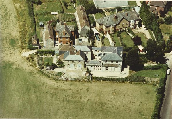
The farm access track (see Gallery) was the narrow track alongside Holcote House which, once past the former Hollands Inn, turned north to the farmhouse.
The location of the farmhouse is today roughly under the tennis courts, south of the Bill Whistlecroft Athletics Arena in Yeovil Recreation Centre (colloquially known as Mudford Rec).
map
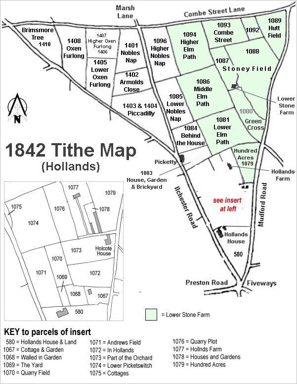
The Hollands area reproduced from the 1842 Tithe Map.
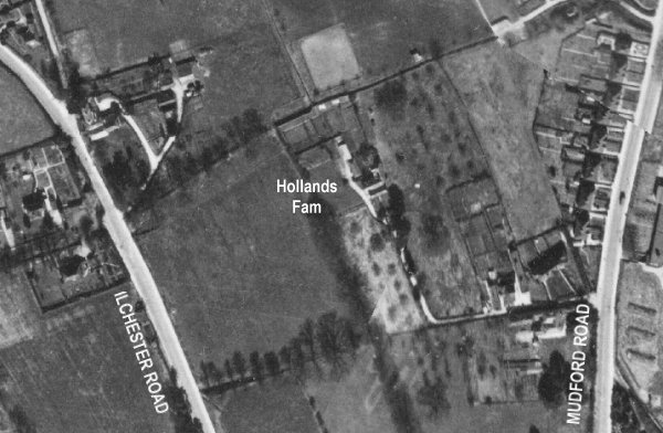
The 1946 aerial photograph showing Hollands Farm at centre, with its access track leading off to Mudford Road at the right.
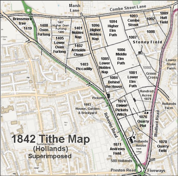
The 1842 Tithe Map superimposed over a modern map.
Gallery
Courtesy of
Simon Noble
An aerial view of Holcote House, probably taken during the 1960s. The Hollands Inn is behind it to the left while Mudford Road is seen at bottom right. The access track to Hollands Farm ran from Mudford Road, along the north side of Holcote House, past the Hollands Inn and then turned north - which section of the track is clearly seen in the top left quadrant of this photo.