hollands
hollands
Named for the first Earl of Kent
 Towards
the end of the
reign of Richard
II (reigned
1377-1399) the
Manor of
Kingston with
the advowson of
the chapel
there, was in
the possession
of the Earls of
Kent. The first
of these was
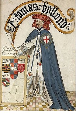
Thomas de Holand
(c1314-1360),
shown at left
from a
contemporary
manuscript.
His son, a
second Thomas De
Holland also
Earl of Kent,
was beheaded in
1399 for having
joined a
conspiracy
against the
king.
Towards
the end of the
reign of Richard
II (reigned
1377-1399) the
Manor of
Kingston with
the advowson of
the chapel
there, was in
the possession
of the Earls of
Kent. The first
of these was
Thomas de Holand
(c1314-1360),
shown at left
from a
contemporary
manuscript.
His son, a
second Thomas De
Holland also
Earl of Kent,
was beheaded in
1399 for having
joined a
conspiracy
against the
king.
The area known as Hollands, as well as the field Hollands (Parcel 580) clearly takes its name from the de Holland family. In describing the boundaries of the great Middle Field of Kingston Manor, the 1589 Terrier records ".... from the lower end of Hollans at the Townsend unto Marshwick...."
An indenture dated 1700 refers to ".... lying at Hollanes Corner bounded with lands of Richard Sely on the west and lands of Gyles Hayncourt....".
In his will dated 1763 William Daniell bequeathed "a Close of Land called Green Cross and also a Close of Land called Hollands containing about seven or eight acres more or less all which said Lands with all their Appurtenances I give my said Daughter Jane Daniell and her Heirs and Assigns forever".
In his will dated 9 February 1805, stone cutter Charles Hewlett bequeathed "all that my Field called Hollands with the appurtenances thereto belonging situated in Yeovil aforesaid containing by estimation three Acres, more or less, unto my said son Charles".
By 1818 Hollands was the property of A'court Daniell, however "A’court Daniell has for many years been unsound in mind and consequently incapable of doing any legal acts or managing his affairs and George Daniell, his brother, had taken upon himself the management of his estate and effects". In an Agreement dated 10 September 1818 George sold Hollands (with an acreage of 8a), together with other parcels of land, to Peter Daniell. In 1838 it was purchased by James Whitby, a wool stapler of Yeovil, who sold it to John Batten the Younger.
The 1846 Tithe Apportionment refers to Hollands House and Lands, pasture, etc (Parcel 580) and in Hollands (Parcel 1072) of 3r 23p arable. Owner-occupier John Batten. An indenture dated 28 September 1848 refers, in a sale to John Batten Jnr, ".... arable land called Hollands 8½ acres. Together with messuage or dwelling house, cottage and other buildings."
Today Hollands House is now offices of Yeovil College and the northern part of Hollands now has the main college block and car park built over it, while the southern part remains a grassed area.
For details on historic land measurement (ie acres, roods and perches) click here.
maps
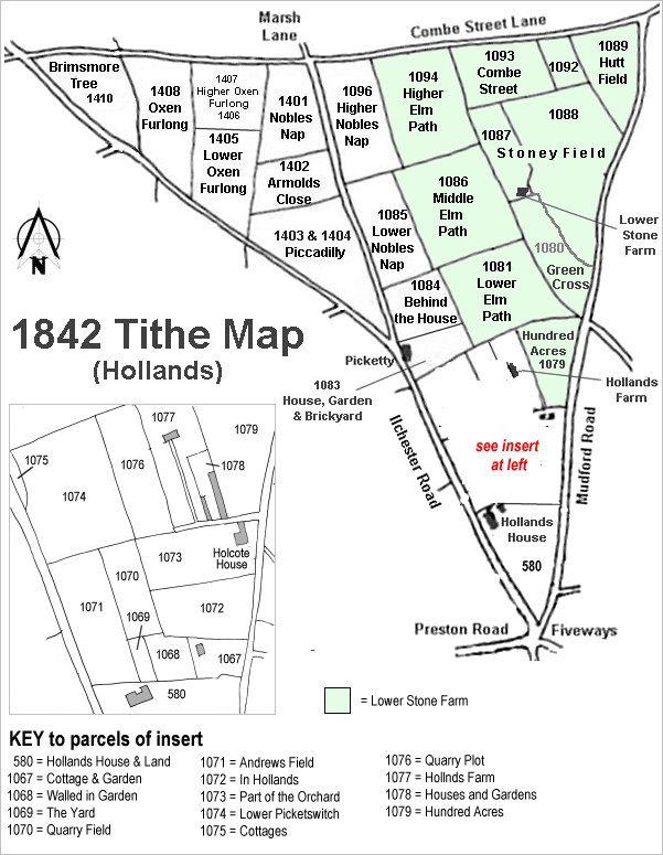
The Hollands area reproduced from the 1842 Tithe Map. Hollands is at bottom right.
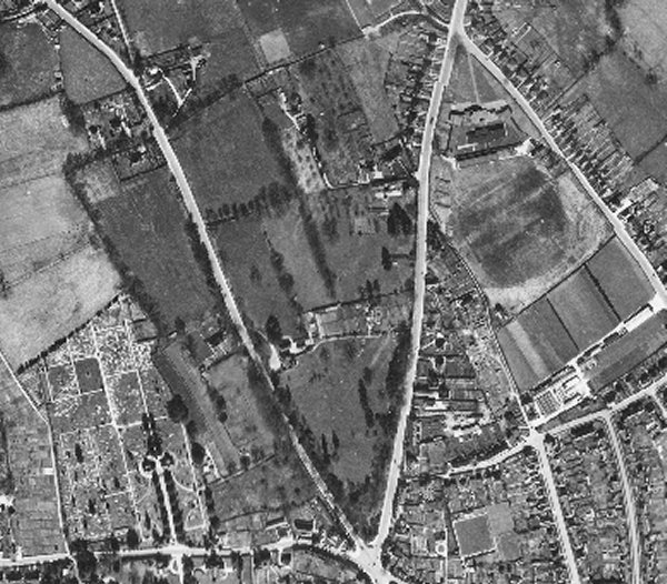
The 1946 aerial photograph showing Hollands as the large triangular field at the junction of Ilchester Road at left and Mudford Road at right.
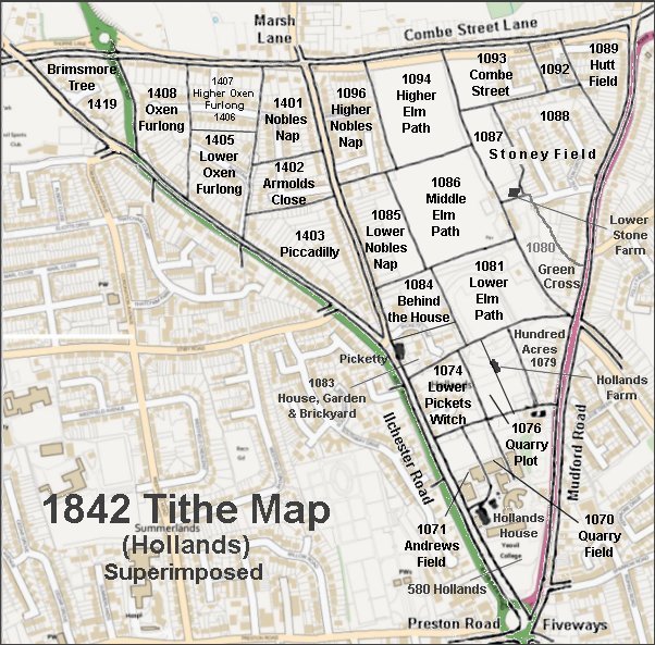
The 1842 Tithe Map superimposed over a modern map.
Gallery
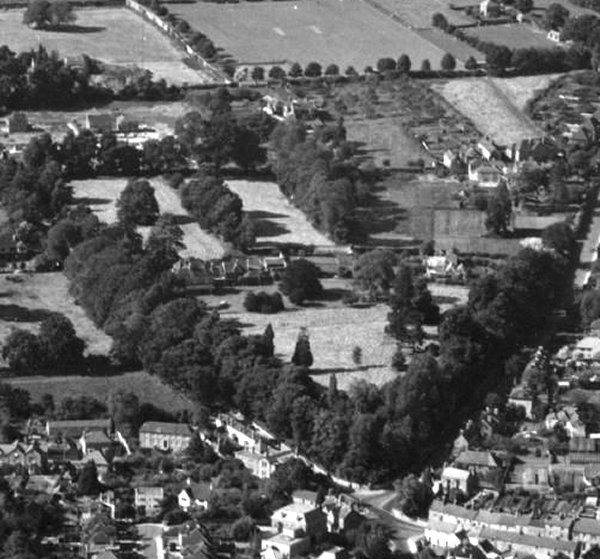
Hollands photographed from the air in 1953.
From my
collection
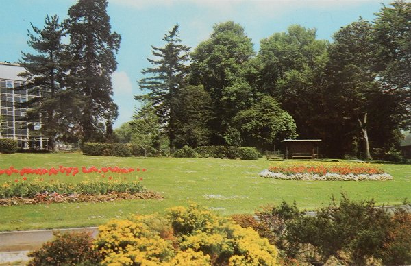
A postcard of the 1980s (?) showing the grassed area between Yeovil College main building at far left and Fiveways roundabout off photo at right. This was the former field called Hollands (Parcel 580).