Little Bucks Mead
Little Bucks Mead
A part of Preston Lower farm
Little Bucks Mead (Parcel 146) was a small rectangular field of Preston Lower Farm. The word 'mead' comes from the Old English 'maed'. Before grass seeds were obtainable this was the only hay land of the community. It usually consisted of land near streams since that was the only kind of land on which hay grew in any quantity, and Little Bucks Mead lay very close to the boundary brook separating the parish of Preston Plucknett from Yeovil.
The 1848 Preston Tithe Apportionment described Three Acre Mead as pasture, rather than meadow, and noted that it was owned by Robert Tucker and occupied by Joseph Roberts. It measured 1a 2r 21p.
John Brook the Younger became the tenant farmer, replacing Joseph Roberts, in 1857. He was the tenant farmer until his retirement around 1878.
Little Bucks Mead was bounded on the north by Catshill Eight Acres (Parcel 147), on the west by Pookhay Mill (Parcel 143), to the south by Three Acre Mead (Parcel 145) and to the west by a Plantation (Parcel 146a).
By the time of the 1889 Ordnance Survey, shown below, Little Bucks Mead had been combined with Pookhay Mill to form a single larger field. Today the former Little Bucks Mead is covered with the houses and gardens of the southern end of Grove Avenue.
For details on historic land measurement (ie acres, roods and perches) click here.
MAPS & Aerial Photographs
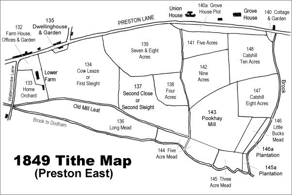
The 1849 Preston Tithe Map. Little Bucks Mead is towards bottom right.
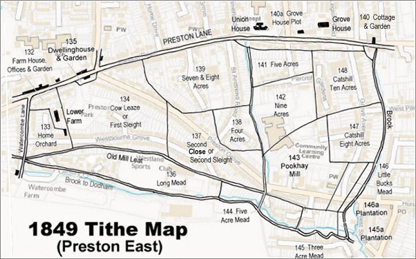
The 1849 Preston Tithe Map overlaid on a modern map (slightly mis-aligned at bottom right).
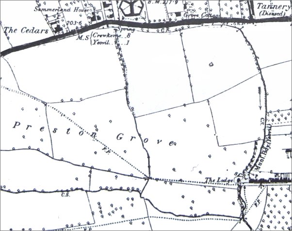
The 1889 Ordnance Survey shows the extensive fields of Lower Farm labelled 'Preston Grove' stretching eastwards. The dotted line across the fields, indicating a footpath, was the line of the later road, also called Preston Grove. By this time Little Bucks Mead had been combined with Pookhay Mill to form the larger field seen here at bottom right containing the words 'The Lodge'.