Preston Lower Farm
Preston Lower Farm
Later Preston Park House
Preston Great Farm, commonly known as Abbey Farm, on the northern side of Preston Road was the manor house of Preston Plucknett. It was never an ecclesiastical building but the mistake was made by Lady Georgiana Fane when she inherited the property in 1841 and has been perpetuated to this day. Preston Lower Farm, or simply Lower Farm, on the south side of Preston Road close to the junction with Watercombe Lane, was also part of the large estate.
The farmhouse of Preston Lower Farm was built about 1820 and the farm lay entirely within the ancient Tithing of Preston Bermondsey.
The farmhouse displays classical Georgian features such as wide, overhanging eaves and 'marginal lights' to the windows. The original house (the extensions to both sides are modern) was of two storeys and three bays, built of stone and Ham stone ashlar under a Welsh slate bell cast hipped roof with wide eaves. It has a central flat roof which, most likely, previously had a lantern light. The central stone doorcase has an open pediment on typical Yeovil console brackets while the doorway itself has a depressed arch with a simple fanlight. The window openings have architraves with keystones while the windows themselves (except the central first floor window) are sashes with small marginal panes. The original house is now Grade II Listed.
Preston Lower Farm was recorded in the 1848 Preston Tithe Apportionment as the various parcels of land shown in the map below. It was owned by Robert Tucker (who served as mayor of Yeovil from 1858 until 1860) and occupied by Joseph Roberts. The total acreage of the farm amounted to 105a 2r 5p (for details on historic land measurement - ie acres, roods and perches - click here).
John Brook the Younger became the tenant farmer, replacing Joseph Roberts, in 1857. He was the tenant farmer until his retirement around 1878.
The 1851 census has an entry for Preston Lower Farm in which 45-year old Joseph Roberts, originally from Marston Magna, was listed as 'Farmer (148 acres employing 7 labourers)'. Joseph lived there with his wife Mary, two daughters, four sons and a servant. By 1861 however, he had moved with his family to Axminster to be replaced by 53-year old John Brook the Younger of the Yeovil family of tenant farmers., originally from Dinnington. In the 1861 census, John Brook gave his occupation as 'Farmer occupying 130 acres employing 6 men & 2 boys'. The 1871 census again lists John Brook with his wife Elizabeth, son William and a domestic servant. John gave his occupation as 'Farmer occupying 160 acres employing 5 men & 2 boys'.
I would think that the southern, rounded extension seen in the fourth photograph below would have been added during the 1860s or 1870s with the projecting portion on the main house elevation dating to the early twentieth century.
In the early part of the twentieth century Preston Park House was the home of Joseph Whitby (1836-1915, the second son of Elias Whitby Jnr), until his death on 11 February 1915, aged 79 years. There is a brass plaque to the memory of Joseph Whitby in St James' church.
By the time of the 1927 Ordnance Survey it would appear that the farm, as such, had been sold off and part of the former field called Cow Leaze had been used to create Preston Park. It is not a great leap to imagine that the house, now a private residence owned by the Whitby family, began to be called Preston Park House around this time. The house had a sweeping drive bordered by mature walnut trees and a small lake lay beyond the lawns on the eastern side of the drive. Further down and back from the drive was the Granary, a two storey building. In the 1920s the ground floor was used by the gardener while the upper floor was sometimes used as a makeshift dental surgery for the village children.
During the latter part of the twentieth century the massive northern extension was added when the house was converted into the Preston Park House Nursing Home.
Today the site of the complex of farm buildings behind the house, together with the orchards shown on the maps below, are covered in the housing of Preston Road to the north, Cambridge Close to the west and Westbourne Grove to the south.
Preston Park House was (autumn 2014) for sale with a guide price of £350,000 and the current care residents will move in the spring of 2015 to a new care home, Cooksons Court off Preston Grove, currently under construction.
Today (2018), the building has been converted into two large homes.
MAPS
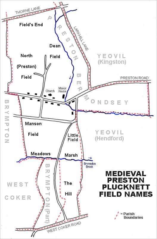
The main medieval fields of Preston Plucknett. The lands of Preston Lower Farm lay entirely within the ancient Tithing of Preston Bermondsey, in the section above containing the letters "MONDSEY".
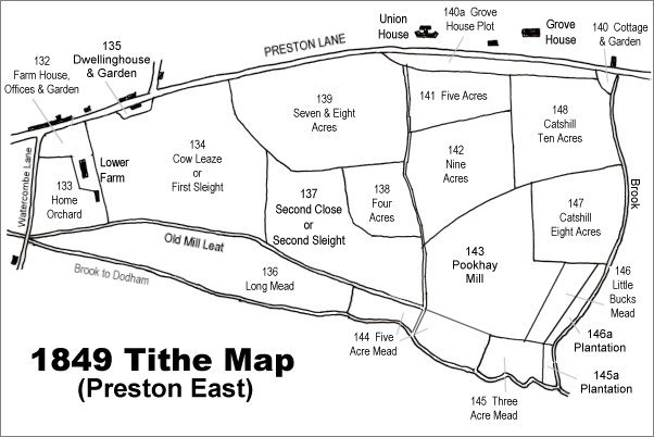
The 1849 Tithe Map - all the fields shown formed part of Preston Lower Farm with the exception of Grove House Plot (Parcel 140a), the dwellinghouse and garden (Parcel 135 - the home of Couly de Chaville), and the two plantations at bottom right (Parcels 145a and 146a). All (except 140a) were owned by Robert Tucker.
| Owner | Parcel | Parcel Name | Use | Area |
| Robert Tucker | 132 | Farm House, Offices & Garden | ||
| Robert Tucker | 133 | Home Orchard | Orchard | 3a 1r 32p |
| Robert Tucker | 134 | Cowleaze & Barton | Pasture | 16a 2r 10p |
| Robert Tucker | 136 | Long Mead | Meadow | 10a 2r 25p |
| Robert Tucker | 137 | Second Close | Pasture | 10a 1r 5p |
| Robert Tucker | 138 | Four Acres | Arable | 3a 2r 27p |
| Robert Tucker | 139 | Seven & Eight Acres | Arable | 12a 2r 5p |
| Robert Tucker | 141 | Five Acres | Arable | 4a 1r 10p |
| Robert Tucker | 142 | Nine Acres | Arable | 7a 2r 8p |
| Robert Tucker | 143 | Pookhay Mill | Pasture | 11a 0r 5p |
| Robert Tucker | 144 | Five Acre Mead | Meadow | 4a 3r 10p |
| Robert Tucker | 145 | Three Acre Mead | Meadow | 2a 2r 10p |
| Robert Tucker | 146 | Little Bucks Mead | Pasture | 1a 2r 21p |
| Robert Tucke | 147 | Catshill Eight Acres | Arable | 6a 0r 32p |
| Robert Tucke | 148 | Catshill Ten Acres | Arable | 8a 2r 10p |
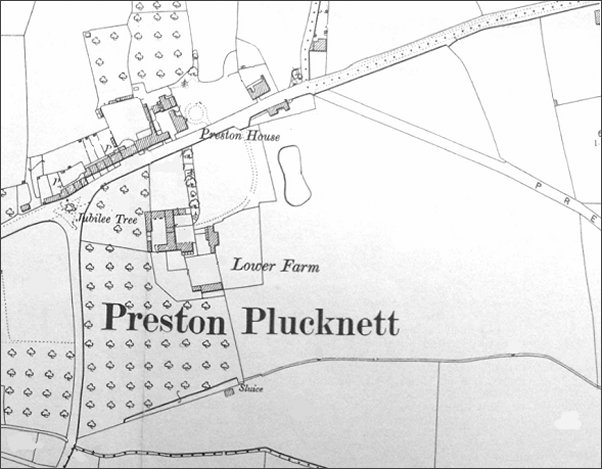
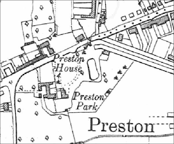
Note: 'Preston House' marked on three of the maps below refers to today's Plucknett Hotel.
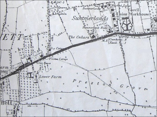
The 1889 Ordnance Survey shows Lower Farm at lower left with extensive fields labelled 'Preston Grove' stretching eastwards. The field in which the words 'Lower Farm' appear, and much of which later became Preston Park, was called Cow Leaze or First Sleight. The dotted line across the fields, indicating a footpath, was the line of the later road, also called Preston Grove.
This map, based on the 1901 Ordnance Survey, shows Lower Farm and its outbuildings. Preston Grove has, by this time, been laid out but no houses have yet been built.
The 1927 Ordnance Survey now shows that the former field, Cow Leaze, has been sub-divided and Preston Park created. Presumably it was around this time that Lower Farm ceased to be worked as a farm and it was possibly at this time that the farmhouse became known as Preston Park House.
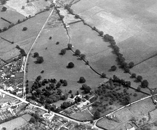
An aerial photograph of 1927. Preston Road runs across lower left and Watercombe Lane is at lower right while Westland's airfield is at top right and relatively newly-built Preston Grove runs up the left of the photograph. Preston Lower Farm is at centre bottom with Home Orchard (Parcel 133) still full of trees at bottom right - and the two streams running from lower right to top centre either side of Long Mead (Parcel 136).
gallery
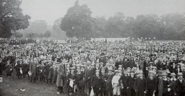
Schoolchildren assembled in Preston Park - despite the rain - to celebrate the Coronation Day of King George V - 22 July 1911.
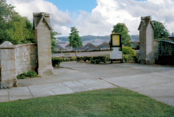
A colourised photograph of the entrance to Preston Park from Preston Road and, judging by the lack of trees, probably from the 1960s.
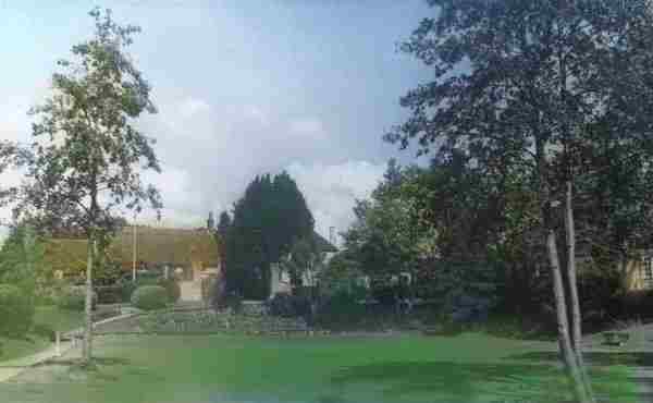
A 1950s' postcard of Preston Park.
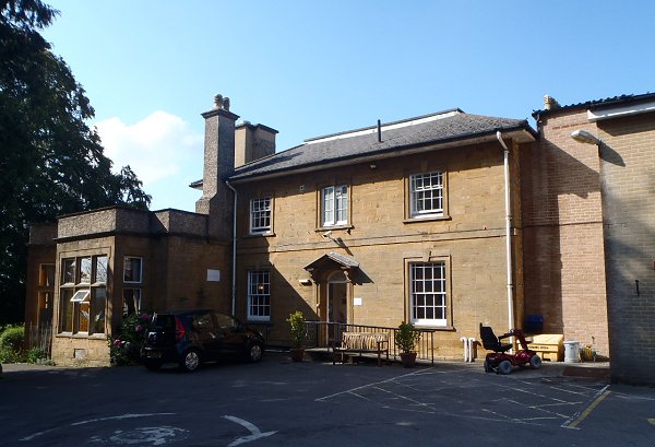
Preston Park House, formerly Lower Preston Farm, photographed in 2014.
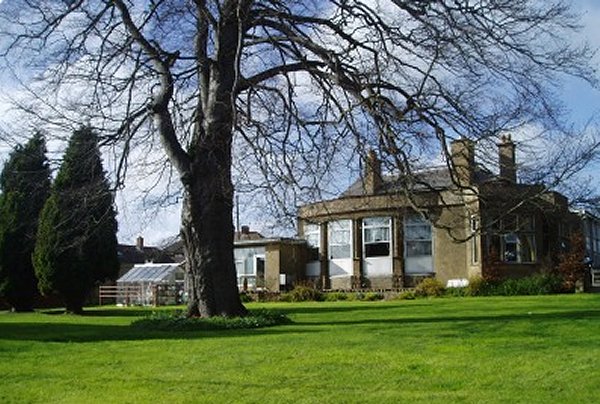
In its guise as Preston Park House Nursing Home. The extension at left is probably mid-Victorian.
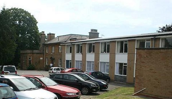
The large extension, dwarfing the original house left of centre, accommodated thirty residents in the nursing home.
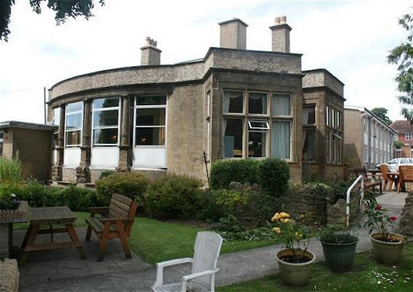
The southern extension - mid- to late-twentieth century.
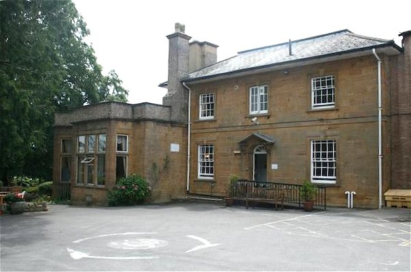
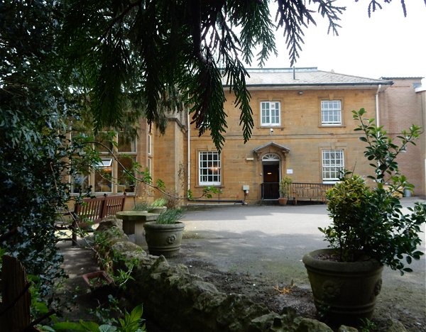
Preston Park House, seen from the garden.
.... and photographed in 2015.
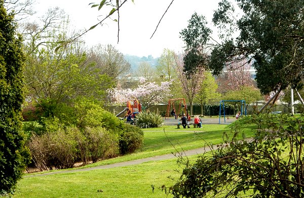
Preston Park looking south, photographed in 2015.
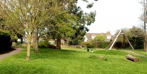
Preston Park looking north, photographed in 2015.
Courtesy of Paul
Allaway
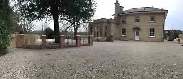
Preston Park House photographed in 2018 after its conversion from care home to houses.
Courtesy of Paul
Allaway
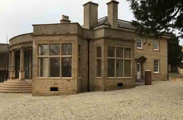
Preston Park House, photographed in 2018 from a different angle.