middle ground
middle ground
A field in the great Middle Field
Middle Ground was a field that originally lay within the great Middle Field of Kingston Manor.
It was bounded on the north by Trent's Close (1003), to the east by Ridgeway (1001), to the south by Higher Ryalls (1005) and to the west by Long Close (1006).
Today, the former Middle Ground is occupied by the houses and gardens of the southern part of Hill Crest Road lying to the north of Highfield Road. Highfield Road was built along the southern boundary of Middle Ground and therefore houses on the northern side of this road lie within the former Middle Ground.
maps

This map, based on the descriptions in the 1589 Terrier and the 1846 Tithe Map of Yeovil shows the approximate boundaries of the Manors of Kingston and Hendford as well as the manorial three-field system used in Kingston.
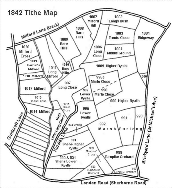
This map is based on the 1842 Tithe Map with field names added from the 1846 Tithe Award.
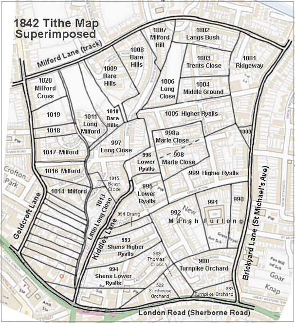
The 1842 Tithe Map superimposed (roughly) over a modern street map showing where several modern roads, for example Gordon Road, Grass Royal and Highfield Road, follow former field boundaries.
Gallery
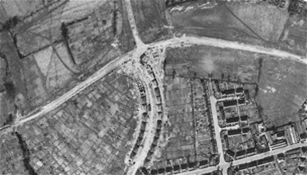
The 1946 aerial photograph clearly shows Langs Bush as a rectangular field at top right, to the south of Milford Road (running across the photograph) and bounded by hedges on three sides with the shadows of seven trees in the southern hedge. To its south, in the lower right corner, the northern part of Hill Crest Road has been built on Trent's Close and the southern part before Highfield Road has been built on Middle Ground.