ridgeway
ridgeway
A field on the edge of the great Middle Field
Ridgeway was originally a roughly-triangular field on the very eastern edge of the great Middle Field of Kingston Manor. It is thought that the name Ridgeway was related to a cultivated strip in the open Middle Field, also known as a ridge, selion, stitch, and so forth - a cultivated strip at this time comprising a ridge with a furrow either side.
By the time of the 1842 Tithe Map it had been allocated the Parcel Number 1001 and its southern tip had been truncated by the formation of the small triangular Parcel 1000. The Tithe Apportionment of 1846 noted that it was used as pasture and measured 6a 2r 11p. At this time the owner was Thomas Binford and the occupier was James Tucker.
From the aerial photograph below, by 1946 half of Ridgeway had been built on.
It was bounded on the north by Milford Lane (today's Milford Road) which was originally simply a field access track and from the aerial photograph it appears to be actually under construction as a proper road at this time. On its western side it was bounded by the fields called Langs Bush (1002), Trent's Close (1003), Middle Ground (1004) and Higher Ryalls (1005). On the east it was bounded by Brickyard Lane (today's St Michael's Avenue).
Today the former field is completely built-up with housing of Milford Road, including an in-fill spur projecting south, St Michael's Avenue and Highfield Road which bisects the former field.
For details on historic land measurement (ie acres, roods and perches) click here.
maps

This map, based on the descriptions in the 1589 Terrier and the 1846 Tithe Map of Yeovil shows the approximate boundaries of the Manors of Kingston and Hendford as well as the manorial three-field system used in Kingston.
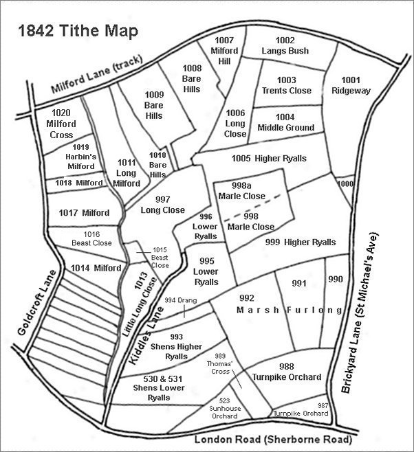
This map is based on the 1842 Tithe Map with field names added from the 1846 Tithe Award.
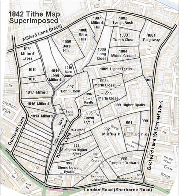
The 1842 Tithe Map superimposed (roughly) over a modern street map showing where several modern roads, for example Gordon Road, Grass Royal and Highfield Road, follow former field boundaries.
Gallery
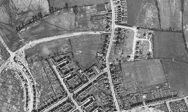
The 1946 aerial photograph clearly shows the surviving top portion of Ridgeway at centre with Milford Road being constructed along its northern boundary, Langs Bush is the rectangular field to its left and St Michael's Avenue runs from top to bottom just right of centre. Housing occupies the northeast corner of the field and Highfield Road bisects it with the small trading estate (recently demolished) showing as a square complex on the north side of Highfield Road. It is just possible to discern the former western field boundary all the way to St Michael's Avenue, which would have included the former small Parcel 1000.