Old Orchard
Old Orchard
A field of Brett Farm
Old Orchard (Parcel 765) was the 'home' orchard of Brett Farm.
The 1846 Tithe Apportionment described Old Orchard (Parcel 765) as measuring 3a 2r 16p and, indeed, used as an orchard. It noted that William Brett of Islington, Middlesex, was the owner and the occupier was Giles Harrison (1797-1874) of Naish (today's Nash), East Coker - less than a mile to the west.
Old Orchard was
bounded on the
north by
Home
Field
(Parcel 768),
on the west by
Farm
Close (Parcel
764), on the
south by
Red
Mead (Parcel
763) and on the
east by the
garden of Brett
Farm (Parcel
766).
As seen in the aerial photograph of 1946 below, Old Orchard had been merged with the garden of Brett Farm to form a large garden. Today it is in the parish of East Coker.
For details on historic land measurement (ie acres, roods and perches) click here.
MAPs & Aerial Photographs
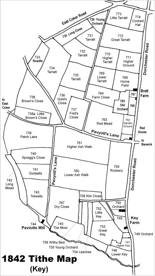
Map based on the 1842 Tithe Map with field names added from the 1846 Tithe Award. Lower Tarratt is in the upper right quadrant.
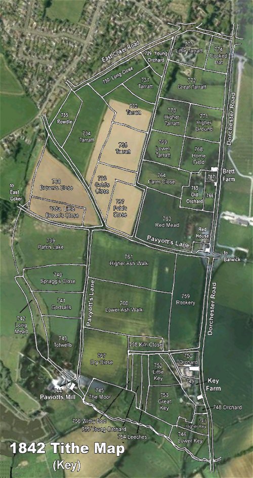
The 1842 Tithe Map superimposed over a modern aerial photograph of the area. Although the field boundaries do not align precisely, remember that the 1846 survey was undertaken by hand using primitive surveying equipment.
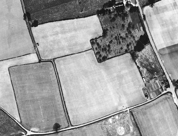
The 1946 aerial photograph with Dorchester Road at right. Old Orchard, by this time combined with the garden of Brett Farm (Parcel 766) is the dark field dotted with trees and shrubs in the top right quadrant.
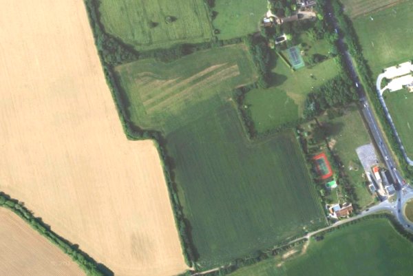
The modern satellite image showing the combined L-shaped Old Orchard and former garden in the top right quadrant.