Penny's Orchard
Penny's Orchard
A field within the great manorial East Field
Penny's Orchard (Parcel 975), also known as Penny's Orchard and Evan's Acre, was originally a near four-acre field, rising gently from south to north, within the great East Field of the Manor of Kingston.
At the time of the 1846 Tithe Apportionment, Penny's Orchard was owned by Captain William Jones Prowse of Enham House, Southampton, Retired Captain RN, son of George Bragge Prowse of Kingston Manor House and Lord of the Manor of Kingston. Part of Pen Mill Farm, it was let to Thomas Frost, who was also the landlord of the Pen Mill Inn.
At the time of the 1846 Tithe Apportionment, Penny's Orchard was actually used as pasture for grazing livestock. It measured 3a 3r 35p.
Following the death of Thomas Frost in 1851, Pen Mill Farm was re-let. Later still, the counterpart of a lease dated 25 March 1857 shows that Captain Prowse let the Pen Mill Inn and Pen Mill Farm, including Penny's Orchard, to John Stone 'of Pen Mill Inn' for a period of seven years.
Penny's Orchard was bounded on the north by Sydlings (Parcel 976), Little Hather Mead (Parcel 977) and Louse & Jeanes Field (Parcel 978). To the east it was bounded by Penny's Close (Parcel 972), to the south by West Beacham's Close (Parcel 973) and Priddle's Mead (Parcel 974) and to the west by Goar Nap (Parcel 980).
Today, the houses and gardens of the eastern half of St Michael's Road, together with the northern end of Victoria Road, occupy the former Penny's Orchard.
For details on historic land measurement (ie acres, roods and perches) click here.
maps

This map, based on the descriptions in the 1589 Terrier and the 1846 Tithe Map of Yeovil shows the approximate boundaries of the Manors of Kingston and Hendford as well as the manorial three-field system used in Kingston.

A map of the great medieval East Field of Kingston Manor showing conjectured locations of several fields based on descriptions in the 1589 Terrier.
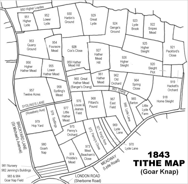
Drawn from the 1846 Tithe Map with field names added from the 1846 Tithe Apportionment, with Penny's Orchard in the lower left quadrant.
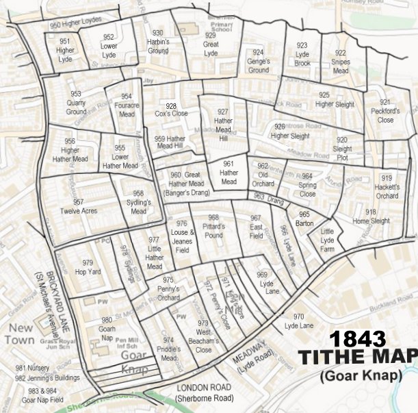
The 1843 Tithe Map overlaid onto a modern map of the area.
Gallery
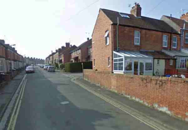
Built right along the centre of the former Penny's Orchard, this is St Michael's Road seen from the junction with Victoria Road and looking west towards St Michael's Avenue.