andrews field
andrews field
An old field now part of Yeovil College campus
Andrews Field was a small rectangular field lying alongside the Ilchester Road and lying to the immediate north of Hollands House. It was bounded on its northern side by Lower Pickets Witch (1074) and to the east by Quarry Field (1070).
The Tithe Award of 1846 recorded that Andrews Field was 2a 1r 34p and was used as pasture for grazing animals.
Today the Ilchester Road entrance to Yeovil College and the college's Sports & Fitness Centre occupy the space that was once Andrews Field.
maps
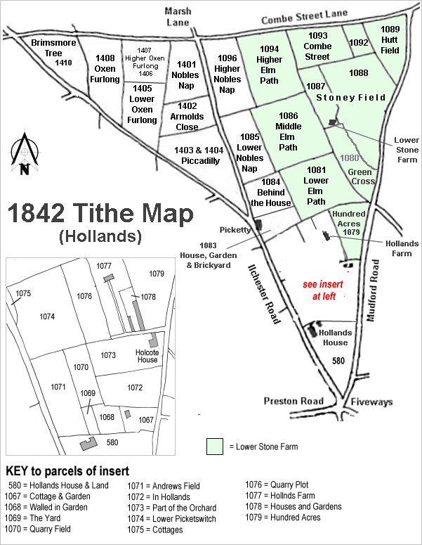
The Hollands area reproduced from the 1842 Tithe Map. Andrews Field is at bottom right above Hollands House.
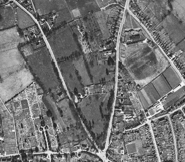
The 1946 aerial photograph showing Andrews Field left of centre, edged with trees and hedges and a lone tree in its middle.
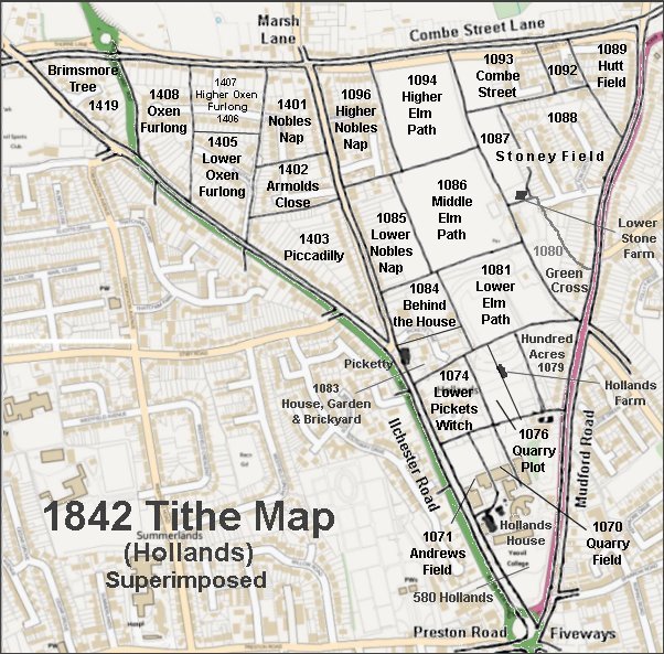
The 1842 Tithe Map superimposed over a modern map.