Bowling Green
Bowling Green
A field level enough for a game of bowls
Bowling Green was a triangular field bounded by East Coker Road to the west, Dorchester Road to the east and Turner's Barn Lane (this section today known as Little Tarrat Lane) to the south.
The name 'Bowling Green' infers a field flat enough, or even actually used for, a game of bowls. The Turnpike Minutes of 26 May 1764 refer to ".... a new road made.... across the fields to the foot of Bowling Green House...." with the old road "from the Middle of Hendford Hill towards Bowling Green (being now stopt up).... "
The
1846 Tithe
Apportionment
described
Bowling Green
(Parcel 775) as
an orchard
measuring 3a 2r
3p and noted
that draper and
grocer
John Glyde
was the owner
and it was
occupied by
Lionel Harrison,
a sailcloth
weaver of East
Coker.
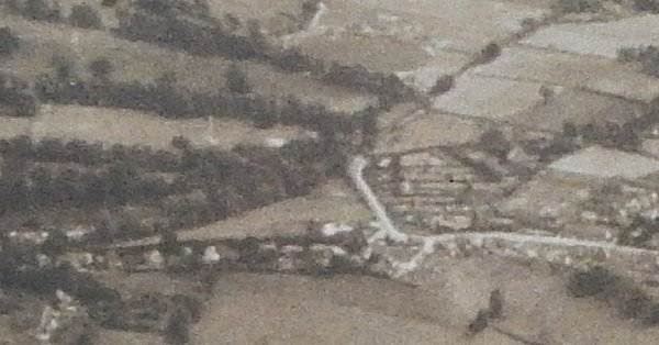
As seen in the aerial photograph of 1946 below, Bowling Green appears to be pasture. By this time it was known as 'Croyde' rather than Bowling Green. Brooke notes that architect John Petter of the Yeovil architectural firm of Petter & Warren had family connections to Croyde, a small seaside village close to Barnstaple.
Today the site
of the former
Bowling Green is
occupied by
large houses.
MAPs & Aerial Photographs
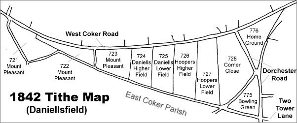
Map based on the 1842 Tithe Map with field names added from the 1846 Tithe Award. Bowling Green is at bottom right.
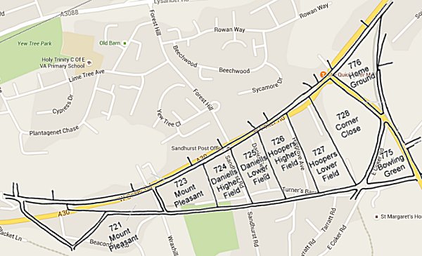
The 1842 Tithe Map superimposed over a modern map of the area. Although the field boundaries do not align precisely, remember that the 1849 survey was undertaken by hand using primitive surveying equipment.
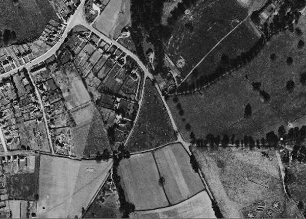
The 1946 aerial photograph with West Coker Road at top left and Dorchester Road running from top left down towards bottom right. Bowling Green is the dark triangular field at centre.
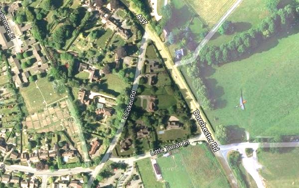
The modern satellite image of the former Bowling Green, bounded by East Coker Road to the west, Dorchester Road to the east and Little Tarrat Lane to the south. The rest of the image has been lightened to make Bowling Green stand out.
This is an aerial photograph taken in 1941 and looking south. West Coker Road runs across the width of the lower part of the photograph and Dorchester Road is seen at right of centre running up and across towards top right. Bowling Green is seen as a light-coloured triangular field at high right of centre, above the built-up former Corner Close.