Briseham Hill
Briseham / Brightmoor Hill
A field within the great manorial East Field
Briseham Hill (Parcel 946), also known as Brightmoor Hill and Brightmore Hill, was originally a field in the great medieval East Field of Kingston Manor.
In his will of 7 May 1668, Edward Drake referred in his will to; "...six acres of land called Brightmore in the possession of Elizabeth Marsh, widow, in Yeovil or Pitney". Leases of 1700 and 1719 refer to a "Close of pasture called Bright Moor Hill".
In his will of 1719, John Saunders the Elder referred to his parcel of "Ground at Brightmore". In his will of 1751, John Sanders the Younger wrote "... Whereas my Brother William Sanders deceased to whom I am Heir at Law by his last Will and Testament bearing date the 5th Day of December 1746 devised to me his Lands called Bright Moorhill in the Words following that is to Say and as for my Lands called Bright Moorhill contained in five closes and about thirty Acres I give it all to my loving Brother John Sanders for his Life and to be disposed of by his at his Death to the Children of my two Sisters begotten on their Bodies by Richard Wright and William Leigh as he shall think fit ...". He further wrote "I give and devise the said Lands called Brightmoorhill ... unto my Nephew John Wright and the Heirs of his Body...".
That William Sanders left to his brother John Sanders the Younger "... contained in five closes and about thirty Acres..." suggests that this estate included several fields around the later Parcel 946.
The 1846 Tithe Apportionment noted that Briseham Hill (Parcel 946) was in the ownership of Ann Collins and let to James Marten. The Tithe Apportionment shows Briseham Hill was used as pasture for grazing livestock. It measured 4a 3r 30p.
Briseham Hill (Parcel 946) was bounded on the north by Collins' Ground (Parcel 936), on the east by Young Orchard (Parcel 935), and on the south by Furzey Close (Parcel 933) and Spring Close (Parcel 947). To the west it was bounded by Long Close (Parcel 945).
By the time of the 1946 aerial photograph, seen below, Briseham Hill was still an open field but had been combined with Young Orchard (Parcel 935). Today, the former Briseham Hill is occupied by much of Bucklers Mead School and houses and gardens of the central section of Fairmead Road.
For details on historic land measurement (ie acres, roods and perches) click here.
maps

This map, based on the descriptions in the 1589 Terrier and the 1846 Tithe Map of Yeovil shows the approximate boundaries of the Manors of Kingston and Hendford as well as the manorial three-field system used in Kingston.

A map of the great medieval East Field of Kingston Manor showing conjectured locations of several fields based on descriptions in the 1589 Terrier.
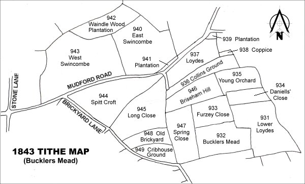
Drawn from the 1846 Tithe Map with field names added from the 1846 Tithe Apportionment, with Briseham Hill (Parcel 946) in the top right quadrant.
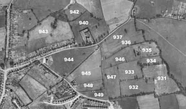
The 1946 aerial survey photograph with parcel numbers of 1846 plotted on.
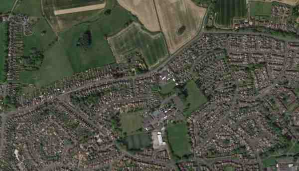
An aerial view (courtesy of Mr Google) of the area today.
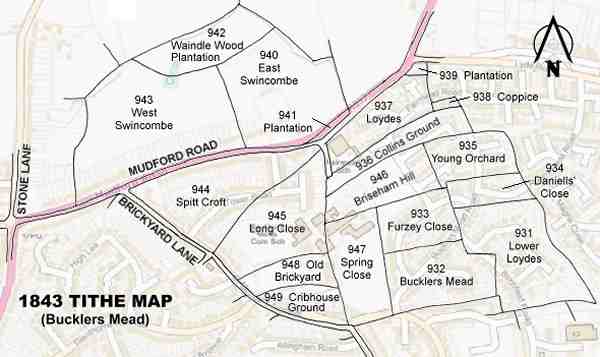
The 1843 Tithe Map overlaid onto a modern map of the area.