broad dean
broad dean
A Victorian field in Preston Plucknett
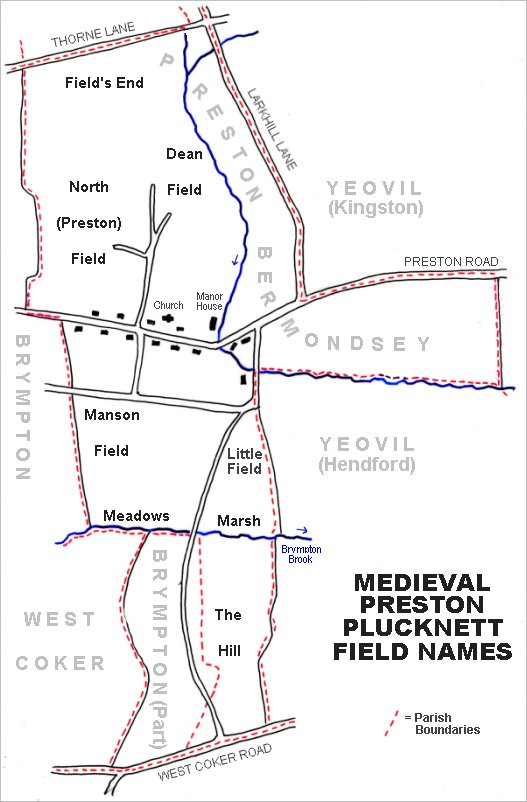
Broad Dean was originally part of a large field called Deane, or Dean Field, in the north of Preston Plucknett, to the north of Preston Road and west of Larkhill Lane.
By the time of the 1763 Survey of the Manor of Preston, It was subdivided into three fields, two called Broad and the third (southern) field was called Little Broad. At this time both fields were used as pasture; Broad measured 1 acre, 2 roods and 12 perches, while Little Broad measured 1 acre, 1 roods and 20 perches (both 'old' system measurements).
The three fields had been combined into one by the middle of the nineteenth century.
The 1846 Preston Tithe Map shows Broad Dean in the upper centre of the field system to the north of Preston Great Farm and Preston Road and west of Larkhill Lane. The Preston Plucknett Tithe Apportionment of 1848 noted that Broad Dean was owned by Lady Georgiana Fane of Brympton d'Evercy and the tenant was Thomas Hawkins. Using the 'new' system of measurements, Broad Dean was reckoned as 6 acres, 2 roods and 10 perches and was used as a meadow.
Shown as Parcel 77 at the centre of the map below, Broad Dean lay at the end of the field access track, known as Eighteen Acre Lane, running up the centre of the map and with Dodham Brook to its east. It was bounded to the north by Hacker's Close (Parcel 69) and to the south by Field Dean (Parcel 78).
Broad Dean disappeared when Abbey Manor was built in the 1980s and the site is now occupied by Poplar Drive and the end of Thorne Gardens.
For details on historic land measurement (ie acres, roods and perches) click here.
map & Aerial photograph
The main post-medieval fields of Preston Plucknett.
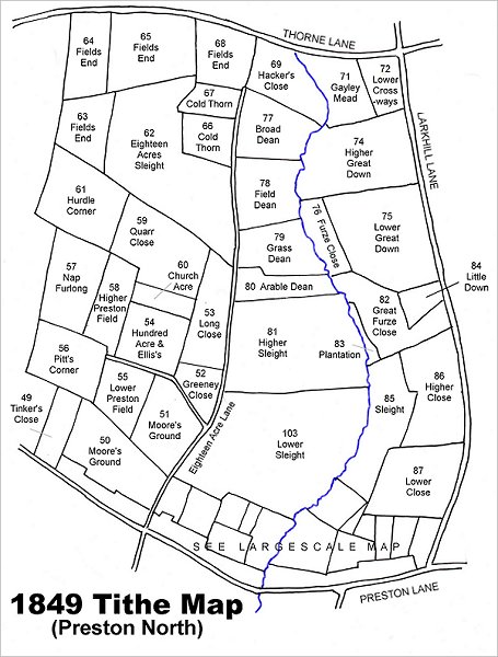
Map based on the 1849 Tithe Map showing Broad Dean at centre top, lying between the field access track, Eighteen Acre Lane (now a footpath), running up the centre of the map and Dodham Brook to its east.
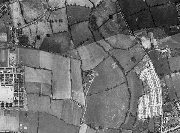
This is a 1946 aerial photograph showing Broad Dean at top centre, with Hackers Close (partly shown) to the north, Cold Thorn to the east, Grass Dean to its south, and Dodham Brook to the east. At lower left of the photograph is Houndstone army camp and at lower right is the post-war Larkhill Lane pre-fabricated housing estate. At centre is the Preston Plucknett Flax Works.
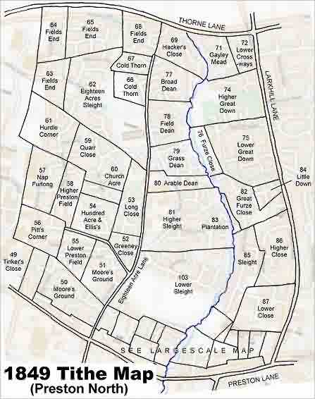
The 1849 Tithe Map superimposed over the modern Ordnance Survey map.