Eight Acres
Eight Acres
A field within the great manorial East Field
Eight Acres (Parcel 910), was (and still is) a field sloping gently down towards the River Yeo within the great East Field of the Manor of Kingston.
Unfortunately the 1846 Tithe Apportionment omitted Eight Acres, so its ownership, usage and size (I'm guessing around eight acres) are unknown. Today it appears (from a distance) to be arable, used for growing crops.
Eight Acres was bounded on the north by Hanging Ground (Parcel 909), on the west by On Down (Parcels 912 and 912a) and to the east it was bounded by In Great Mead (Parcel 892) and Hornetts (Parcel 891).
By the time of the 1946 aerial photograph seen below, Eight Acres was still an open field - as it remains today.
For details on historic land measurement (ie acres, roods and perches) click here.
maps

This map, based on the descriptions in the 1589 Terrier and the 1846 Tithe Map of Yeovil shows the approximate boundaries of the Manors of Kingston and Hendford as well as the manorial three-field system used in Kingston.

A map of the great medieval East Field of Kingston Manor showing conjectured locations of several fields based on descriptions in the 1589 Terrier.
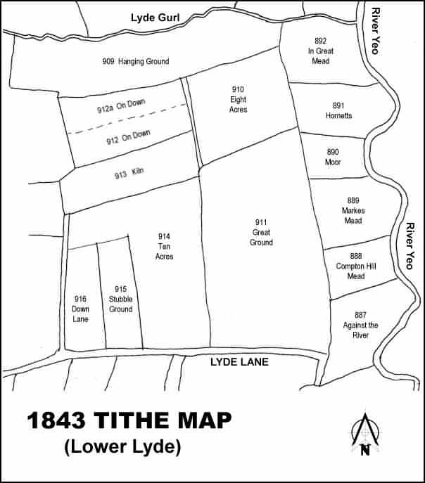
Drawn from the 1846 Tithe Map with field names added from the 1846 Tithe Apportionment, with Eight Acres (Parcel 910) at the top.
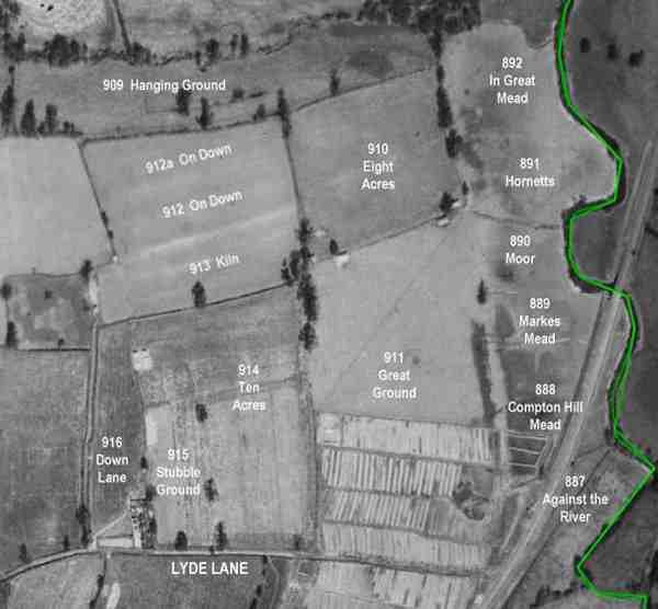
The 1946 aerial survey photograph with parcel numbers of 1846 plotted on. The green line is the county boundary running along the River Yeo.
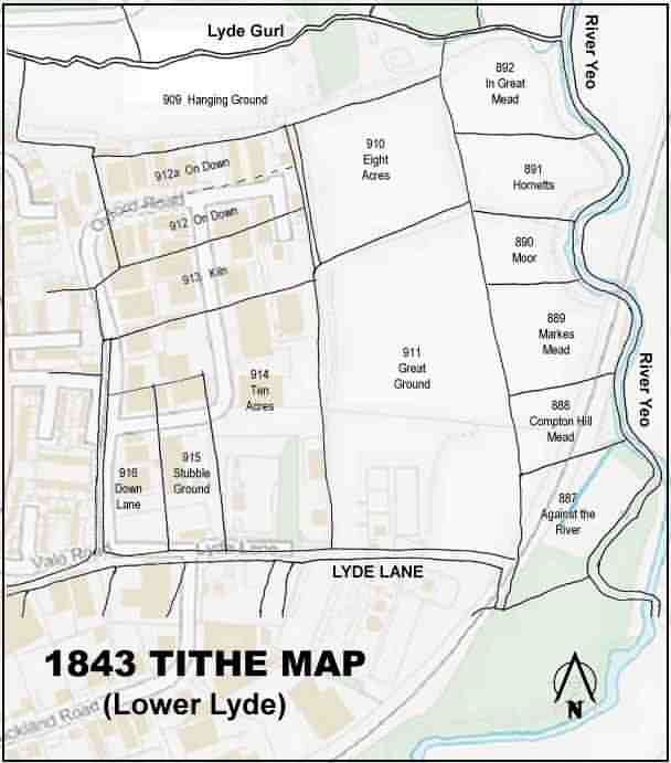
The 1843 Tithe Map overlaid onto a modern map of the area. The course of the Yeo just above the north point appears to have changed course somewhat.
Gallery
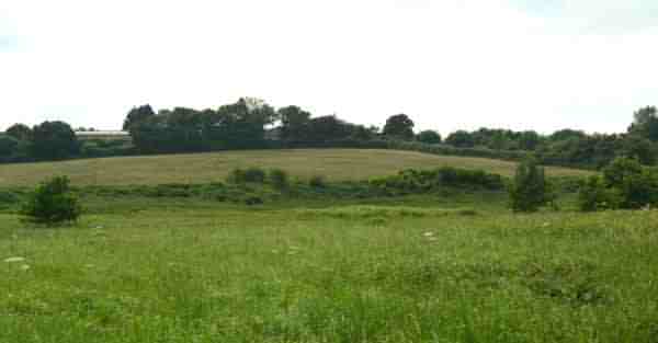
Eight Acres (Parcel 910) is the brownish field in the middle distance, photographed from In Great Mead (Parcel 892) in 2014.