foan's buildings
foan's buildings
Also known Wesleyan Place
From its location in the 1851 census, Foan’s Buildings was a ‘court’ of low cost housing “in Middle Street above the Wesleyan Chapel". By the time of the 1886 Ordnance Survey Foan’s Buildings were called Wesleyan Place.
The buildings
were not shown
on Watts' map of
1806 but had
been built by
the time he
produced his map
of 1831, thereby
approximately
dating when they
were built.
As seen on the
Ordnance Survey
below, Wesleyan
Place was a pair
of dwellings,
completely
enclosed and set
behind the
Salvation Hall
(Wesleyan
Chapel) in
Middle Street.
They were
reached via
steps in Middle
Street and then
an alley between
the Salvation
Hall and
Ebenezer
Terrace.
It is not known when Wesleyan Place was demolished but the buildings had been replaced by commercial buildings by the time an aerial photograph was taken in 1928.
MAP
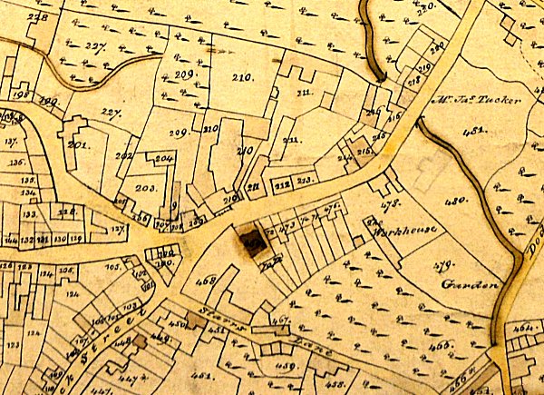
Watts' map of 1831 shows Ebenezer Row next to the newly-built Wesleyan Chapel, shaded deep brown. Behind the chapel are Foan's Buildings.
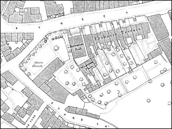
The 1886 Ordnance Survey showing Wesleyan Place at centre.