Footpath Field
Footpath Field
A field within the Manor of Hendford
Footpath Field (Parcel 806) was originally within the Manor of Hendford and has been, for generations, part of Aldon Farm. The name Aldon was known before Aldon house was built since Watt's map of 1806 shows a footpath "To Aldon Farm, etc." and clearly the footpath traversed this field as it approached Aldon Farm.
At the time of the 1846 Tithe Apportionment, Footpath Field was owned by John Batten Snr and was let to John Brook. It was recorded as arable for growing crops and measured 4a 2r 30p. For other tenant farmers, see Aldon Farm.
Footpath Field (Parcel 806) was bordered on the north and east by Plantation 3 (Parcel 807), on the south by Home Close (Parcel 803) and on the west by Home Field (Parcel 805).
Today, the former Footpath Field forms part of the parkland surrounding Aldon House.
For details on historic land measurement (ie acres, roods and perches) click here.
maps

This map, based on the descriptions in the 1589 Terrier and the 1846 Tithe Map of Yeovil shows the approximate boundaries of the Manors of Kingston and Hendford as well as the manorial three-field system used in Kingston.
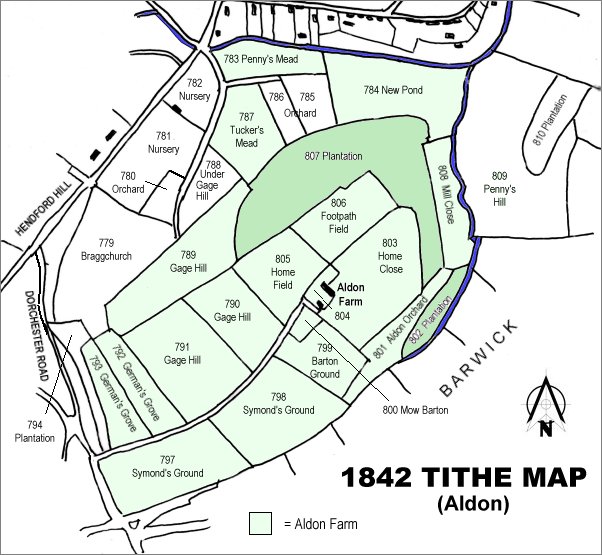
The 1842 Tithe Map showing the Aldon area and the parcels of Aldon Farm shaded light green. Footpath Field (Parcel 806) is at the centre.