Great Hide
Great Hide
A former part of the great West Field of Kingston Manor
The Terrier of 1589, referring to the great West Field recorded "In Elizabeth Diers close next the way 5yds upon the Hide" - 'next the way' meaning alongside Ilchester Road. Originally a hide had been an area of land, albeit a variable unit but usually taken to mean about 120 acres. Originally the hide represented the amount of land which could be ploughed in a day by one plough team of eight oxen. A hide was considered adequate for the support of one free family and the term had originally meant a household. Apparently Hide Farm existed until 1950 but I have been able to find little trace of it in the records.
Great Hide was a large rectangular field running west from Ilchester Road almost opposite the junction with Marsh Lane.
The 1846 Tithe Apportionment noted Great Hide as 7a 1r 26p and used as pasture to graze livestock. The Apportionment noted that the owner was George Mayo and the tenant was William Buck who also leased Long Ground (Parcel 1436) from Mayo.
Great Hide was bounded on the north by Hide Field (Parcel 1426) and Hide Plot (Parcel 1427), on the west by Long Ground (Parcel 1436), to the south by an un-named field (Parcel 1431) and Sugg's Close (Parcel 1432) and to the east by Ilchester Road.
Today the former Great Hide is occupied by the houses and gardens of Southway Crescent, the centre section of Southway Drive, Southway Close and a spur of Ilchester Road opposite the southern end of Pickett Lane..
For details on historic land measurement (ie acres, roods and perches) click here.
maps & Aerial Photographs

This map, based on the descriptions in the 1589 Terrier and the 1846 Tithe Map of Yeovil shows the approximate boundaries of the Manors of Kingston and Hendford as well as the manorial three-field system used in Kingston.
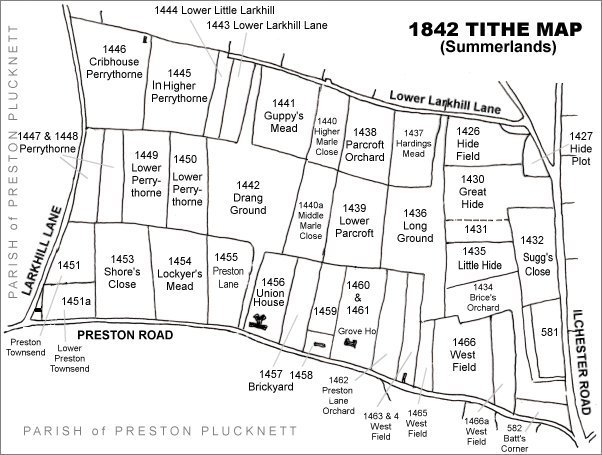
The Larkhill area reproduced from the 1842 Tithe Map. Great Hide is in the top right quadrant.
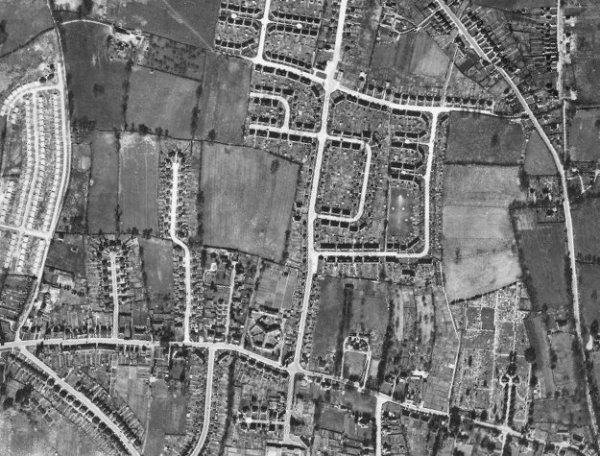
The 1946 aerial photograph - at this time Great Hide had not been built on.
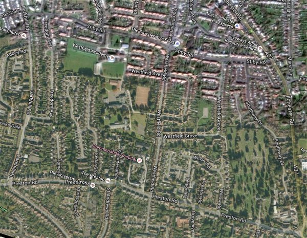
The same area today 'borrowed' from Google maps.
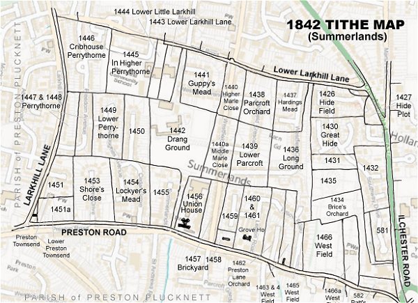
The 1842 Tithe Map superimposed (only very slightly out at the bottom) over a modern map.