Plot by Grove House Plot
Plot by Grove House
A long, thin roadside strip of field
The 'Plot by Grove House' (Parcel 140a) was a long, thin strip of land running along the southern side of Preston Lane (today's Preston Road) from a point just west of the Union Workhouse (now Summerlands Hospital) almost as far as today's Willow Road. Grove House, on the north side of Preston Road, was in Yeovil but the Plot was in the parish of Preston Plucknett.
The 1848 Preston Tithe Apportionment noted that the 'Plot by Grove House' was owned by Thomas Isaac, the brother of Yeoman farmer Samuel Isaac, and rented by Harriett White. Thomas Isaac and Harriett White were also owner and occupier of Grove House itself. The Apportionment recorded the area of the Plot as 0a 3r 35p and used as both arable for growing crops and pasture for grazing livestock.
'Plot by Grove House' was bounded on the north by Preston Lane, on the west by Seven & Eight Acres (Parcel 139), on the south by Five Acres (Parcel 141) and Catshill Ten Acres (Parcel 148) and on the east by the small 'Cottage & Garden' (Parcel 140) owned and occupied by Robert Watts (measuring just 0a 0r 18p).
At the very western end of the Plot was a spring that fed a small brook that flowed south, to join with the Old Mill Leat. The 1889 Ordnance Survey, shown below, shows that 'Plot by Grove House' was still there at this time but by 1903 the Plot had disappeared - absorbed into Five Acres and Catshill Ten Acres. Today the former 'Plot by Grove House' is completely filled with the houses and gardens of Preston Road.
For details on historic land measurement (ie acres, roods and perches) click here.
MAPS & Aerial Photograph
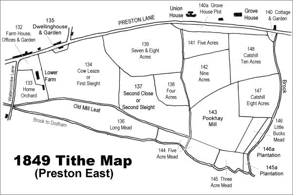
The 1849 Preston Tithe Map. 'Plot by Grove House' is at top right.
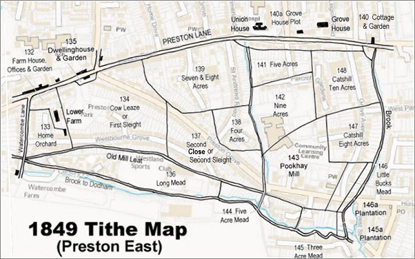
The 1849 Preston Tithe Map overlaid on a modern map (the 1849 map is slightly incorrect at bottom right).
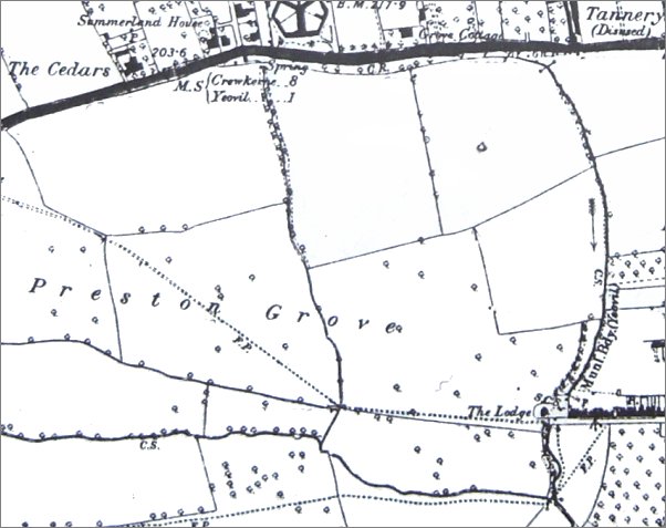
The 1889 Ordnance Survey shows the extensive fields of Lower Farm labelled 'Preston Grove' stretching eastwards. The dotted line across the fields, indicating a footpath, was the line of the later road, also called Preston Grove. 'Plot by Grove House' is at centre top.