Harbin's milford
Harbin's milford
A field once owned by the famous Yeovil family
Harbin's Milford was a small field just southeast of the junction of today's Milford Road and Goldcroft. The Harbin family were the builders and occupiers of Newton Surmaville House.
The field was shown on E Watts' map of Yeovil of 1806. The 1842 Tithe Map allocated the Parcel Number 1019 to the field but didn't name it and the 1846 Tithe Award described it as pasture of 2a 1r 30p in area.
The field was bounded in the west by Gold Croft Lane (today's Goldcroft), to the north by Milford Cross (1020), to the east by Milford Brook and to the south by Milford (1018).
Houses in Goldcroft were built on Harbin's Milford from the early 1920s. During the Second World War and in the immediate post-war period, with the drive to cultivate every spare piece of land for food production, the field was divided into allotments as seen in the aerial photograph below.
Today just under
half of the
field is
occupied by
Goldcroft houses
and their
gardens, while
the northeast
corner of the
field alongside
Milford Brook
(now culverted)
was
re-landscaped to
form part of the
present playing
field.
MAP

This map, based on the descriptions in the 1589 Terrier and the 1846 Tithe Map of Yeovil shows the approximate boundaries of the Manors of Kingston and Hendford as well as the manorial three-field system used in Kingston.
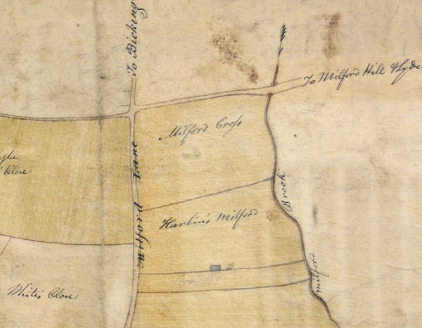
E Watts' map of Yeovil of 1806.
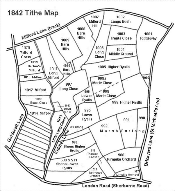
This map is based on the 1842 Tithe Map with field names added from the 1846 Tithe Award.
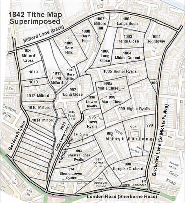
The 1842 Tithe Map superimposed (roughly) over a modern street map showing where several modern roads, for example Gordon Road, Grass Royal and Highfield Road, follow former field boundaries.
gallery
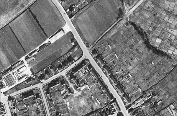
An aerial photograph of 1946 showing Goldcroft running diagonally across the photograph from top left of centre to bottom right of centre and Sparrow Road, fairly recently constructed, running to the bottom left. At centre is Milford Cross with the track known as Milford Lane, later to become Milford Road, running off towards top right. The circular structure on the north corner of Milford Lane is a Second World War emergency water tank and on the southern corner is the pair of experimental Nissen-Petren houses. Note the extensive allotments occupying the right half of the photograph.
The field known as Harbin's Milford (1019) is in the bottom right corner.