Hartwells Orchard
Hartwells Orchard
Of Stone Farm, a detached part of Preston Plucknett
In his
'Agricultural
Survey of
Somerset' of
1797, John
Billingsley
refers to the
large number of
orchards for
which the land
is "peculiarly
adapted". The
large acreage
devoted to this
purpose in the
Yeovil area
reflects the
county's
reputation for
cider making.
The low wages
being paid at
that time to
agricultural
workers were
augmented by an
allowance of
cider; a
labourer
received one
shilling a day
in winter 'with
cider' and one
shilling and
fourpence with
cider in summer.
The latter
amount was also
paid for mowing
grass per acre
and one gallon
of cider, while
reaping wheat
was paid for
with four
shillings per
acre and 2½
Hartwells Orchard was a small field to the immediate northeast of Stone Farm.
This area is actually a detached part of the parish of Preston Plucknett, known as Preston in Stone, and the Preston Plucknett Tithe Map of 1849 shows Hartwells Orchard as Parcel 169. It was bounded on the south by Garden Field (Parcel 177), to the west by Hetts Orchard (Parcel 171) and Home Close (Parcel 175), on the north by Higher Ground (Parcel 167) and on the east by Hanging Orchard (Parcel 168). Set within the boundary between Hartwells Orchard and Garden Field was a small plot containing Stone Farm Cottage and garden (Parcel 170).
The Preston Plucknett Tithe Apportionment of 1848 notes that Hartwells Orchard was in the ownership of Henry Goodford Esq. of Chilton Cantello and occupied by Mrs Phillis Coles, as indeed was the whole of Stone Farm at this time. The Tithe Apportionment reckoned the area of Hartwells Orchard to be 5a 3r 18p.
Other known owners / occupiers had been James Harris (1800), Mr Pester (1810), Mr Spear (1818), Stephen Coles (c1821-1827). Phillis Coles, in her later years assisted by her sons, ran Stone Farm after the death of her husband Stephen until her own death in 1877. Her son Edmund ran the farm after her death until his death in 1885. By 1886 a Mr Russell was farming Stone Farm but his widow sold up and retired in February 1900. In 1901 the tenant farmer was John Sawtell.
As seen in the aerial photograph of 1946, shown below, by this time Hartwells Orchard had been combined with part of Garden Field to form a new pasture, as it remains today.
For details on historic land measurement (ie acres, roods and perches) click here.
maps and aerial photographs
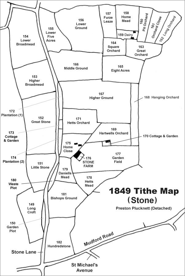
The Stone area reproduced from the 1849 Tithe Map. Hartwells Orchard is above and right of Stone Farm.
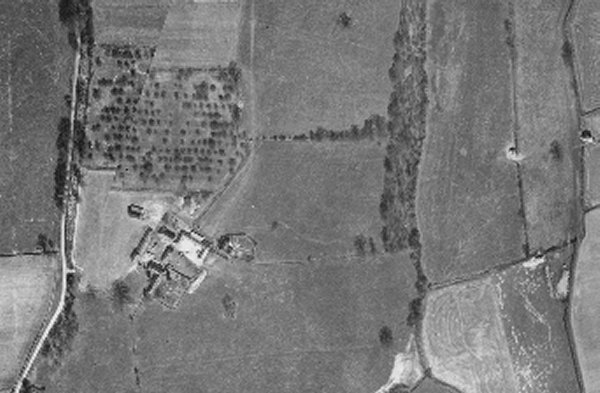
The 1946 aerial photograph showing the former Hartwells Orchard at centre. By this time its southern boundary with Garden Field had been moved south to include part of Garden Field.
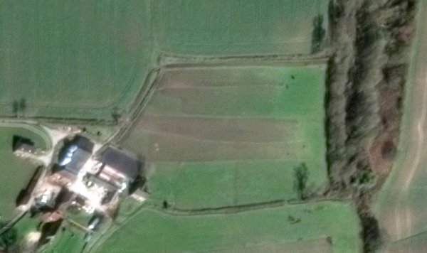
The modern aerial view showing Hartwells Orchard to the immediate northeast of Stone Farm. The original southern boundary of the field was along the bottom of the brown area running across the field, the hedgerow at bottom is later and encloses part of garden Field.
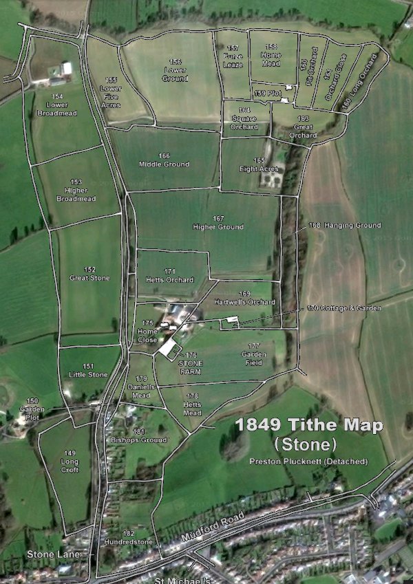
The 1849 Tithe Map superimposed over the current Google Earth image. Although the field boundaries do not align precisely, remember that the 1849 survey was undertaken by hand using primitive surveying equipment. The location of the former Hartwells Orchard is to the immediate northeast of Stone Farm.