high street
high street
One of Yeovil's first streets
Being within the confines of the early Borough of Yeovil and in the edge of the early churchyard precinct, High Street was one of Yeovil's first streets.
In 1386 High Street was noted as being maintained under letters patent of King Richard II “Grant to Richard Fauntleroy and Richard Bursy, good men of Yeovil, of pavage for 5 years for the high street, which runs through the middle of their town.” Pavage was a medieval toll for the maintenance or improvement of a road or street. The king, by letters patent, granted the right to collect it to an individual, or the corporation of a town, or, as in the case of Yeovil, to the "bailiffs and good men" of the town.
A deed of 1407 refers to High Street “Demise by John Ganvill', rector of the parish church of Ievele, and lord of that vill, to William Martyn, Joan his wife, and William their son, of a messuage in the High Street of Ievele (Yeovil).Witnesses:—William Graungere, provost (propositus) of Ivele, and others”. An indenture in the Woborn Muniments of 1433 records "William Lumbard grants to John Kingman and Johanna his wife for their lives a messuage with 'selar' and garden which Nicholas Rocke lately held of him within the free borough of Yevele on the east side of the tenement of Isabella Bentley and the 'selar' is on the east side of the messuage under a 'shoppe' which John Hobbes lately held in the High Street as an annual rent of 26s 8d.
Vickery, in 1856, described High Street as follows “The houses in High-street and its vicinity consisted chiefly of low pent-house buildings of wood and plaster, covered with thatch, and almost impervious to light and air; a friend recollects many of them. The shop now occupied by Mr Manning had an ascent of three or four steps before persons could reach it, and when they did their hats touched the ceiling. This was the case, more or less, with many houses. Some also had two or three steps descending to the door. Our plodding, canny forefathers appear to have studied economy, and looked for sure and steady profits, caring little for external show, and much less for internal accommodation”.
Even in the early twentieth century High Street was often referred to as the Borough. On the other hand the Borough is the traditional name for the old market place, the wide area at the junction of High Street, Silver Street, Middle Street and Wine Street although technically the Borough doesn't exist as a postal address and is actually part of High Street.
MAP

The 1901 Ordnance Survey showing High Street and the Borough, technically all High Street.
gallery
This
drawing
features in my
book "Lost Yeovil"
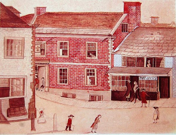
The earliest known depiction of High Street, this drawing, showing the Fleur-de-Lys next door to Yeovil's first Post Office (replaced in 1836 by what would become Lindsay Denner's shop - see next image), has been dated to between 1766 and 1780 based on notes on its back as to the people depicted - see next image.
The Fleur building itself is constructed in red brick with stone quoins, string course, window surrounds and the fine columned entrance. The windows are of the sash type to the front elevation but a casement window is open on the gable indicating one or more rooms in the roof space. At ground level the two grilled windows at pavement level indicate an extensive cellar.
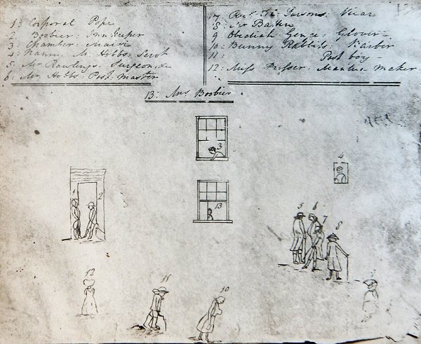
This is the back of the above coloured drawings with the people numbered and their names appended. It's not too easy to read, so the names are -
|
1.
Corporal
Pope |
8. Mr
Batten |
From my
collection
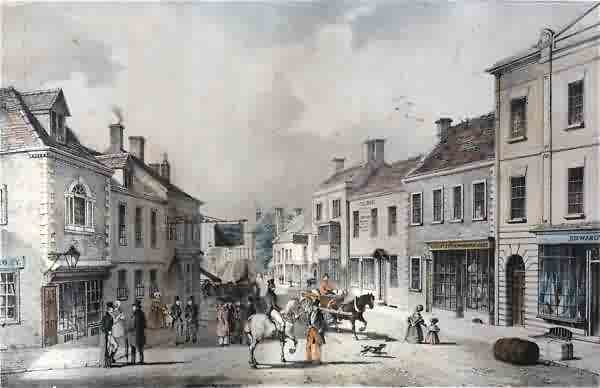
This lithograph looks down High Street from its junction with Hendford / Princes Street. On the left the Mermaid with its familiar archway and large overhanging sign is clearly seen. On the opposite side of the road, just right of centre, the white three storey building with the two-storey projecting bay is the Kings Head Inn. It is likely that the two storey building next to the Kings Head Inn is the building that held the former George Inn.
This hand-tinted stone lithograph was by Henry Burn (1807-1884) entitled 'Market Place - Yeovil'. There are not many known stone lithographs by Henry Burn because he left for Australia in 1852. It was published by William Porter and Henry Marsh Custard in January 1839 and printed by Charles Joseph Hullmandel (1789-1850) of London, where he maintained a lithographic establishment on Great Marlborough Street from about 1819 until his death.
For a more detailed account of the buildings in this 1839 lithograph, click here.

A celebratory sketch dated 1850 of the Town Hall and Market House opened the previous year. The clock, illustrated here in the pediment, was a bit of wishful thinking as the actual clock was not installed until 1864 and even then wasn't set into the pediment as shown here, but mounted in a short tower so that all four faces of the clock could be seen. The George Inn, referred to in the previous painting, is at extreme left.
This colourised photograph
features in my
book 'Yeovil From Old Photographs'.
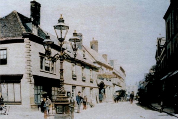
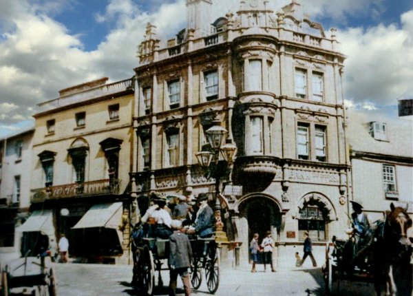
This is about the earliest photograph I've found of High Street - it was taken between 1887 (when the 3-light Sugg lamp in the foreground was presented to the town to celebrate the Golden Jubilee of Queen Victoria) and 1897 (when the three storey Capital and Counties Bank opened on the corner of High Street and Princes Street - replacing the building seen here at left). Of greatest interest, perhaps, is that this building preceding the bank, the home and shop of furniture maker Henry White, had an arched Venetian window at first floor similar to that above the Mermaid's entrance.
Courtesy of
Colin Haine
The junction of Princes Street at left and High Street at right - in a colourised photograph of around 1900 when horse-power meant horse-power.

The corner of Princes Street, at left, and High Street, at right, photographed in 1906.
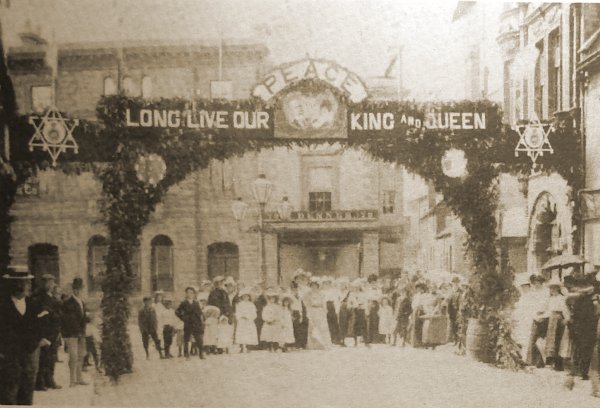
This photograph
looks along High
Street to
Hendford - the
triumphal arch
was the
highlight of the
town's
decorations of
the 1902
coronation of
King Edward VII
and Queen
Alexandra. In
the background
at left is
Stuckey's Bank
and at centre is
lindsay
Denner's
"gentleman's and
juvenile
ready-made and
outfitting
establishment".
Note to its
immediate right
the very narrow
entrance to
Porter's Lane.
Stuckey's bank
was later
demolished and
the present
Westminster bank
was opened in
today's building
in 1919.
Denner's
building was
also demolished
and Porter's
Lane was widened
to become
Westminster
Street as seen
below.
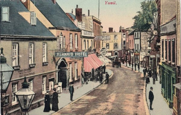
A postcard of High Street, dated 1906.
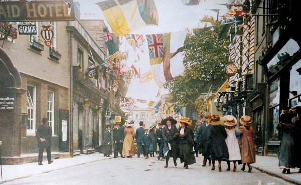
From the Cave
Collection
(colourised),
Courtesy of South Somerset Heritage Collection
High Street decorated to celebrate the coronation of George V in June 1911.
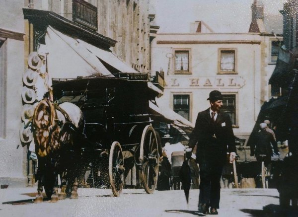
In a colourised photograph of around 1912, a man (looking every part the city gent with his bowler hat and umbrella) walks along High Street past Benjamin Penny's draper's shop.
From my
collection
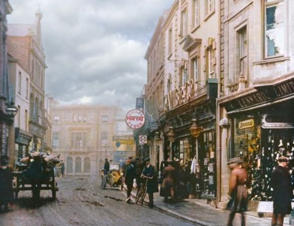
High Street in a colourised photograph of around 1914, with Stuckey's Bank in the background.
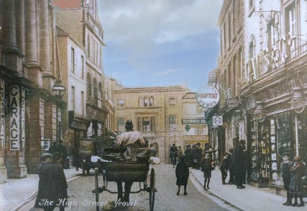
A colourised postcard of High Street looking west of around 1915 (certainly taken before Stuckey's Bank in Hendford was demolished) with Ince Gamis' shop at right (with two large lamps). The building was to be rebuilt in 1932.
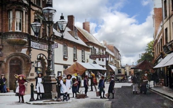
A colourised photograph of High Street in 1918. Note the Sugg lamp, the Mermaid's horse-drawn omnibus and also that the market was held here in the street.
Courtesy of the
Western Gazette
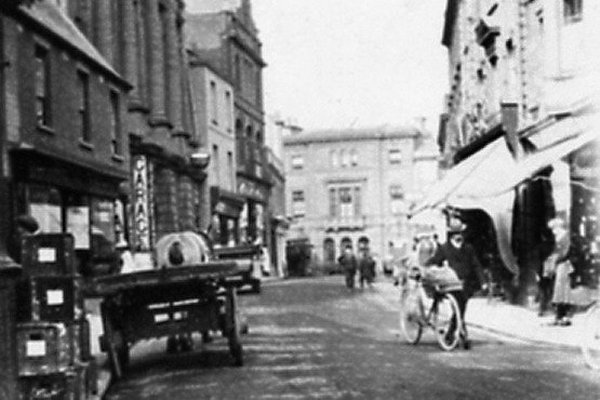
Although the Western Gazette dates this photograph to 1920, it must have been taken a year or two earlier than that because it shows Stuckey's Bank at centre - demolished and replaced by today's Westminster Bank building that opened in 1919.
From my
collection
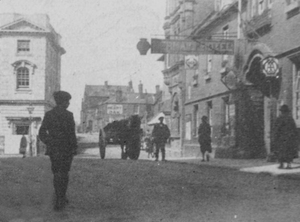
Almost the same view in this is an interesting photograph of the late 1920s taken from High Street and showing the newly-built bank building at left and the newly-widened Westminster Street ahead. Notice that very few buildings existed in Westminster Street at this time except the Heart of Oak pub (now the Westminster) on the corner of Clarence Street. At right is the Mermaid without shops.
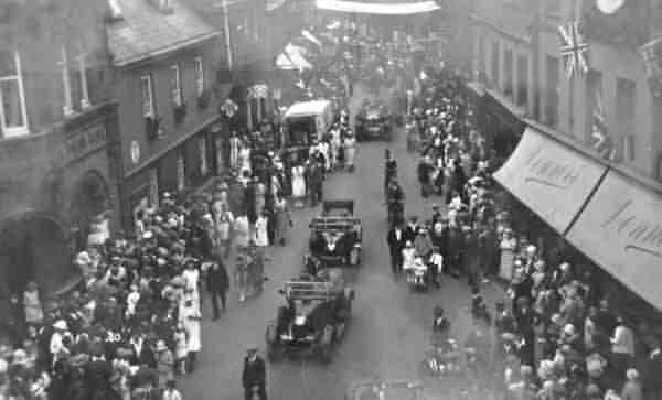
A procession - possibly Empire Day - passes along High Street during the 1920s.
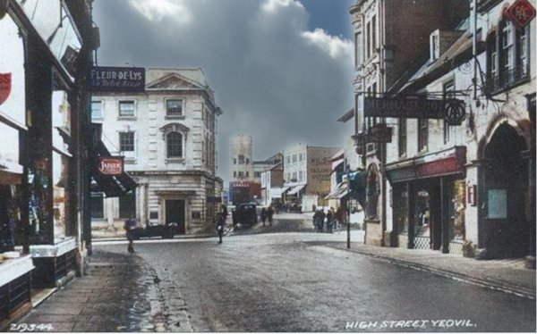
.... and moving on to the 1930s - in this colourised postcard, apart from the shops in front of the Mermaid, the only real changes are in Westminster Street where Douglas Seaton's tower is seen on the corner with Clarence Street and a new building has sprung up by the side of the Heart of Oak.
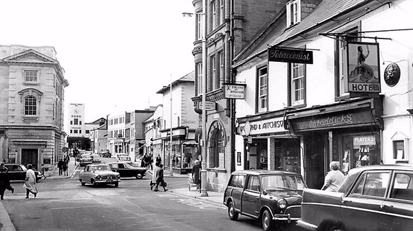
.... and almost the same view - Westminster Street seen from High Street in the mid-1960s.
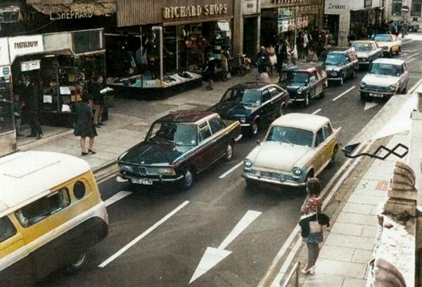
Traffic build-up outside Richard Shops and Borough Arcade in this colourised photograph of the 1960s.
From the Cave
Collection
(colourised),
Courtesy of South Somerset Heritage Collection
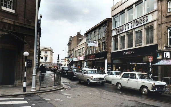
... and moving a little further east. This photograph is taken from the crossing on King George Street, again in the 1960s.

From the Cave
Collection
(colourised),
Courtesy of South Somerset Heritage Collection
The junction of Hendford, Princes Street and High Street shown in the 1950 Yeovil Guide.
From my
collection. This
photograph
features in my
book "Lost Yeovil"
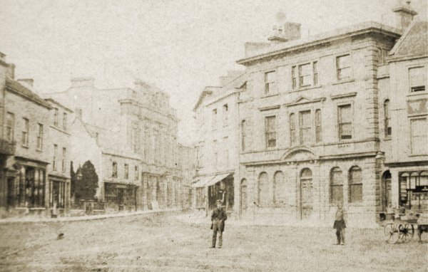
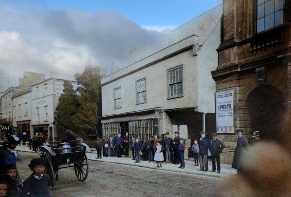
A very early photograph, dating to about 1860, shows High Street as seen from the Borough. Notice that at this stage the Town Hall lacks a clock tower which was not to be erected until 1864 but taken down in 1887 as unsafe.
From the Stiby
Collection
(colourised),
Courtesy of South Somerset Heritage Collection
Denner & Stiby's shop photographed in 1883, probably by Henry Stiby who was a keen amateur photographer and left a good record of photographs of Yeovil. Note under the right of the three first floor windows, where Thomas and his family lived, is the entrance to the less-than-savoury George Court.
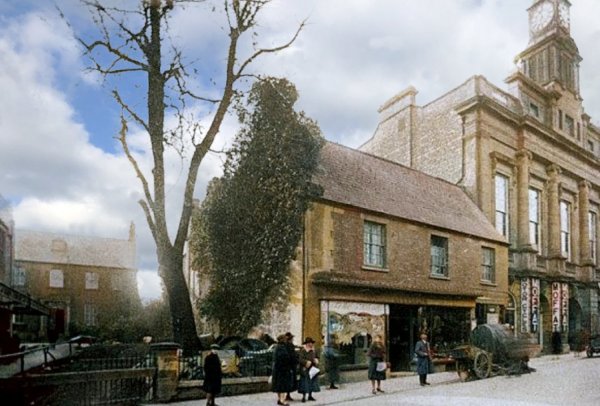
This colourised photograph of High Street, dating to about 1925, shows the building on the site of the George Inn - occupied by Denner and Stiby's ironmongery business until 1892 and then (at the time of this photograph) by Llewellyn's greengrocery and florist premises. Below the right hand window of the three first floor windows was the High Street entrance to George Court. The set-back building at left is the former Bell Inn. The shop was later taken over by the Petters as seen below.
From my
collection. This
colourised photograph
features in my
book 'Secret Yeovil'.
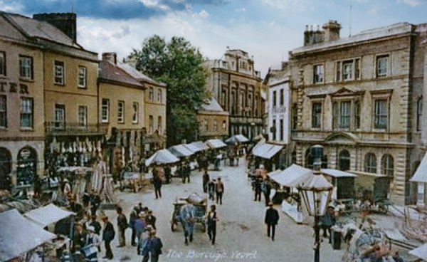
A postcard of about 1905 (this one was posted in 1911) showing the Town Hall beyond the weekly market in the Borough that extended along High Street.
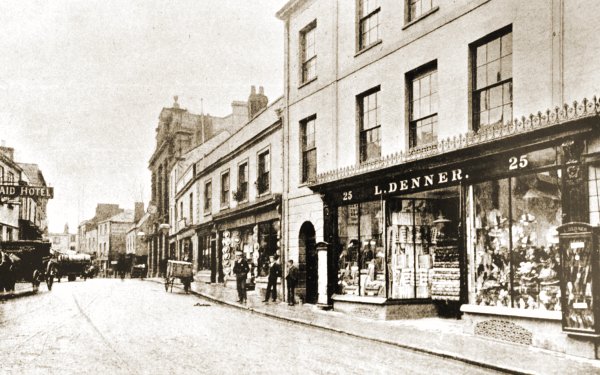
This photograph was taken by Yeovil Photographer Jarratt Beckett and published in his 1897 book "Somerset viewed through a Camera".
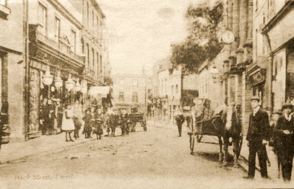
A postcard of High Street, dated 1905. John Gliddon's shop is at left with the five large lamps outside. On the opposite side of the road, the columned building is the Town Hall.
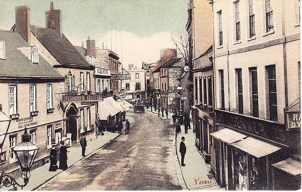
A hand-coloured postcard, dated 1906, showing High Street as seen from the first floor of the Stuckey's Bank building in Hendford.
Courtesy of the
Western Gazette
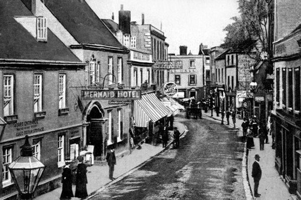
.... and the photograph the postcard above was taken from.
From my
collection.
This
colourised
image
features in my
book 'Yeovil
- The Postcard
Collection'.
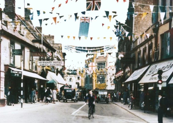
High Street decorated for the coronation of King George VI on 12 May 1937. The Odeon Cinema opened four days earlier on 8 May 1937, the King's speech was to be played at the Odeon as part of to opening week programme.
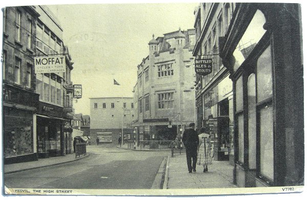
From my
collection
High Street, looking towards the Borough, in a postcard of 1960.
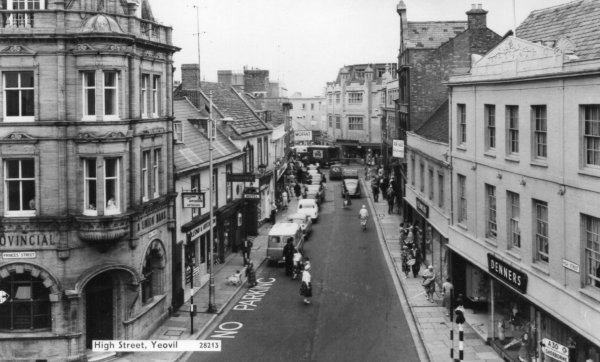
From my
collection
High Street, looking towards the Borough, in a postcard of around 1962.
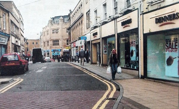
Courtesy of the
Western Gazette
High Street, looking towards the Borough. Photographed in 2007.
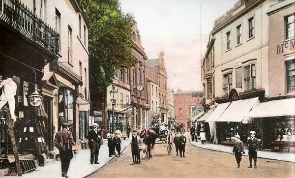
From my
collection. This
photograph
features in my
book "Lost Yeovil"
A hand-coloured and heavily touch-up photograph of High Street dating to 1907. If you look closely you will see that most of the people, as in the previous postcard, all of whom have no shadows, have been added to the photograph in the photographer's studio.
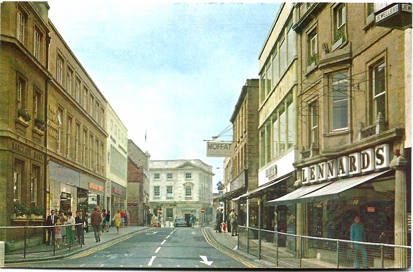
A postcard dated 1970, looking west along High Street from the junction of King George Street.
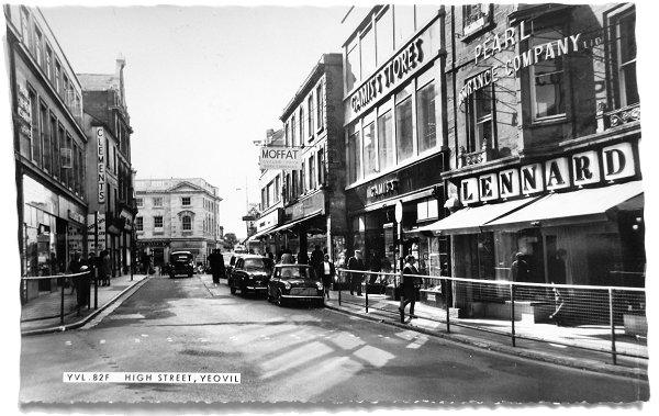
From my
collection
Almost the same view in the 1960s - again looking west along High Street from the junction with King George Street (on the left)
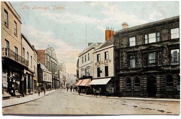
From my
collection
High Street, seen from the Borough. This postcard was sent in 1904.
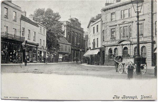
From my
collection
High Street, again seen from the Borough. This postcard was sent in 1905.
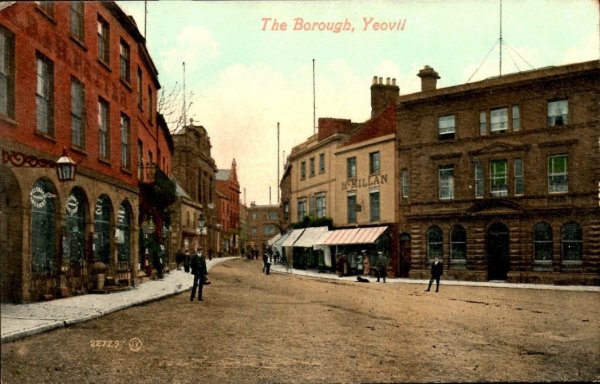
A heavily hand-tinted postcard of the Borough and High Street also dating to about 1907.
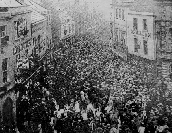
Crowds in the Borough and High Street awaiting the declaration of the election from the Town Hall in 1910.
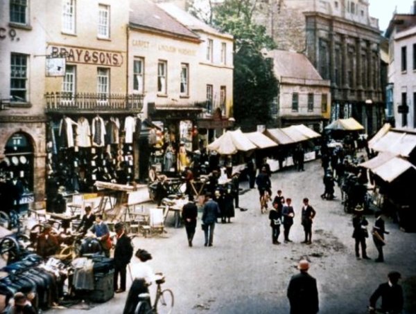
The weekly market in High Street about 1912. The shop in the extreme top left corner is today's Superdrug.
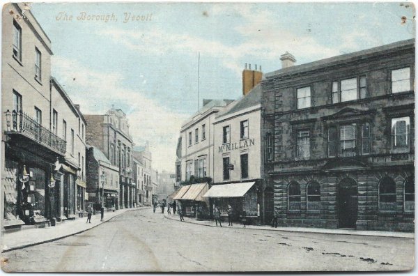
From my
collection
A hand-coloured postcard of High Street dating to about 1910, just before the Town Hall got its new clock tower.
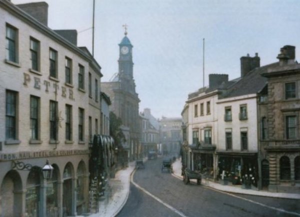
This colourised photograph of High Street dates to about 1914, by which time the Town Hall clock tower had been built. The building at the far end is Stuckey's Bank that predated the present bank building.
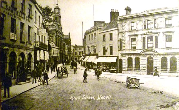
A postcard of High Street dating to about 1916.
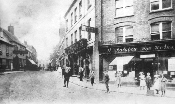
The High Street junction with Hendford, colloquially known a "Denner's Corner" before Lynsey Denner expanded his mercantile empire by acquiring more and more properties on this and the opposite corner.
From my
collection.
This
colourised
image
features in my
book 'Yeovil
- The Postcard
Collection'.
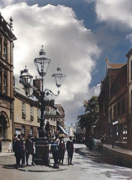
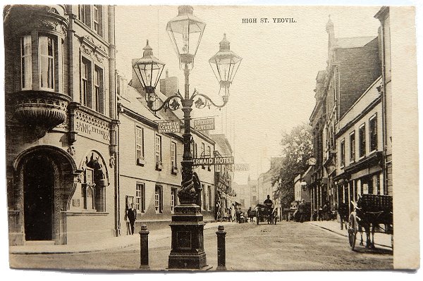
High Street seen from the junction with Hendford. This photograph, from around 1910, gives a really good indication of just how large Sugg lamps were. Nice to see that even before my time lads used to hang around on street corners. Mind you, I don't think that even if I was around in 1910 I would have worn a boater and plus fours, let alone sport a cane.

A postcard dated 1904 showing High Street as seen from Hendford. At this time High Street itself was also colloquially known as The Borough. The three-lamp 'Sugg Lamp' was donated to the town in 1887 by the Gas and Coke Company to mark the Golden Jubilee of Queen Victoria.
From my
collection
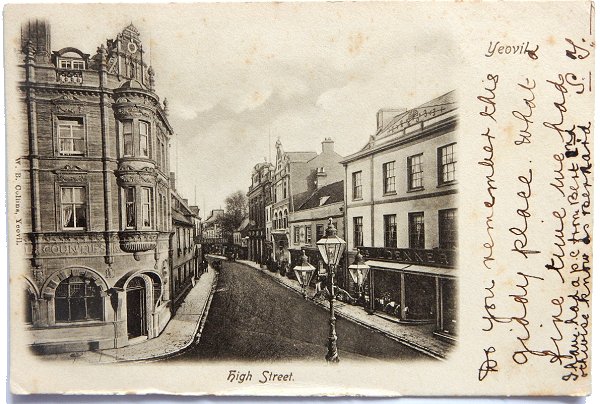
A very similar postcard, but this one was posted in 1907. Note that the lovely Sugg lamp has now been adorned with two tiny directional traffic signs; that pointing up Princes Street to Ilminster, Ilchester and Sparkford, while that pointing down Hendford to Dorchester and Crewkerne. I suppose they didn't have to be much bigger in those days as you had plenty of time to read them as you meandered past on your horse and cart.
From my
collection
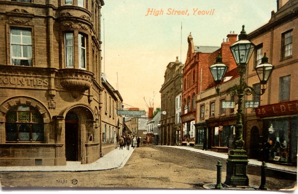
Now, be honest, you really don't hear Yeovil being described as a "giddy place" these days. This postcard was posted in 1904 - I'm glad they had such a "fine time" here.
From my
collection.
This
image
features in my
book 'Yeovil
- The Postcard
Collection'.
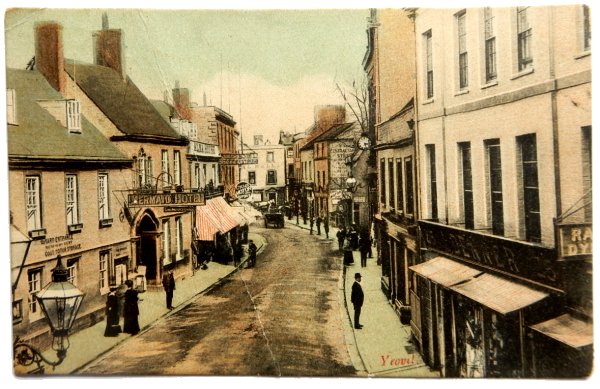
A hand-coloured postcard of High Street, this one postmarked 1910 but I've seen this card used as early as 1906, showing the new building in red brick between Denner's shop and the Town Hall (without its clock). Note the Fleur-de-Lys next door to the red building.
From my
collection.
This
image
features in my
book 'Yeovil
- The Postcard
Collection'.
A hand-coloured postcard of High Street, this one postmarked 1907.
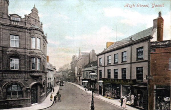
A similar view in a postcard of the 1910s. Note that the Town Hall still has no clock tower.
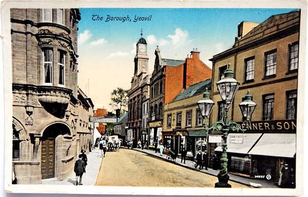
From my
collection.
This
image
features in my
book 'Yeovil
- The Postcard
Collection'.
An almost identical to the previous by a couple of years later in this hand-coloured postcard as the Town Hall now has its new clock, erected in 1912. The postcard was published by William Beale Collins of Princes Street, the photograph was by his son Harold Beale Collins
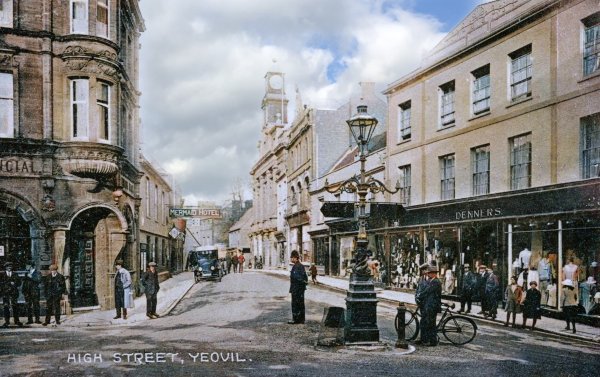
From my
collection. This
colourised photograph
features in my
book 'Yeovil
From Old
Photographs'.
A postcard dated 1926 of the same view, but notice that the Town Hall has its second clock tower. The Town Hall was to burn down in 1935. Denner's shop-front now incorporates the two-storey building to its side.
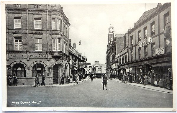
From my
collection
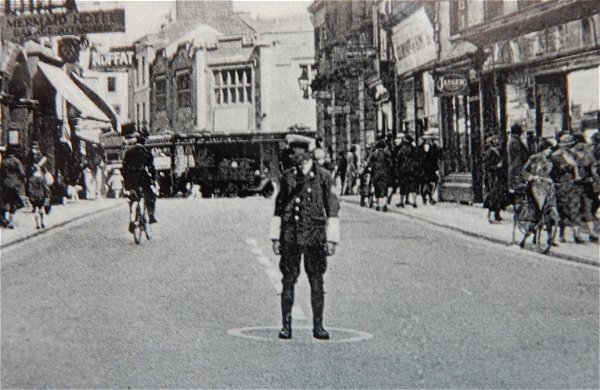
Although this postcard is postmarked 1938, the photograph was clearly taken before the Town Hall burnt down in 1935. Note that the Sugg lamp has now gone and the AA or RAC man on traffic duty has his own circle marked on the road (see below).
From my
collection
An enlargement of the previous postcard showing the AA, RAC or policeman's traffic duty circular marking.
From my
collection
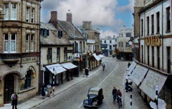
High Street in a colourised postcard I'm guessing to be from the late 1940s or early 1950s.
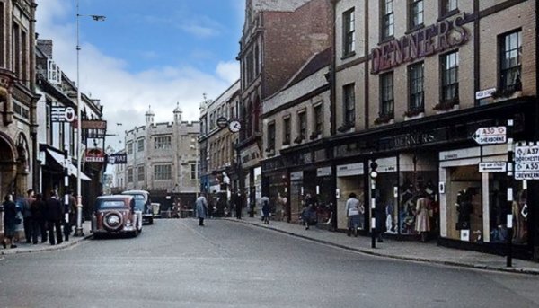
A colourised photograph depicting pretty much the same scene, but (I'm guessing again) in the late 1950s. Note that in the distance, Frederick Taylor's store is only three stories high.

... and a comparison photograph of the former Frederick Taylor's premises, photographed on 24 May 2024.
From my
collection
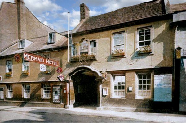
I'm not sure when the photograph of this colourised postcard was taken but it must have been during the 1920's or 1930's judging by the AA and RAC signs (although, of course, the RAC was founded in 1897 and the AA in 1905). However it does show up particularly well the fine entrance arch and the Venetian window over - frequently overlooked as today's world rushes by. Note too the absence of shops on the ground floor either side of the arched entrance - I doubt that many Yeovilians can remember it looking like this!
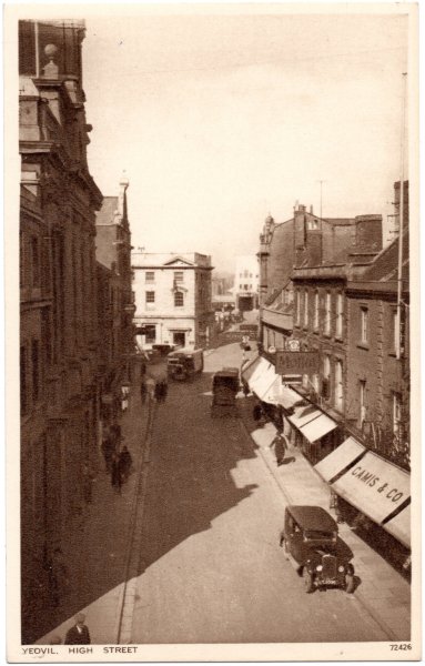
From my
collection
An unusual view of High Street. This is a postcard purchased in 1942 but the photograph was clearly taken before the Town Hall (at extreme left) burnt down in 1935.
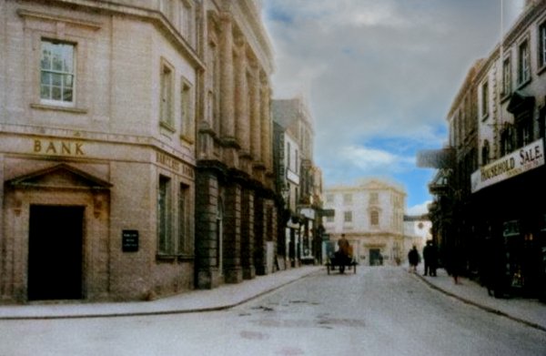
So who remembers Barclay's Bank being on the corner of King George Street? as seen in this colourised photograph of High Street taken in 1931.
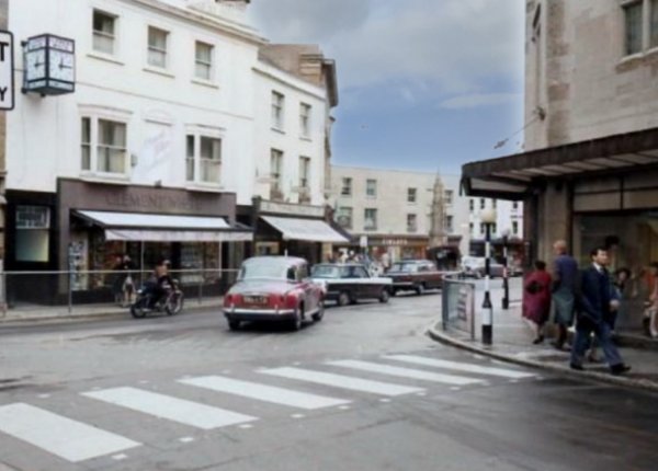
... and looking in the other direction, this is the view from King George Street to High Street and the Borough, in a colourised photograph of the mid-1960s.
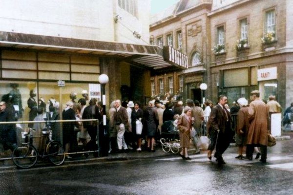
Busy shoppers in High Street move past Plummer's store (formerly Frederick Taylor's), on the corner of High Street and King George Street, in the colourised photograph of the 1960s.
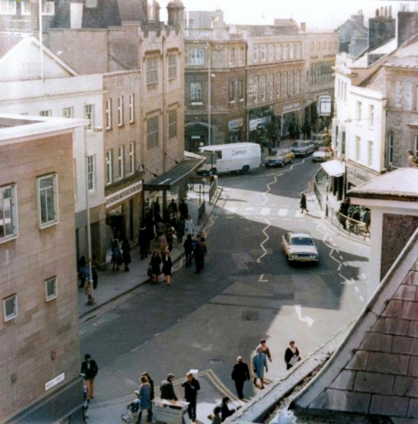
A colourised photograph of the 1960s, looking across the Borough and High Street.
Courtesy of
Chris Rendell
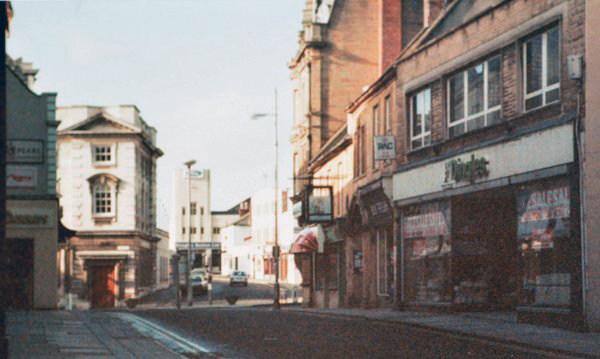
Looking west along High Street to Westminster Street. Photographed in 1985.
From my
collection
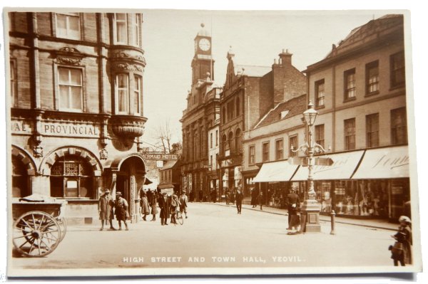
High Street seen from Hendford in this postcard sent 1927 (although it was clearly taken a few years earlier since the Frederick Taylor's store and King George Street have yet to be built. Note that the Sugg lamp is still here and a traffic policeman stands patiently by it, waiting for some traffic.
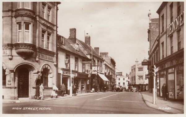
A postcard of the late 1940s - note that the traffic light posts have temporarily lost their post-war black and white stripes (undercoat perhaps? because they're back to being striped later). They did, of course, replace the policemen of the previous two postcards. Also, Frederick Taylor's store seen in the distance is still just three storeys.
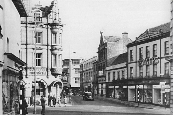
From my
collection
High Street in 1950, seen from Westminster Street.
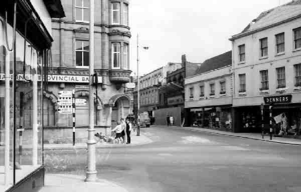
Almost the same view taken around 1965. Clement's store (built around 1905) is being demolished and the two-storey part of Denner's store is yet to become four-storeys.
This
image
features in my
book 'Yeovil
- The Postcard
Collection'.
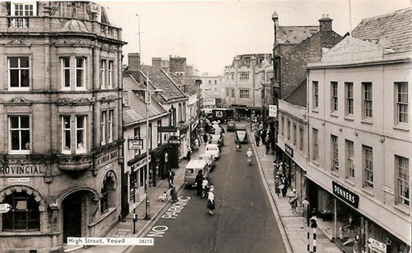
This postcard is dated 1966 - substantially unaltered from the previous photographs but one-way traffic is now in operation.
Courtesy of
Chris Rendell
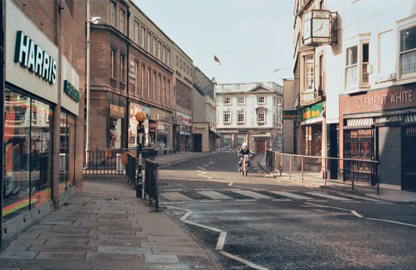
High Street, looking west, photographed in 1985.
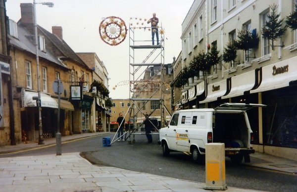
I often wondered who put up Yeovil's Christmas decorations. This must have been the 1990s when Denners splashed out on dozens of Christmas trees.
High Street - Then and Now

From my 2024
book "Yeovil,
Then and Now"
This "Then and Now" comparison (1927 above, 2024 below) shows, above, the impressive building at the centre, with the tall clock tower, that was the Town Hall. Behind the streetlight is the two-storey Fleur-de-Lys, by this time the building had been divided into two premises. The large building between the inn and the Town Hall was the grocery premises of Thomas Clements & Sons from the 1890s.
Today’s scene, below, lacks the Town Hall that was destroyed by fire in 1935. The Clements’ building was demolished during the 1960s. The Fleur-de-Lys building was incorporated into Denner’s store, later Beale’s. The Fleur-de-Lys building was later given another floor and today the building has a continuous roofline parapet at third floor level and a fourth floor set within the roof, as seen below - it is the white building at the right. The narrower road, wider pavement, seating and planting is the result of the ‘Yeovil Refresh’ project.